Category:20th-century maps of Cambridge, Massachusetts
Jump to navigation
Jump to search
Subcategories
This category has the following 3 subcategories, out of 3 total.
1
- 1902 Map of Broad Canal (2 F)
Media in category "20th-century maps of Cambridge, Massachusetts"
The following 23 files are in this category, out of 23 total.
-

-

-
 1912 map of Eliot and Bennett yards.png 760 × 608; 198 KB
-
 1917 BERy system map.png 3,500 × 4,891; 18.12 MB
-
 An historic guide to Cambridge (1907) (14594654069).jpg 1,944 × 2,814; 334 KB
-
 An historic guide to Cambridge (1907) (14801138303).jpg 2,042 × 2,642; 381 KB
-
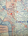
 Cambridge MA (July 1970) (7960500614).jpg 1,408 × 1,032; 397 KB
-
 Cambridge MA 1956 (8649388495).jpg 1,442 × 1,061; 492 KB
-
 Cambridge MA 1965 (7694007952).jpg 1,044 × 1,330; 417 KB
-
 Cambridge, Massachusetts, Kendall Square Area, 1903.jpg 1,536 × 1,010; 374 KB
-
 Christ Church (Cambridge, Massachusetts) - 00000a.jpg 1,024 × 830; 68 KB
-
 Christ Church (Cambridge, Massachusetts) - 00000a.tif 9,354 × 7,584; 192 KB
-
 Fort Washington (Cambridge, Massachusetts) - 00000a.tif 9,328 × 7,584; 341 KB
-
 Harvard University map (older, date unknown).jpg 656 × 869; 612 KB
-
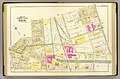
 Layout of Eliot Shops, 1912.jpg 1,540 × 756; 226 KB
-
 Lechmere Canal, Cambridge (2673751701).jpg 2,000 × 1,310; 1.94 MB
-
 Map of Cambridge in the vicinity of Harvard College 1903-4 (3855463045).jpg 2,000 × 1,683; 3.39 MB
-
 Map1924.jpg 621 × 577; 68 KB
-
 PSM V67 D481 Proposed site of mit in relation to harvard university.png 864 × 1,677; 160 KB
-
 Sketch Plan of Lands- Oakley Country Club, 30 April 1909 (76fda4ee-0dfe-4aeb-963e-f79a26e1c4ed).jpg 13,520 × 11,667; 124.78 MB
-
 The birds of the Cambridge region of Massachusetts (1906) (20804312251).jpg 3,796 × 2,646; 2.03 MB
-

-
 Track layout of Bennett Street Carhouse, 1912.jpg 1,545 × 931; 205 KB


_(14594654069).jpg)
_(14801138303).jpg)
_(7960500614).jpg)
.jpg)
.jpg)

_-_00000a.jpg)
.jpg)

.jpg)
.jpg)


.jpg)
_(20804312251).jpg)
_(14781546704).jpg)
