
Category:2024 maps of the United States
Countries of the Americas: Belize · Bolivia · Brazil · Canada · Costa Rica · Guatemala · Guyana · Honduras · Mexico · United States
Other areas: French Guiana · Greenland · Puerto Rico
Other areas: French Guiana · Greenland · Puerto Rico
States of the United States: Alabama · Alaska · Arizona · Arkansas · California · Colorado · Connecticut · Delaware · Florida · Georgia · Hawaii · Idaho · Illinois · Indiana · Iowa · Kansas · Kentucky · Louisiana · Maine · Maryland · Massachusetts · Michigan · Minnesota · Mississippi · Missouri · Montana · Nebraska · Nevada · New Hampshire · New Jersey · New Mexico · New York · North Carolina · North Dakota · Ohio · Oklahoma · Oregon · Pennsylvania · Rhode Island · South Carolina · South Dakota · Tennessee · Texas · Utah · Vermont · Virginia · Washington · West Virginia · Wisconsin · Wyoming
Puerto Rico
Puerto Rico
Subcategories
This category has the following 52 subcategories, out of 52 total.
Media in category "2024 maps of the United States"
The following 38 files are in this category, out of 38 total.
-
 2024 tornado track map summary.png 15,200 × 9,239; 17.26 MB
-
 2024 United States drone sightings map (states).png 4,210 × 2,688; 913 KB
-
 Abortion access protections in the US by state.svg 959 × 593; 71 KB
-
 Age restrictions on tattooing in the United States by State.png 5,000 × 3,500; 1.56 MB
-
 Beer Tax Map2.jpg 2,200 × 1,700; 347 KB
-
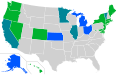
 Big6 teams by state province 2024.svg 1,712 × 1,781; 184 KB
-

-

-
 Day1otlk 20240715 2000 prt.gif 815 × 555; 32 KB
-
 Day1probotlk 20240403 1300 hail prt.gif 815 × 555; 24 KB
-
 Day1probotlk 20240403 1300 wind prt.gif 815 × 555; 26 KB
-
 Drought United States usdm 20241029.jpg 720 × 547; 215 KB
-
 Eastern United States Map.jpg 1,242 × 1,550; 608 KB
-
 Flag Map of the U.S. States and Territories (2024).png 1,759 × 989; 355 KB
-
 Flag map of the USA ~ Rivers and Lakes.png 2,413 × 1,484; 1.01 MB
-
 Flag Map of United States Small Scale.png 597 × 481; 21 KB
-
 High speed railroad map of the United States.png 2,751 × 2,394; 730 KB
-
 High speed railroad map of the United States.svg 512 × 466; 56 KB
-

-
 Map of alcoholic beverage control states.png 5,000 × 3,500; 1.2 MB
-
 Map of authorized LPTV FM6 operations.png 793 × 482; 163 KB
-
 Map of Second Most Common Religions in the United States by State.svg 411 × 299; 108 KB
-
 Map of US minimum wage by state.svg 512 × 341; 53 KB
-
 Miss-Teen-USA-2024-Final-Results.png 1,762 × 1,140; 208 KB
-
 Miss-Teen-USA-2024-Results.png 1,956 × 1,274; 558 KB
-
 Mister USA 2024 Final Results.png 1,714 × 1,004; 282 KB
-
 Most common U.S. county etymologies.png 6,900 × 4,326; 5.66 MB
-
 Northeastern United States Passenger Rail Diagram.svg 512 × 471; 6.28 MB
-
 States with laws banning bumpstocks 2024.png 4,388 × 2,742; 853 KB
-
 United States Senators by Gender.svg 400 × 247; 458 KB
-
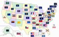 United States state flags, territory flags, and DC flags24.png 1,600 × 1,010; 560 KB
-
 United States with territory states and DC flags new 2024 03.jpg 1,600 × 1,010; 521 KB
-
 US map showing which states increased their minimum wage this year.png 1,542 × 1,167; 60 KB
-
 US map. Delta-8 THC legal status by state.png 1,220 × 1,006; 180 KB
-
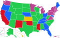
 US map. State regulated cannabis programs. With legend.png 1,970 × 2,200; 570 KB
-
 US map. State regulated cannabis programs.png 1,968 × 1,509; 176 KB
-
 US Southeastern Plains ecoregion map - Detail of Mississippi and Alabama.svg 765 × 990; 3.99 MB
-
 US states and territories marriage age with exceptions.svg 958 × 602; 191 KB

.png)


.png)


.png)
.png)