Category:2020s maps of Brazil
Jump to navigation
Jump to search
Subcategories
This category has the following 2 subcategories, out of 2 total.
Media in category "2020s maps of Brazil"
The following 10 files are in this category, out of 10 total.
-
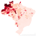 Mapa dos municípios brasileiros por indígenas (2022).png 5,048 × 4,992; 3.63 MB
-
 Taxa homicídio Regiões Brasil.png 2,328 × 1,576; 300 KB
-
 Centro de endemismo Belem cobertura vegetal.png 649 × 530; 584 KB
-
 Mapa dos estados brasileiros por renda per capita (2023).png 752 × 726; 52 KB
-
 Estados brasileiros por ensino superior (2022).png 744 × 736; 66 KB
-
 Estados brasileiros por incidência de extrema pobreza (2022).png 4,304 × 4,304; 849 KB
-
 Lista de municípios do Rio de Janeiro em Mapa (Censo 2022).png 1,980 × 1,300; 517 KB
-
 Mapa de viagem por todas as capitais do Brasil.png 2,900 × 3,339; 1.96 MB
-
 Regiões brasileiras por incidência da extrema pobreza (2022).png 4,288 × 4,304; 756 KB
-
 Regiões brasileiras por incidência de extrema pobreza (2022).png 4,288 × 4,304; 590 KB
.png)


.png)
.png)
.png)
.png)

.png)
.png)