Category:2020 maps of Ahorn (Baden)
Jump to navigation
Jump to search
Media in category "2020 maps of Ahorn (Baden)"
The following 6 files are in this category, out of 6 total.
-
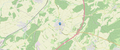 Lage Berolzheim (Ahorn).png 1,859 × 778; 1.09 MB
-
 Lage Buch am Ahorn (Ahorn).png 1,860 × 777; 1.06 MB
-
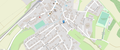 Lage ehemalige Synagoge Eubigheim.png 1,851 × 778; 837 KB
-
 Lage Eubigheim (Ahorn).png 1,845 × 768; 1.08 MB
-
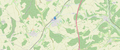
 Lage Hohenstadt (Ahorn).png 1,860 × 770; 1.06 MB
-
 Lage Schillingstadt (Ahorn).png 1,861 × 778; 1.01 MB
.png)
.png)

.png)
.png)
.png)