Category:2020 Vietnamese floods
Jump to navigation
Jump to search
2020 Vietnamese floods in Center area  | |||||
| Upload media | |||||
| Instance of | |||||
|---|---|---|---|---|---|
| Location |
| ||||
| Point in time |
| ||||
| |||||
Tiếng Việt: Lũ lụt miền Trung Việt Nam năm 2020
Media in category "2020 Vietnamese floods"
The following 18 files are in this category, out of 18 total.
-
 17W Geostationary VIS-IR 2020.png 320 × 320; 77 KB
-
 2020 CIMSS 18W Nangka visible infrared map.GIF 800 × 600; 4.38 MB
-
 2020 CWB Nangka forecast map (en-US).png 956 × 700; 80 KB
-
 2020 JTWC 18W forecast map.wp1820.gif 2,289 × 1,489; 98 KB
-
 2020 PAGASA Nika forecast map.png 3,300 × 2,550; 504 KB
-
 Bờ Nam Huế thời điểm lũ rút 2020.jpg 960 × 504; 105 KB
-
 JTWC wp1720 forecast map.gif 1,622 × 990; 74 KB
-
 Linfa 2020 track.png 2,700 × 1,669; 3.01 MB
-
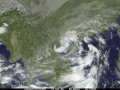
 Linfa 2020-10-11 0330Z.jpg 3,200 × 4,000; 1.24 MB
-
 Linfa 2020-10-11 0600Z.jpg 3,200 × 4,000; 2.05 MB
-
 Linfa 2020-10-11 0624Z.jpg 4,883 × 6,654; 2.1 MB
-
 Lũ lụt Huế 2020.jpg 960 × 720; 206 KB
-
 Nangka 2020 track.png 2,700 × 1,669; 3.84 MB
-
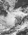
 Nangka 2020-10-12 0095Z.jpg 2,213 × 2,832; 904 KB
-
 Nangka 2020-10-14 0095Z.jpg 1,815 × 1,893; 396 KB
-
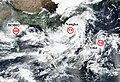 Nangka, Ofel and BOB02 2020-10-13.jpg 1,547 × 1,051; 729 KB
-
 Newone - Tỉmes City ủng hộ miền Trung lũ lụt.jpg 1,536 × 2,048; 530 KB
-
 Đập Đá, Huế trong Lũ lụt miền Trung 2020.jpg 960 × 720; 115 KB


.png)


