Category:2019 maps of Creglingen
Jump to navigation
Jump to search
Media in category "2019 maps of Creglingen"
The following 6 files are in this category, out of 6 total.
-
-
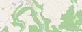
 Badesee Schonach - auch Karrodsee, Karoth-See oder Weiher Karrod.png 1,863 × 713; 425 KB
-
 Badesee und Hochwasserrückhaltebecken Schwarzenbronn.png 1,850 × 725; 226 KB
-
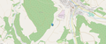
 Lage Altmühle (Creglingen) bei Creglingen-Reinsbronn.png 1,859 × 833; 288 KB
-
 Lage Jüdischer Friedhof Creglingen.png 1,863 × 772; 838 KB
-
 Lage Äckerbrunnen (Creglingen).png 1,870 × 839; 582 KB
_bei_Creglingen-Reinsbronn.png)

.png)