Category:2018 maps of urban areas in Norway
Jump to navigation
Jump to search
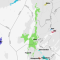
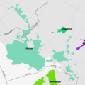
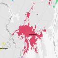
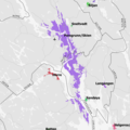
Maps of urban areas in Norway as of 2018
Media in category "2018 maps of urban areas in Norway"
The following 20 files are in this category, out of 20 total.
-
 Tettsted 0001 Halden 2018.png 2,362 × 2,362; 386 KB
-
 Tettsted 0022 Fredrikstad Sarpsborg 2018.png 2,362 × 2,362; 979 KB
-
 Tettsted 0031 Moss 2018.png 2,362 × 2,362; 710 KB
-
 Tettsted 0801 Oslo 2018.png 2,362 × 2,362; 1.62 MB
-
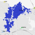
 Tettsted 1001 Hamar 2018.png 2,362 × 2,362; 610 KB
-
 Tettsted 2003 Drammen 2018.png 2,362 × 2,362; 1.01 MB
-
 Tettsted 2521 Tønsberg 2018.png 2,362 × 2,362; 710 KB
-
 Tettsted 2531 Sandefjord 2018.png 2,362 × 2,362; 693 KB
-
 Tettsted 2541 Larvik 2018.png 2,362 × 2,362; 488 KB
-
 Tettsted 3005 Porsgrunn Skien 2018.png 2,362 × 2,362; 968 KB
-
 Tettsted 3511 Arendal 2018.png 2,362 × 2,362; 818 KB
-
 Tettsted 4002 Kristiansand 2018.png 2,362 × 2,362; 679 KB
-
 Tettsted 4522 Stavanger Sandnes 2018.png 2,362 × 2,362; 995 KB
-
 Tettsted 4532 Haugesund 2018.png 2,362 × 2,362; 690 KB
-
 Tettsted 5001 Bergen 2018.png 2,362 × 2,362; 1.37 MB
-
 Tettsted 5201 Askøy 2018.png 2,362 × 2,362; 638 KB
-
 Tettsted 6025 Ålesund 2018.png 2,362 × 2,362; 655 KB
-
 Tettsted 6501 Trondheim 2018.png 2,362 × 2,362; 696 KB
-
 Tettsted 7501 Bodø 2018.png 2,362 × 2,362; 300 KB
-
 Tettsted 8011 Tromsø 2018.png 2,362 × 2,362; 412 KB


