Category:2018 aerial photographs
Jump to navigation
Jump to search
English: 2018 aerial photographs
Svenska: Flygfotografier från 2018
Deutsch: Luftbildfotografien aus 2018
Norsk bokmål: Flyfoto tatt i år 2018
Subcategories
This category has the following 22 subcategories, out of 22 total.
A
F
G
I
- 2018 aerial photographs of Iran (40 F)
- 2018 aerial photographs of Italy (16 F)
J
M
N
- 2018 aerial photographs of Namibia (104 F)
- 2018 aerial photographs of Norway (515 F)
P
S
T
U
Media in category "2018 aerial photographs"
The following 200 files are in this category, out of 350 total.
(previous page) (next page)-
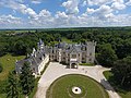
 A Batthyány–Strattmann kastély - légi felvétel (Körmend).jpg 900 × 675; 764 KB
-
 A Batthyány–Strattmann kastély - légi fotó (Körmend).jpg 900 × 675; 566 KB
-
 A budapesti Kossuth Lajos tér a magasból.jpg 900 × 600; 210 KB
-
 A bujáki vár légi fotón.jpg 900 × 675; 740 KB
-
 A földvár madártávlatból (Szabolcs).jpg 900 × 675; 441 KB
-
-
 A Kossuth Lajos tér látképe madártávlatból.jpg 900 × 600; 401 KB
-
 A kőszegi vár légi felvételen.jpg 675 × 900; 771 KB
-
 A monoki kastély légi felvételen.jpg 900 × 675; 683 KB
-
 A muhi csata emlékparkja a levegőből, 2018.jpg 600 × 400; 144 KB
-
 A muhi csata helyszínén épült emlékpark légifotón 2018-ban.jpg 400 × 600; 139 KB
-
 A nagyerdei szabadtéri színpad légi felvételen.jpg 600 × 400; 194 KB
-
 A siklósi vár madártávlatból.jpg 900 × 600; 342 KB
-
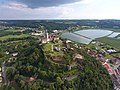
 A szerencsi vár légi felvételen.jpg 675 × 900; 502 KB
-
 A sümegi vár légi felvételen.jpg 675 × 900; 347 KB
-
 A Thury vár légi felvételen (Várpalota).jpg 900 × 675; 318 KB
-
 A Thury vár légi fotón (Várpalota).jpg 900 × 675; 341 KB
-
 A Thury vár madártávlatból (Várpalota).jpg 900 × 675; 270 KB
-
 A vaskúti-halmok - légi felvétel.jpg 900 × 675; 296 KB
-
 A vár - levegőből fényképezve (Kőszeg).jpg 675 × 900; 734 KB
-
 A vár - magasból fotózva (Kőszeg).jpg 900 × 675; 754 KB
-
 A vár látképe madártávlatból (Sirok).jpg 900 × 675; 325 KB
-
 A vár légi fotón (Sümeg).jpg 900 × 675; 285 KB
-
 A vár madártávlatból (Szerencs).jpg 900 × 675; 490 KB
-
 A zsenyei kastély légi felvételen.jpg 900 × 1,200; 1.2 MB
-
 Algerian Navy Rescue Tug, the El Mousif MOD 45165131.jpg 3,000 × 2,217; 5.11 MB
-
 Alps 20180714 101305.jpg 3,216 × 2,136; 2.46 MB
-
 Alps 20180714 101338.jpg 3,216 × 2,136; 2.78 MB
-
 Alps 20180714 101557.jpg 3,216 × 2,136; 2.69 MB
-
 Andrássy-kastély.jpg 600 × 400; 154 KB
-
 Az Andrássy-kastély légi felvételen.jpg 600 × 400; 160 KB
-
 Az Országház a Duna felől, fentről fényképezve.jpg 600 × 400; 154 KB
-
 Az Országház kupolája a magasból.jpg 600 × 400; 143 KB
-
 Az Országház Pest felől légi fotón.jpg 600 × 400; 134 KB
-
 Balatonszabadi, pusztatorony légi fotón.jpg 675 × 900; 671 KB
-
 Barkó, a vár romjai légi felvételen.jpg 900 × 675; 793 KB
-
 Barkó, a vár romjai légi fotón.jpg 900 × 675; 848 KB
-
 Batthyány tér légi felvételen.jpg 600 × 400; 182 KB
-
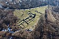
 Bernecebaráti - őskori földvár légi felvétel.jpg 900 × 675; 585 KB
-
 Bikolpuszta, Leányvár légi felvételen (Süttő).jpg 900 × 675; 411 KB
-
 Bikolpuszta, Leányvár légi fotón (Süttő).jpg 900 × 675; 314 KB
-
 Boldog Özséb observation tower 2018 1.jpg 4,000 × 3,000; 4.42 MB
-
 Boldog Özséb observation tower 2018 2.jpg 4,000 × 3,000; 4.61 MB
-
 Boldog Özséb observation tower 2018 3.jpg 4,000 × 3,000; 4.95 MB
-
 Bozsok - Batthyány várkastély - légi fotó.jpg 675 × 900; 745 KB
-
 Bozsok - Puszta vára - légi felvételen.jpg 900 × 660; 762 KB
-
 Bozsok - Sibrik várkastély a magasból.jpg 900 × 675; 882 KB
-
 Bozsok - Templom madártávlatból.jpg 675 × 900; 780 KB
-
 Bronzkori Sáncvár a magasból (Soroksár).jpg 900 × 675; 259 KB
-
 Budafok kocsiszín - légi fotó.jpg 600 × 400; 171 KB
-
 Budapest a magasból.jpg 600 × 400; 123 KB
-
 Budapest látképe a magasból.jpg 600 × 400; 137 KB
-
 Budapest látképe hidakkal légi felvételen.jpg 600 × 400; 129 KB
-
 Budapest és a Duna madártávlatból.jpg 600 × 400; 161 KB
-
 Békésszentandrás, vízerőmű légi felvételen.jpg 600 × 400; 106 KB
-
 Bükkszék - Pósvár légi fotó.jpg 900 × 675; 710 KB
-
 Bükkzsérc - Ódorvár légi fotó.jpg 900 × 600; 718 KB
-
 Bükkábrány, temető légi fotón.jpg 900 × 675; 860 KB
-
 Cataratas Victoria, Zambia-Zimbabue, 2018-07-27, DD 04.jpg 4,203 × 6,530; 9.91 MB
-
 Ciszterci apátság a magasból (Szentgotthárd).jpg 675 × 900; 419 KB
-
 Ciszterci apátság légi felvétel (Szentgotthárd).jpg 675 × 900; 393 KB
-
 Ciszterci apátság légi fotón (Szentgotthárd).jpg 900 × 675; 419 KB
-
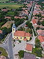
 Csabdi - templom légi fotó.jpg 900 × 675; 625 KB
-
 Csobánc vára - légi fotó.jpg 900 × 675; 560 KB
-
 Csobánc vára légi felvételen.jpg 900 × 675; 840 KB
-
 Csobánc vára, légi felvétel.jpg 900 × 675; 722 KB
-
 Csobánc vára, légi fotó.jpg 900 × 675; 622 KB
-
 Csákánydoroszló, Batthyány várkastély légi felvételen.jpg 900 × 675; 577 KB
-
 Csákánydoroszló, Batthyány várkastély légi fotója.jpg 900 × 675; 678 KB
-
 Csévharaszt, Pótharaszt, földvár légi fotón.jpg 900 × 675; 745 KB
-
 Csúcshegy légi felvételen (Tihany).jpg 900 × 675; 331 KB
-
 Csúcshegy légi fotón (Tihany).jpg 900 × 675; 493 KB
-
 Csővár castle aerial 2018 1.jpg 4,000 × 3,000; 5.46 MB
-
 Debrecen a levegőből.jpg 600 × 400; 171 KB
-
 Debrecen a magasból.jpg 400 × 600; 177 KB
-
 Debreceni Nagyerdő, sportközpont a magasból.jpg 600 × 400; 168 KB
-
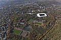
 Debreceni Nagyerdő, stadion légi felvételen.jpg 600 × 400; 177 KB
-
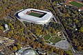 Debreceni Nagyerdő, stadion madártávlatból.jpg 600 × 400; 170 KB
-
 Debreceni Nagyerdő. Szabadtéri színpad a levegőből.jpg 600 × 400; 192 KB
-
 Debreceni ortodox zsinagóga - légi felvétel (Pásti utca).jpg 600 × 400; 146 KB
-
 Debreceni ortodox zsinagóga - légi fotó (Pásti utca).jpg 600 × 400; 137 KB
-
 Doboz, Sámson vár légi felvételen.jpg 900 × 675; 558 KB
-
 Domony - földvár légi fotón.jpg 900 × 675; 735 KB
-
 Dunakeszi tőzegtavak.jpg 1,280 × 720; 248 KB
-
 Erzsébet híd légi felvételen.jpg 600 × 400; 126 KB
-
 F-35B, B-1B, and F-15J in flight (170831-O-N0132-006).jpg 2,096 × 1,397; 1.53 MB
-
 Felsőgöd - Várdomb, légi fotó.jpg 900 × 675; 744 KB
-
 Folyóparti látkép légi fotón (Tiszadob).jpg 600 × 400; 169 KB
-
 Fonyód - Alsóvár, Fácános, légi fotó.jpg 900 × 675; 784 KB
-
 Fonyód - Fehérbézseny - török vár, légi fotó.jpg 900 × 675; 834 KB
-
 Fonyód - Várhegy légi felvételen.jpg 900 × 675; 750 KB
-
 Földvár a magasból (Szabolcs).jpg 900 × 675; 474 KB
-
 Golop, régi kastély légi felvételen.jpg 900 × 675; 551 KB
-
 Ground surface in northern Atsuma Town after 2018 earthquake.jpg 11,034 × 4,066; 8.46 MB
-
 Gróf Tisza István emlékmű madártávlatból.jpg 600 × 400; 111 KB
-
 Gyöngyös, Püspöki - templom, légi felvétel.jpg 900 × 675; 712 KB
-
 Gyöngyössolymos - Nyesett vár, légi felvétel.jpg 675 × 900; 623 KB
-
 H30 07gouu-0713kuretoubu-C3-0143 Central Yasuura 2018-07-13.jpg 2,061 × 1,546; 789 KB
-
 Hajós - Érseki kastély légi felvételen.jpg 675 × 900; 726 KB
-
 Hajós - Érseki kastély légi fotón.jpg 900 × 675; 810 KB
-
 Harkány - Terehegy, várdomb és templom légi fotón.jpg 675 × 900; 681 KB
-
 Hegyesd, palánk - alsóvár - légi fotó.jpg 900 × 675; 686 KB
-
 Hegyestű - légi felvételen.jpg 600 × 400; 158 KB
-
 Hegyestű a magasból.jpg 600 × 400; 207 KB
-
 Hegyestű légi felvételen.jpg 900 × 675; 641 KB
-
 Hegyestű légi fotón.jpg 900 × 675; 852 KB
-
 HelenaAirportFromMtHelena.jpg 5,230 × 2,918; 8.14 MB
-
 Hild-Érsekhalom, földvár légi fotón.jpg 900 × 675; 849 KB
-
 Hintersee pfarrkirche.jpg 3,070 × 1,724; 4.39 MB
-
 Héhalom - légi fotó.jpg 900 × 675; 698 KB
-
 Ipolydamásd - Damásd vár légi fotón.jpg 900 × 675; 801 KB
-
 Isaszeg, Szt. Márton templom légi felvételen.jpg 900 × 675; 590 KB
-
 Isaszeg, Szt. Márton templom légi fotón.jpg 900 × 675; 818 KB
-
 Jákfa, temető és templom légi felvételen.jpg 900 × 675; 740 KB
-
 Jákfa, temető és templom légi fotón.jpg 900 × 675; 702 KB
-
 Jánosháza, várkastély légi fotón.jpg 675 × 900; 734 KB
-
 Kapuvár várhelyei légi fotón.jpg 900 × 675; 801 KB
-
 Karakó - Ókarakó - légi fotó.jpg 900 × 675; 621 KB
-
 Kastély a magasból (Zsennye).jpg 900 × 675; 774 KB
-
 Kemendi vár légi felvételen (Kemendollár).jpg 900 × 675; 788 KB
-
 Kemendi vár légi fotón (Kemendollár).jpg 900 × 675; 900 KB
-
 Kemendollár - Kemendi vár légi felvétel.jpg 900 × 675; 841 KB
-
 Kemendollár - Kemendi vár légi fotón.jpg 900 × 675; 873 KB
-
 Kisbucsa, temetődomb légi felvételen.jpg 900 × 675; 802 KB
-
 Kisbucsa, temetődomb légi fotón.jpg 900 × 675; 654 KB
-
 Kolostorerőd a levegőből (Pécsvárad).jpg 900 × 675; 553 KB
-
 Kolostorerőd légi felvételen (Pécsvárad).jpg 900 × 675; 623 KB
-
 Kolostorerőd légi fotón (Pécsvárad).jpg 900 × 675; 549 KB
-
 Kossuth Lajos emlékmű a magasból.jpg 600 × 400; 143 KB
-
 Kossuth Lajos tér (Budapest) légi felvételen.jpg 900 × 600; 282 KB
-
 Kossuth Lajos tér - légi fotó (Budapest).jpg 900 × 600; 200 KB
-
 Kossuth Lajos tér légi fotón (Budapest).jpg 900 × 600; 308 KB
-
 Koyaike Park from airplane window.jpg 2,327 × 2,318; 1.28 MB
-
 Kácsi vár légi fotón (2018).jpg 900 × 675; 970 KB
-
 Kéthely - Fancsika légi fotón.jpg 900 × 675; 848 KB
-
 Kéthely - Őskori földvár, Paraplé domb légi felvételen.jpg 900 × 675; 878 KB
-
 Kővágóörs, Ecséri templomrom légi felvételen.jpg 675 × 900; 882 KB
-
 Kővágóörs, Ecséri templomrom légi fotón.jpg 900 × 675; 693 KB
-
 La prada 2018.png 1,484 × 849; 3.49 MB
-
 Lenti vára légi fotón.jpg 900 × 675; 802 KB
-
 Lenti, Bárszentmihályfa - temetődomb légi felvételen.jpg 900 × 675; 798 KB
-
 Leányvár, Kolostor-hegy légi felvételen.jpg 900 × 675; 634 KB
-
 Lockenhaus madártávlatból (Léka).jpg 675 × 900; 692 KB
-
 Lovászad, Karácsfa, Hagensdorf légi felvételen.jpg 900 × 675; 916 KB
-
 Lovászad, Karácsfa, Hagensdorf légi fotón.jpg 900 × 675; 733 KB
-
 Látkép az Andrássy-kastéllyal.jpg 600 × 400; 169 KB
-
 Légi felvételen a Budafok kocsiszín.jpg 600 × 400; 169 KB
-
 Légi felvételen a kácsi vár, 2018-ban.jpg 900 × 675; 806 KB
-
 Légi fotón az Országház (részlet).jpg 600 × 400; 142 KB
-
 Léka - Lockenhaus, légi felvétel.jpg 900 × 675; 710 KB
-
 Léka - Lockenhaus, légi fotó.jpg 900 × 675; 743 KB
-
 Magyar Szecesszió Háza légi fotón.jpg 600 × 400; 154 KB
-
 Manizales (46461305412).jpg 3,024 × 4,032; 2.97 MB
-
 Mende, Leányvár - bronzkori földvár légi fotón.jpg 900 × 675; 535 KB
-
 Mihályi várkastély légi felvételen.jpg 675 × 900; 829 KB
-
 Monok, kastély légi fotón.jpg 675 × 900; 719 KB
-
 Monyorókerék - Eberau, légi felvétel.jpg 900 × 675; 755 KB
-
 Monyorókerék - Eberau, légi fotó.jpg 675 × 900; 664 KB
-
 Máriabesnyői Nagyboldogasszony Bazilika légi felvételen.jpg 900 × 675; 705 KB
-
 Nagyboldogasszony Bazilika - légi fotó (Máriabesnyő).jpg 900 × 675; 725 KB
-
 Nagybörzsöny - Szent István-templom a magasból.jpg 900 × 675; 854 KB
-
 Nagybörzsöny, Szent István templom - légi fotó.jpg 900 × 600; 636 KB
-
 Nagybörzsöny, Szent István templom légi felvételen.jpg 900 × 675; 718 KB
-
 Nagybörzsöny, Szent István templom légi fotón.jpg 900 × 675; 864 KB
-
 Nagykökényes, templom légi felvételen.jpg 900 × 675; 648 KB
-
 Nagykökényes, templom légi fotón.jpg 900 × 675; 560 KB
-
 Nagykőrős, földvár légi fotón.jpg 900 × 675; 629 KB
-
 Nagykőrős, légi felvétel (Csipvár, Csíkvár, Csépvár).jpg 900 × 675; 811 KB
-
 Nagyvázsony vára.jpg 3,968 × 2,976; 6.92 MB
-
 Nemesvámos légi felvételen.jpg 900 × 600; 203 KB
-
 Nemesvámos légi fotón.jpg 900 × 600; 423 KB
-
 Nemzeti Közszolgálati Egyetem - légi felvétel.jpg 600 × 400; 144 KB
-
 Nemzeti Közszolgálati Egyetem - légi fotó.jpg 600 × 400; 165 KB
-
 Nemzeti Közszolgálati Egyetem a levegőből.jpg 600 × 400; 168 KB
-
 Nádasdladány, Nádasdy-kastély - légi felvétel.jpg 900 × 675; 740 KB
-
 Nádasdladány, Nádasdy-kastély madártávlatból.jpg 900 × 675; 722 KB
-
 Nádasdy-kastély - levegőből fényképezve (Nádasdladány).jpg 900 × 675; 603 KB
-
 Nádasdy-kastély a magasból (Nádasdladány).jpg 900 × 675; 755 KB
-
 Nádasdy-kastély légi fotón (Nádasdladány).jpg 900 × 675; 767 KB
-
 Németújvár - Güssing - légi felvétel.jpg 900 × 600; 554 KB
-
 Németújvár - Güssing - légi fotó.jpg 900 × 675; 607 KB
-
 Németújvár - Güssing a magasból.jpg 900 × 675; 622 KB
-
 Ordacsehi, kisvár légi felvételen.jpg 900 × 675; 640 KB
-
 Ordacsehi, kisvár légi fotón.jpg 900 × 675; 631 KB
-
 Orosháza légi felvételen.jpg 600 × 400; 168 KB
-
 Osli, templom és kárvária légi felvételen.jpg 675 × 900; 702 KB
-
 Osli, templom és kárvária légi fotón.jpg 900 × 675; 731 KB
-
 Ostffyasszonyfa, Csonkavár légi felvételen.jpg 900 × 675; 759 KB
-
 Ostffyasszonyfa, Csonkavár légi fotón.jpg 900 × 675; 654 KB
-
 Pilisszentlélek, Pálos romok - légi fotó.jpg 900 × 600; 648 KB
-
 Pilisszentlélek, Pálos romok légi felvételen.jpg 900 × 675; 725 KB
-
 Pálos romok légi felvételen (Pilisszentlélek).jpg 900 × 675; 737 KB
-
 Pálos romok légi fotón (Pilisszentlélek).jpg 900 × 675; 707 KB
-
 Pálos romok madártávlatból (Pilisszentlélek).jpg 900 × 675; 690 KB
-
 Pécel, várhegy légi felvételen.jpg 900 × 675; 530 KB
-
 Pécel, várhegy légi fotón.jpg 900 × 675; 611 KB
-
 Pécs belvárosa (Széchenyi tér) - légi felvétel.jpg 600 × 400; 207 KB
-
 Pécsi bazilika a magasból.jpg 600 × 400; 158 KB
-
 Pécsvárad, kolostorerőd légi felvételen.jpg 900 × 675; 598 KB
-
 Pécsvárad, kolostorerőd légi fotón.jpg 900 × 675; 700 KB
.jpg)
.jpg)


.jpg)


.jpg)
.jpg)
.jpg)

.jpg)
.jpg)
.jpg)
.jpg)
.jpg)


.jpg)
.jpg)


.jpg)


.jpg)
.jpg)
.jpg)


.jpg)
.jpg)


.jpg)
.jpg)


.jpg)

.jpg)


.jpg)


.jpg)
.jpg)
.jpg)


.jpg)
.jpg)
.jpg)

_l%C3%A9gi_felv%C3%A9telen.jpg)
.jpg)
.jpg)

.jpg)


.jpg)


.jpg)


.jpg)


.jpg)


.jpg)


.jpg)
.jpg)
.jpg)


.jpg)
.jpg)
.jpg)


_-_l%C3%A9gi_felv%C3%A9tel.jpg)


