Category:2017 in Castleford, West Yorkshire
Jump to navigation
Jump to search
Media in category "2017 in Castleford, West Yorkshire"
The following 46 files are in this category, out of 46 total.
-
 Aire and Calder navigation canal (geograph 5648133).jpg 4,608 × 3,072; 2.87 MB
-
 Allotments - off Pine Close (geograph 5264678).jpg 640 × 480; 71 KB
-
 And then there were three (geograph 5649817).jpg 4,608 × 3,072; 3.34 MB
-
 Beech Court - Thornhill Road (geograph 5264673).jpg 640 × 480; 90 KB
-
 Brookfield Avenue - Close Road (geograph 5264756).jpg 640 × 469; 60 KB
-
 Carr Lane - viewed from Carr Wood Road (geograph 5264880).jpg 640 × 480; 53 KB
-
 CAS2.jpg 2,340 × 4,160; 2.04 MB
-
 Castigers1.jpg 2,340 × 4,160; 2.14 MB
-
 Castleford Forum Museum April 2017.jpg 3,264 × 2,448; 2.47 MB
-
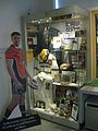 Castleford Tigers display Castleford Forum Museum.jpg 2,448 × 3,264; 2.82 MB
-
 College Road - Hastings Crescent (geograph 5364641).jpg 640 × 480; 68 KB
-
 College Road - Redhill Drive (geograph 5364626).jpg 640 × 480; 79 KB
-
 Fairfield Court - Redhill Avenue (geograph 5364415).jpg 640 × 480; 64 KB
-
 Footbridge over the River Aire (geograph 5649827).jpg 4,608 × 3,072; 3.33 MB
-

-
 Front Street - viewed from School Lane (geograph 5264873).jpg 640 × 454; 40 KB
-
 Fryston Road - viewed from Milnes Grove (geograph 5365336).jpg 640 × 460; 67 KB
-
 Grafton Street - looking towards Leeds Road (geograph 5264684).jpg 640 × 476; 70 KB
-
 Hastings Crescent - Airedale Road (geograph 5364642).jpg 640 × 480; 65 KB
-
 Hastings Crescent - Queens Road (geograph 5364636).jpg 640 × 480; 58 KB
-
 Hawthorne Avenue - Holywell Lane (geograph 5365356).jpg 640 × 480; 74 KB
-
 Hill Road - Churchfield Lane (geograph 5264807).jpg 640 × 480; 57 KB
-
 Kings Avenue - Queens Road (geograph 5364633).jpg 640 × 438; 52 KB
-
 Michael Shenton Castleford.jpg 994 × 2,050; 623 KB
-
 Milnes Grove - Kershaw Avenue (geograph 5364679).jpg 640 × 480; 66 KB
-
 Mount Pleasant - Churchfield Lane (geograph 5264805).jpg 640 × 480; 57 KB
-
 Newly renovated Barge (geograph 5649819).jpg 4,608 × 3,072; 3.79 MB
-
 Princess st.jpg 2,340 × 4,160; 2.41 MB
-
 Quarrydene Drive - Redhill Drive (geograph 5364620).jpg 640 × 480; 82 KB
-
 Queens Road - Hastings Crescent (geograph 5364640).jpg 640 × 480; 53 KB
-
 Redhill Gardens - Redhill Avenue (geograph 5364428).jpg 640 × 480; 72 KB
-
 Redhill Walk - Redhill Heights (geograph 5364424).jpg 640 × 480; 52 KB
-
 Rock Hill - Front Street (geograph 5364343).jpg 640 × 480; 66 KB
-
 Rock Hill - Holywell Lane (geograph 5364332).jpg 640 × 480; 67 KB
-
 Rock Inn - Rock Hill (geograph 5364339).jpg 640 × 480; 74 KB
-
 School Lane - Pontefract Road (geograph 5264706).jpg 640 × 480; 53 KB
-
 St Paul the Apostle - Pontefract Road (geograph 5264739).jpg 640 × 466; 82 KB
-
 The Crescent - Churchfield Lane (geograph 5264810).jpg 640 × 480; 49 KB
-
 The Jungle Castleford Tigers Rugby league Ground (geograph 5648191).jpg 4,160 × 2,745; 2.43 MB
-
 The New Airedale - Fryston Road (geograph 5365347).jpg 640 × 480; 59 KB
-
 Tickle Cock Bridge April 2017.jpg 3,264 × 2,448; 1.95 MB
-
 Tickle Cock Bridge plaque April 2017.jpg 3,264 × 2,448; 1.82 MB
-
 Track - Redhill Drive (geograph 5364618).jpg 640 × 480; 92 KB
-
 Wakefield College Castleford April 2017.jpg 3,264 × 2,448; 2.25 MB
-
 Woodfest 2017 (geograph 5454592).jpg 1,024 × 768; 177 KB
-
 WRE2.jpg 2,340 × 4,160; 2.25 MB
.jpg)
.jpg)
.jpg)
.jpg)
.jpg)
.jpg)


.jpg)
.jpg)
.jpg)
.jpg)
.jpg)
.jpg)
.jpg)
.jpg)
.jpg)
.jpg)
.jpg)
.jpg)
.jpg)

.jpg)
.jpg)
.jpg)

.jpg)
.jpg)
.jpg)
.jpg)
.jpg)
.jpg)
.jpg)
.jpg)
.jpg)
.jpg)
.jpg)
.jpg)


.jpg)

.jpg)
