Category:2017 aerial photographs of Namibia
Jump to navigation
Jump to search
Countries of Africa: Namibia
Media in category "2017 aerial photographs of Namibia"
The following 187 files are in this category, out of 187 total.
-
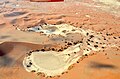
 Aerial view of Fairy circles, Namibia (2017).jpg 4,928 × 3,264; 9.91 MB
-
 Aerial view of Farm Simplon, Namibia (2017).jpg 4,286 × 2,847; 7.06 MB
-
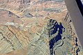
 Aerial view of Fish River Canyon (2017).jpg 4,928 × 3,264; 7.22 MB
-
 Aerial view of Lüderitz (2017).jpg 4,928 × 3,264; 7.69 MB
-
 Aerial view of old lime kiln, Simplon Namibia (2017).jpg 4,526 × 3,033; 7.12 MB
-
 Aerial view of Swakopmund Lighthouse, Namibia.jpg 4,452 × 3,061; 6.82 MB
-
 Agglomeration um den Goreangab Damm.jpg 5,472 × 3,648; 9.99 MB
-
 Airfield Aus (Namibia).jpg 4,928 × 3,264; 7.88 MB
-
 Aminuis bird eye view.jpg 5,472 × 3,648; 8.3 MB
-
 Aranos bird eye view.jpg 5,472 × 3,648; 10.3 MB
-
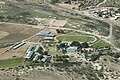
 Aranos High School.jpg 5,472 × 3,648; 7.83 MB
-
 Aroams Oos in Tswanaland, Namibia (2017).jpg 4,519 × 2,941; 4.88 MB
-
 Auob at Gochas.jpg 5,472 × 3,648; 9.11 MB
-
 Bahn Sand.jpg 4,928 × 3,264; 3.84 MB
-
 Bahnhof Gobabis Luftaufnahme (2017).jpg 5,472 × 3,648; 7.8 MB
-
 Billstein mountain, Namibia (2017).jpg 4,563 × 3,075; 7.23 MB
-
 Blick in die Berge der Doppelkuppe, Namibia (2017).jpg 4,928 × 3,264; 7.05 MB
-
 Brukkaros aerial view (2017).jpg 5,472 × 3,648; 13.43 MB
-
 Brukkaros Bird's Eye View.jpg 2,024 × 1,349; 2.8 MB
-
 Brukkaros Mountain, Namibia (2017).jpg 4,928 × 3,264; 7.73 MB
-
 Canyon Village in Namibia (2017).jpg 4,529 × 2,900; 8.6 MB
-
 Canyon Village, Gondwana, Namibia (2017).jpg 4,386 × 2,803; 7.75 MB
-
 D1985, Verbindungsstraße zwischen C28 und D1982 in Namibia.jpg 4,532 × 2,993; 6.11 MB
-
 Dead Vlei, Namibia (2017).jpg 4,928 × 3,264; 7.69 MB
-
 Deadvlei Vogelperspektive.jpg 4,928 × 3,264; 6.78 MB
-
 Der Swakop NE Langer Heinrich, Namibia (2017).jpg 4,928 × 3,264; 7.3 MB
-
 Desert Homestead Lodge (2017).jpg 4,618 × 3,018; 7.38 MB
-
 Desert Homestead, Namibia (2017).jpg 4,469 × 3,035; 5.14 MB
-
 Diamantensperrgebiet.jpg 5,472 × 3,648; 9.62 MB
-
 District road D1237, Rehoboth (Namibia).jpg 4,928 × 3,264; 8.77 MB
-
 Distriktstraße D1001 bei Farm Gunsteling, Namibia (2017).jpg 4,928 × 3,264; 6.76 MB
-
 Distriktstraße D1984 und Eisenbahnlinie bei Walvis Bay (2017).jpg 4,928 × 3,264; 5.43 MB
-
 Distriktstraße D3819, Namibia (2017).jpg 4,928 × 3,264; 6.47 MB
-
 Distriktstraße D707 bei Farm Kanaan (Namibia).jpg 4,928 × 3,264; 6.87 MB
-
 Distriktstraße D707 bei Namtib (Namibia).jpg 4,928 × 3,264; 5.97 MB
-
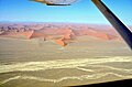
 Dune 45, Sossusvlei (2017).jpg 4,928 × 3,264; 5.79 MB
-
 Dunes and Tsauchab, Sossusvlei (2017).jpg 4,928 × 3,264; 6.83 MB
-
 Dunes at Tsauchab valley, Namibia (2017).jpg 4,928 × 3,264; 9.66 MB
-
 Dunes of Sossusvlei region, Namibia (2017).jpg 4,928 × 3,264; 10.01 MB
-
 Dünen (Namib).jpg 5,760 × 3,840; 6.85 MB
-
 Dünen bei Sossusvlei, Namibia (2017).jpg 4,928 × 3,264; 7.97 MB
-
 Ejuva I and II bird eye view.jpg 5,472 × 3,648; 9.45 MB
-
 Elegant Desert Lodge, Namibia (2017).jpg 4,928 × 3,264; 7.21 MB
-
 Extended Runway Walvis Bay Airport (2017).jpg 4,928 × 3,264; 5.59 MB
-
 Farm Edelweiss in Namibia Bird Eye View.jpg 5,472 × 3,648; 7.12 MB
-
 Farm Gunsteling, Namibia (2017).jpg 4,928 × 3,264; 5.28 MB
-
 Farm in Namibia (2017).jpg 3,937 × 2,518; 3.86 MB
-
 Farm Langverwacht, Namibia (2017).jpg 4,928 × 3,264; 5.75 MB
-
 Farm Makam, Namibia (2017).jpg 4,306 × 2,902; 5.39 MB
-
 Farm Nuiba in Namibia (2017).jpg 4,563 × 2,994; 4.62 MB
-
 Farm within Kalahari Desert (Namibia).jpg 4,536 × 2,961; 6.03 MB
-
 Farm within Kalahari Desert, Namibia.jpg 4,928 × 3,264; 5.75 MB
-
 Fischfluss-Canyon 2017.jpg 3,264 × 2,448; 5.68 MB
-
 Fish River Canyon aerial view, Namibia (2017).jpg 4,691 × 3,082; 8.64 MB
-
 Fish River Canyon, Namibia.jpg 4,928 × 3,264; 8.66 MB
-
 Flughafen Walfish Bay Luftaufnahme.jpg 4,928 × 3,264; 4.08 MB
-
 Flugplatz Swakopmund Vogelperspektive.jpg 4,928 × 3,264; 6.52 MB
-
 Gobabis Private Hospital.jpg 5,472 × 3,648; 7.61 MB
-
 Gochas aerial view.jpg 5,472 × 3,648; 8.69 MB
-
 Gochas bird eye view.jpg 4,928 × 3,264; 5.03 MB
-
 Gochas Nord.jpg 5,472 × 3,648; 9.06 MB
-
 Goreangab Dam.jpg 5,472 × 3,648; 9.03 MB
-
 Goreangab Damm.jpg 5,472 × 3,648; 7.37 MB
-
 Gravel road along Fish River Canyon, Namibia (2017).jpg 4,739 × 3,073; 6.67 MB
-
 H.E.S.S. Vogelperspektive 2017.jpg 4,928 × 3,264; 8.09 MB
-
 Haltepunkt Haalenberg an der Bahnstrecke Lüderitz-Seeheim (2017).jpg 4,604 × 2,967; 7.92 MB
-
 Hauptstraße C13 bei Aus, Namibia (2017).jpg 4,928 × 3,264; 5.77 MB
-
 Hauptstraße C13 bei Rosh Pinah, Namibia (2017).jpg 4,928 × 3,264; 5.9 MB
-
 Hauptstraße C19 bei Sesriem, Namibia (2017).jpg 4,928 × 3,264; 6.33 MB
-
 Hauptstraße C22, Namibia (2017).jpg 4,928 × 3,264; 5.83 MB
-
 Hauptstraße C27, Namibia.jpg 4,928 × 3,264; 5.62 MB
-
 Hebron Falte, Namibia (2017).jpg 4,928 × 3,264; 7.95 MB
-
 Hebronfalte in Namibia (2017).jpg 4,928 × 3,264; 6.38 MB
-
 Heldenacker Namibia Vogelperspektive. 2017.jpg 4,602 × 2,995; 7.64 MB
-
 Hobas Airfield, Namibia (2017).jpg 3,690 × 2,266; 4.76 MB
-
 Husab Mine and Klan mountains, Namibia (2017).jpg 4,464 × 2,867; 4.46 MB
-
 Husab Mountains, Namibia (2017).jpg 4,630 × 2,980; 4.67 MB
-
 Inachabkuppe in Namibia (2017).jpg 4,321 × 2,763; 4.64 MB
-
 Inachabkuppe Radar reflector, Namibia (2017).jpg 4,691 × 3,056; 4.97 MB
-
 Inachabkuppe, Karas, Namibia.jpg 4,551 × 2,935; 5.38 MB
-
 Inachabkuppe, Namibia (2017).jpg 4,691 × 3,056; 8.04 MB
-
 Inachabkuppe, Southern Namibia (2017).jpg 4,262 × 2,849; 9.06 MB
-
 Jakalswater Bahnstation.jpg 4,928 × 3,264; 5.86 MB
-
 Jakalswater, alte Bahnstation (Namibia).jpg 4,928 × 3,264; 7.12 MB
-
 Jakalswater, alte Bahnstation in Namibia.jpg 4,928 × 3,264; 7.59 MB
-
 Kalahari Lehmpfanne.jpg 4,928 × 3,264; 4.43 MB
-
 Kanaan Desert Retreat, Namibia (2017).jpg 4,215 × 2,745; 4.7 MB
-
 Karibib aerial view.jpg 5,472 × 3,648; 8.94 MB
-
 Keetmanshoop bird eye view.jpg 4,928 × 3,264; 7.15 MB
-
 Keetmanshoop Railway Station bird eye view.jpg 4,928 × 3,264; 7.22 MB
-
 Klein Aus Vista, Aerial View (2017).jpg 4,895 × 3,074; 7.45 MB
-
 Kolmanskop near Lüderitz, Namibia (2017).jpg 4,652 × 3,052; 6.86 MB
-
 Krater des Brukkaros, Namibia (2017).jpg 4,928 × 3,264; 5.35 MB
-
 Kreisförmige Luzernefelder Kalahari.jpg 5,472 × 3,648; 10.85 MB
-
 Kreuzung der Hauptstraßen C18 und C15 bei Gochas, Namibia (2017).jpg 4,928 × 3,264; 7.05 MB
-
 Kuiseb bird eye view.jpg 5,472 × 3,648; 9.87 MB
-
 Lake Oanob Bird´s eye view.jpg 4,928 × 3,264; 5.91 MB
-
 Landscape west of district road D459, Karas, Namibia (2017).jpg 4,693 × 2,956; 7.55 MB
-
 Langer Heinrich Namibia.jpg 4,928 × 3,264; 6.04 MB
-
 Linker Nebenfluss des Swakop in Namibia (2017).jpg 4,928 × 3,264; 7.19 MB
-
 Luderitz bird's eye view.jpg 2,024 × 1,518; 2.53 MB
-
 Luftaufnahme Sossusvlei (2017).jpg 4,928 × 3,264; 6.93 MB
-
 Luzerne Kalahari.jpg 5,472 × 3,648; 5.7 MB
-
 Lüderitz Robert Harbour and Islands, Namibia (2017).jpg 4,679 × 3,066; 6.66 MB
-
 Mariental bird eye view 2.jpg 5,472 × 3,648; 8.02 MB
-
 Marmor Karibib.jpg 5,472 × 3,648; 9.42 MB
-
 Mole Swakopmund, Namibia.jpg 4,632 × 2,954; 6 MB
-
 Mole, Jetty and Lighthouse Swakopmund, Namibia.jpg 4,384 × 2,951; 6.93 MB
-
 Mphe Thuto Primary School bird eye view.jpg 5,472 × 3,648; 7.37 MB
-
 Muendung des Swakop.jpg 4,928 × 3,264; 6.4 MB
-
 Mukurob gefallen.jpg 5,472 × 3,648; 8.89 MB
-
 MukurobBirdView.jpg 4,928 × 3,264; 4.72 MB
-
 Namib High School, Swakopmund.jpg 4,928 × 3,264; 7.18 MB
-
 Namib, nördlich von Tsondab.jpg 4,928 × 3,264; 8.88 MB
-
 Namibia Sperrgebiet Vogelperspektive.jpg 5,472 × 3,648; 7.61 MB
-
 Namibia Tony Rust race track bird's eye view.jpg 2,024 × 1,349; 3.72 MB
-
 Namibküste-2.jpg 5,419 × 3,613; 1.45 MB
-
 Namibküste.jpg 5,333 × 3,555; 16.72 MB
-
 Nationalstraße B4 bei Aus, Namibia (2017).jpg 4,928 × 3,264; 5.52 MB
-
 Nationalstraße B4 bei Lüderitz (2017).jpg 4,441 × 2,842; 5.09 MB
-
 Nationalstraße B4 nach Lüderitz, Namibia (2017).jpg 4,928 × 3,264; 8.2 MB
-
 NauteDamBirdView.jpg 5,472 × 3,648; 8.43 MB
-
 Neckartaldamm Oktober 2017.jpg 5,472 × 3,648; 9.68 MB
-
 Nonidas Vogelperspektive.jpg 4,466 × 2,887; 4.49 MB
-
 Nosob River bird eye view.jpg 5,472 × 3,648; 8.96 MB
-
 Nossob und Nebenstraße M39, Namibia (2017).jpg 4,928 × 3,264; 5.46 MB
-
 Nubibberge (2017).jpg 4,928 × 3,264; 5.41 MB
-
 Otavi 1945.jpg 5,472 × 3,648; 8.94 MB
-
 Platz am Meer (Shopping Mall Swakopmund), aerial view 2017.jpg 4,928 × 3,264; 6.97 MB
-
 Prinzessin Rupprecht Heim Vogelperspektive 2.jpg 4,928 × 3,264; 5.39 MB
-
 Prinzessin Rupprecht Heim Vogelperspektive.jpg 4,928 × 3,264; 5.31 MB
-
 Rehoboth Bird´s-eye view.jpg 4,928 × 3,264; 6.02 MB
-
 Robert Harbour, Redford Bay and Isles of Lüderitz (Namibia).jpg 4,928 × 3,264; 7.37 MB
-
 Roter Kamm Bird's Eye View.jpg 4,928 × 3,264; 5.26 MB
-
 Ruinen aus der Schutztruppen-Zeit Dicker Wilhelm.jpg 4,206 × 2,823; 12.03 MB
-
 Runway Keetmanshoop.jpg 4,928 × 3,264; 4.01 MB
-
 Rössingberge Vogelperspektive.jpg 4,821 × 3,033; 6.88 MB
-
 Salt evaporation ponds, Swakopmund.jpg 4,928 × 3,264; 4.44 MB
-
 Sand dune in the Kalahari Desert (Namibia).jpg 4,435 × 3,023; 5.85 MB
-
 Sandsturm in der Namib (2017).jpg 4,928 × 3,264; 6.41 MB
-
 Sandwich Harbour (Luftaufnahme).jpg 3,212 × 2,318; 1.59 MB
-
 Seebrücke Swakopmund, Namibia.jpg 4,928 × 3,264; 7.27 MB
-
 Shopping Mall (Platz am Meer) Swakopmund, aerial view 2017.jpg 4,928 × 3,264; 8.32 MB
-
 Skorpion Zink Mine.jpg 5,472 × 3,648; 6.5 MB
-
 Solar Power Plant and High Voltage Plant in Keetmanshoop.jpg 5,472 × 3,648; 8.09 MB
-
 Solar Power Plant Karibib.jpg 5,472 × 3,648; 8.08 MB
-
 Solar Power Plant Keetmanshoop.jpg 5,472 × 3,648; 9.68 MB
-
 Solar Power Plant Rosh Pinah.jpg 5,472 × 3,648; 8.95 MB
-
 Solitaire.jpg 5,472 × 3,648; 8.52 MB
-
 Sossusvlei aus der Vogelperspektive.jpg 4,928 × 3,264; 5.8 MB
-
 Sossusvlei, Namibia (2017).jpg 4,928 × 3,264; 5.78 MB
-
 Sossuvlei, Deadvlei (2017).jpg 4,928 × 3,264; 6.93 MB
-
 Sperrgebiet Namibia (2017).jpg 4,928 × 3,264; 6.77 MB
-
 Sperrgebiet Namibia aus der Vogelperspektive (2017).jpg 4,928 × 3,264; 7.26 MB
-
 Spiegelberg from top (2017).jpg 5,472 × 3,648; 14.1 MB
-
 Stampriet.jpg 5,472 × 3,648; 8.33 MB
-
 Step-like landform, Namibia (2017).jpg 4,928 × 3,264; 6.95 MB
-
 Swakop Vogelperspektive.jpg 4,928 × 3,264; 6.32 MB
-
 Swakopbrücke, Namibia (2017).jpg 4,553 × 2,803; 6.07 MB
-
 Swakopmund with Jetty, Swakop Bridge and poles of old railway line (2017).jpg 4,928 × 3,264; 6.39 MB
-
 Swakoppforte-Damm.jpg 5,472 × 3,648; 9.02 MB
-
 Terraces near Fish River Canyon, Namibia.jpg 4,633 × 3,017; 7.08 MB
-
 Top of Spiegelberg (2017).jpg 5,472 × 3,648; 13.14 MB
-
 Tsauchab und Düne 45, Sossusvlei (2017).jpg 4,928 × 3,264; 6.34 MB
-
 Tsauchab valley, Sossusvlei, Deadvlei (2017).jpg 4,928 × 3,264; 5.52 MB
-
 Tsaus Berge.jpg 4,928 × 3,264; 7.11 MB
-
 Tsaus mountains in Namibia (2017).jpg 4,585 × 3,107; 6.16 MB
-
 Tsaus mountains, Namibia (2017).jpg 4,928 × 3,264; 6.73 MB
-
 Tsaus mountains, Sperrgebiet (Namibia).jpg 4,928 × 3,264; 8.17 MB
-
 Tsaus mountains, Sperrgebiet Namibia (2017).jpg 4,928 × 3,264; 6.13 MB
-
 Tsausberge (2017).jpg 3,218 × 2,491; 1.85 MB
-
 Tsausberge Ausläufer.jpg 5,472 × 3,648; 6.76 MB
-
 Tsausberge Detail.jpg 2,024 × 1,518; 2.86 MB
-
 Tsausberge im Sperrgebiet.jpg 2,024 × 1,349; 1.78 MB
-
 Tsondab Rivier, Namibia (2017).jpg 4,928 × 3,264; 6.78 MB
-
 Tsondab Valley Lodge, Namibia (2017).jpg 4,119 × 2,736; 5.21 MB
-
 Ueber dem Sperrgebiet Namibia.jpg 5,472 × 3,648; 6.07 MB
-
 Unabhängigkeits-Gedenkmuseum Windhoek, Luftaufnahme (2017).jpg 4,928 × 3,264; 10.35 MB
-
 Votovoltaikanlage Rosh Pinah Bird´s eye view.jpg 4,928 × 3,264; 7.98 MB
-
 WHS-Stadion, Windhoek, Luftaufnahme (2017).jpg 4,928 × 3,264; 10.32 MB
-
 Wilhelmstal.jpg 5,472 × 3,648; 5.61 MB
-
 Windkraftwerk Lüderitz.jpg 5,472 × 3,648; 10.44 MB
-
 Witrand plateau, Namibia (2017).jpg 3,769 × 2,479; 3.02 MB
-
 Witvlei aerial view.jpg 5,472 × 3,648; 7.98 MB
-
 Wolwedans Dunes Lodge, Namibia (2017).jpg 4,928 × 3,264; 6.96 MB
-
 Wüstenboden (Namibia) .jpg 5,760 × 3,840; 4.52 MB
-
 Zink Mine Rosh Pinah.jpg 5,472 × 3,648; 8.47 MB
.jpg)
.jpg)
.jpg)
.jpg)
.jpg)


.jpg)


.jpg)


.jpg)
.jpg)
.jpg)
.jpg)

.jpg)
.jpg)
.jpg)

.jpg)

.jpg)
.jpg)
.jpg)

.jpg)
.jpg)
.jpg)
.jpg)
.jpg)
.jpg)
.jpg)
.jpg)
.jpg)
.jpg)
.jpg)
.jpg)

.jpg)
.jpg)

.jpg)
.jpg)
.jpg)
.jpg)
.jpg)
.jpg)


.jpg)


.jpg)

.jpg)
.jpg)
.jpg)
.jpg)
.jpg)

.jpg)
.jpg)

.jpg)
.jpg)
.jpg)
.jpg)
.jpg)

.jpg)
.jpg)

.jpg)


.jpg)


.jpg)
.jpg)
.jpg)

.jpg)


.jpg)

.jpg)

.jpg)

.jpg)


.jpg)
.jpg)
.jpg)


.jpg)
.jpg)

,_aerial_view_2017.jpg)


.jpg)


.jpg)
.jpg)
.jpg)

_Swakopmund,_aerial_view_2017.jpg)


.jpg)
.jpg)
.jpg)
.jpg)
.jpg)

.jpg)

.jpg)
.jpg)


.jpg)
.jpg)
.jpg)

.jpg)
.jpg)
.jpg)
.jpg)
.jpg)


.jpg)
.jpg)

.jpg)

.jpg)


.jpg)

.jpg)
_.jpg)
