Category:2016 presidential election maps of Connecticut
Jump to navigation
Jump to search
States of the United States: Alabama · California · Connecticut · Florida · Georgia · Illinois · Kentucky · Massachusetts · New Hampshire · New York · North Carolina · Ohio · Pennsylvania · Texas
Media in category "2016 presidential election maps of Connecticut"
The following 7 files are in this category, out of 7 total.
-
 2016 Conn. Map.png 1,920 × 1,393; 743 KB
-
 2016 conn.png 1,920 × 1,393; 743 KB
-
 2016 CT Election.png 1,920 × 1,393; 761 KB
-
 2016 Presidential Election in Connecticut.svg 512 × 371; 89 KB
-
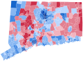
 Connecticut Presidential Election Results 2016 by Municipality.svg 810 × 595; 85 KB
-
 Connecticut Presidential Election Results 2016.svg 156 × 127; 5 KB
-
 CT President 2016.svg 810 × 595; 3.95 MB


