Category:2016 maps of California
Jump to navigation
Jump to search
States of the United States: Arizona · California · Indiana · Iowa · Massachusetts · New York · Ohio · Pennsylvania · South Carolina · Utah · Virginia – Washington, D.C.
Puerto Rico
Puerto Rico
| ← 2010 2011 2012 2013 2014 2015 2016 2017 2018 2019 → |
Subcategories
This category has only the following subcategory.
{
Media in category "2016 maps of California"
The following 3 files are in this category, out of 3 total.
-
 2016 California wildfires map.png 5,000 × 6,000; 27.88 MB
-
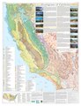 California Level IV ecoregions 1 map.pdf 5,400 × 7,050; 20.82 MB
-


