Category:2016 aerial photographs of Main-Tauber-Kreis
Jump to navigation
Jump to search
Urban districts (cities): Stuttgart ·
English: 2016 aerial photographs of Main-Tauber-Kreis.
Deutsch: Luftbildfotografien aus dem Main-Tauber-Kreis von 2016.
Media in category "2016 aerial photographs of Main-Tauber-Kreis"
The following 7 files are in this category, out of 7 total.
-
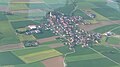
 2016-05-21 Luftbild Vilchband 01.jpg 3,264 × 1,836; 833 KB
-
 2016-05-21 Luftbild Vilchband 02.jpg 3,264 × 1,836; 1.09 MB
-
 2016-05-21 Vilchbänder See near K 2801.jpg 2,000 × 1,100; 414 KB
-
 2016-05-21 Vilchbänder See, near K 2801.jpg 1,000 × 500; 97 KB
-
 BoschPrüfzentrumTeststreckeBoxberg2016-09-29-12-26-14 (Strecke).jpg 3,393 × 1,187; 2.05 MB
-
 BoschPrüfzentrumTeststreckeBoxberg2016-09-29-12-26-14.jpg 3,888 × 2,592; 4.83 MB
-
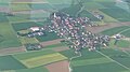
 Unterbalbach im Mai 2016.jpg 3,992 × 2,992; 7.89 MB


.jpg)