Category:2015 in Bramley, Leeds
Jump to navigation
Jump to search
Media in category "2015 in Bramley, Leeds"
The following 31 files are in this category, out of 31 total.
-
 BP filling station, Pudsey Road (geograph 4680793).jpg 1,024 × 768; 657 KB
-
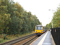 Bramley station with train to Leeds (geograph 4704271).jpg 1,024 × 768; 700 KB
-
 Bramley station, looking east - geograph.org.uk - 4695086.jpg 1,024 × 768; 693 KB
-
 Bramley station, looking west (geograph 4695080).jpg 1,024 × 768; 696 KB
-
 Bramley station, with arriving train (geograph 4695096).jpg 1,024 × 768; 699 KB
-

-
-
-
-

-

-

-
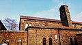
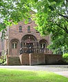 Christ the King, Bramley, Leeds- east end (geograph 4600284).jpg 844 × 1,024; 353 KB
-
 Gamble Hill estate (geograph 4680789).jpg 1,024 × 768; 584 KB
-
 Greek car on Spring Valley Crescent (geograph 4636207).jpg 1,024 × 768; 123 KB
-
 Henconner Lane shops (2) (geograph 4643176).jpg 1,024 × 768; 92 KB
-
 Henconner Lane shops (geograph 4643169).jpg 1,024 × 768; 113 KB
-
 Heron Foods, Henconner Lane (geograph 4643198).jpg 1,024 × 768; 125 KB
-
 Hough Lane Stores, Bramley (geograph 4616178).jpg 1,024 × 768; 140 KB
-
 InPost collection point, Henconner Lane (geograph 4643182).jpg 1,024 × 768; 135 KB
-
 Newsagents on Raynville Road (geograph 4602671).jpg 1,024 × 768; 132 KB
-
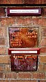
 Old Tetley sign (geograph 4598768).jpg 640 × 480; 58 KB
-
 Open space off Raynville Road, Bramley (geograph 4598773).jpg 1,024 × 768; 184 KB
-
 Poplar Mount and Court (geograph 4643082).jpg 1,024 × 768; 169 KB
-
 Raynville Court and Raynville Grange (geograph 4598748).jpg 1,024 × 768; 130 KB
-
 Raynville Drive, Bramley (geograph 4598759).jpg 1,024 × 768; 157 KB
-
 Raynville Superstore, Kirkstall Mount (geograph 4598802).jpg 1,024 × 768; 159 KB
-
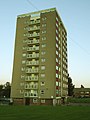 Rycroft Towers, Swinnow Lane (geograph 4636303).jpg 768 × 1,024; 99 KB
-
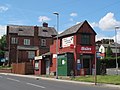
 Shops on the corner of Pudsey Road and Henconner Lane (geograph 4643215).jpg 1,024 × 768; 120 KB
-
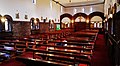
 Trinity Methodist Church, Bramley (geograph 4666074).jpg 1,024 × 768; 177 KB
-
 West Court, Spring Valley, near Bramley (geograph 4636204).jpg 1,024 × 768; 100 KB
.jpg)
.jpg)

.jpg)
.jpg)
.jpg)
.jpg)
.jpg)
.jpg)
.jpg)
.jpg)
.jpg)
.jpg)
.jpg)
.jpg)
_(geograph_4643176).jpg)
.jpg)
.jpg)
.jpg)
.jpg)
.jpg)
.jpg)
.jpg)
.jpg)
.jpg)
.jpg)
.jpg)
.jpg)
.jpg)
.jpg)
.jpg)