Category:2015 in Beverley
Jump to navigation
Jump to search
Media in category "2015 in Beverley"
The following 115 files are in this category, out of 115 total.
-
 Sign for the Foresters Arms, Beverley (geograph 4349942).jpg 758 × 787; 191 KB
-
 A Jaguar on Keldgate, Beverley (geograph 4476345).jpg 2,448 × 1,624; 1.63 MB
-
 A Jaguar on Keldgate, Beverley (geograph 4476349).jpg 2,448 × 1,624; 1.87 MB
-
 Allotments - Queensgate (geograph 4592761).jpg 640 × 480; 83 KB
-
 Allotments off Kitchen Lane, Beverley (geograph 4402446).jpg 1,600 × 1,062; 943 KB
-
 Allotments off Kitchen Lane, Beverley (geograph 4402461).jpg 1,600 × 1,062; 833 KB
-
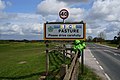
 Approaching Beverley Pastures - The Westwood (geograph 4322285).jpg 5,121 × 3,596; 4.4 MB
-
 Autumn track IMG 7068.jpg - panoramio.jpg 1,600 × 1,046; 572 KB
-
 Beverley & East Riding Golf Club (geograph 4476355).jpg 2,448 × 1,624; 1.09 MB
-
 Beverley & East Riding Golf Club (geograph 4476359).jpg 2,448 × 1,624; 1.27 MB
-
 Beverley Grammar School, Queensgate, Beverley (geograph 4402169).jpg 1,600 × 1,062; 615 KB
-
 Beverley IMG 8292 - panoramio.jpg 1,600 × 955; 630 KB
-
 Beverley IMG 8310 - panoramio.jpg 1,061 × 1,600; 664 KB
-
 Beverley Minster IMG 7786 - panoramio.jpg 1,600 × 1,067; 806 KB
-
 Beverley Westwood (geograph 4299490).jpg 1,024 × 768; 130 KB
-
 Beverley Westwood golf course (geograph 4446672).jpg 1,280 × 960; 1.39 MB
-
 Beverley Westwood IMG 1338.JPG - panoramio.jpg 1,600 × 886; 767 KB
-
 Beverley Westwood IMG 1342.JPG - panoramio.jpg 1,600 × 971; 682 KB
-
 Beverley Westwood IMG 1344.JPG - panoramio.jpg 1,600 × 971; 886 KB
-
 Beverley Westwood IMG 1348.JPG - panoramio.jpg 1,600 × 966; 1,013 KB
-
 Beverley Westwood IMG 7806 - panoramio.jpg 1,600 × 1,067; 1.14 MB
-
 Beverley Westwood IMG 7810 - panoramio.jpg 1,600 × 1,067; 1.05 MB
-
 Black Mill, Beverley Westwood (geograph 4299296).jpg 1,024 × 768; 124 KB
-
 Burton Bushes bluebells IMG 1362.JPG - panoramio.jpg 1,600 × 891; 832 KB
-
 Burton Bushes IMG 1365 - panoramio.jpg 1,600 × 1,067; 1,012 KB
-
 Burton Bushes IMG 1513.jpg - panoramio.jpg 1,600 × 1,067; 614 KB
-
 Burton Bushes IMG 1519.jpg - panoramio.jpg 1,600 × 1,067; 631 KB
-
 Butt Lane at Springdale Way, Beverley (geograph 4402239).jpg 1,600 × 1,062; 767 KB
-
 Butt Lane cut short by the A164, Beverley (geograph 4402223).jpg 1,600 × 1,062; 785 KB
-
 Butt Lane off Queensgate, Beverley (geograph 4402204).jpg 1,600 × 1,062; 611 KB
-
 Butt Lane off Queensgate, Beverley (geograph 4402208).jpg 1,600 × 1,062; 683 KB
-
 Butt Lane towards Newton Drive, Beverley (geograph 4402225).jpg 1,600 × 1,062; 852 KB
-
 Butt Lane towards Newton Drive, Beverley (geograph 4402296).jpg 1,600 × 1,062; 771 KB
-
 Cartwright Lane, Beverley, Yorkshire (geograph 4720910).jpg 3,067 × 2,270; 2.58 MB
-
 Cartwright Lane, Beverley, Yorkshire (geograph 4720913).jpg 3,264 × 2,448; 2.54 MB
-
 Cartwright Lane, Beverley, Yorkshire (geograph 4720914).jpg 2,800 × 2,119; 2.28 MB
-
 Cartwright Lane, Beverley, Yorkshire (geograph 4720923).jpg 3,264 × 2,448; 2.35 MB
-
 Cartwright Lane, Beverley, Yorkshire (geograph 4720929).jpg 3,236 × 2,410; 3.31 MB
-
 Cartwright Lane, Beverley, Yorkshire (geograph 4720936).jpg 3,264 × 2,448; 3.31 MB
-
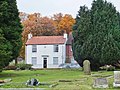
 Cemetery off Sloe Lane, Beverley (geograph 4392066).jpg 1,600 × 1,062; 712 KB
-
 Cemetery off Sloe Lane, Beverley (geograph 4392085).jpg 1,600 × 1,062; 997 KB
-
 Cemetery off Sloe Lane, Beverley (geograph 4392088).jpg 1,600 × 1,062; 828 KB
-
 Cemetery off Sloe Lane, Beverley (geograph 4392090).jpg 1,600 × 1,062; 881 KB
-
 Cemetery off Sloe Lane, Beverley (geograph 4392094).jpg 1,062 × 1,600; 1.21 MB
-
 Cemetery off Sloe Lane, Beverley (geograph 4392096).jpg 1,600 × 1,062; 739 KB
-
 Cemetery off Sloe Lane, Beverley (geograph 4392100).jpg 1,600 × 1,062; 924 KB
-
 Central Avenue, Beverley (geograph 4392119).jpg 1,600 × 1,062; 733 KB
-
 Christopher Hobson Place (geograph 4402450).jpg 1,600 × 1,062; 785 KB
-
 Cow Parsley IMG 3494.jpg - panoramio.jpg 1,600 × 754; 575 KB
-
 Cows at dusk IMG 4735.JPG - panoramio.jpg 1,600 × 984; 501 KB
-
 Cycle path beside Hull Road (A1174) (geograph 4349918).jpg 640 × 480; 66 KB
-

-
-
 Figham Bridge over Beverley and Barmston Drain (geograph 4460122).jpg 1,280 × 960; 1.2 MB
-
 Garden at Christopher Hobson Place (geograph 4402457).jpg 1,600 × 1,062; 881 KB
-
 Grosvenor Place, Beverley, Yorkshire (geograph 4720940).jpg 3,264 × 2,448; 2.82 MB
-
 Grosvenor Place, Beverley, Yorkshire (geograph 4720945).jpg 3,224 × 2,392; 3.4 MB
-
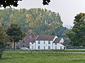
 Grovehill Road, Beverley, Yorkshire (geograph 4674549).jpg 3,090 × 2,322; 3 MB
-
 Houses on Butt Lane, Beverley (geograph 4402220).jpg 1,600 × 1,062; 696 KB
-
 Houses on Butt Lane, Beverley (geograph 4402226).jpg 1,600 × 1,062; 591 KB
-
 Houses on Butt Lane, Beverley (geograph 4402236).jpg 1,600 × 1,062; 658 KB
-
 Houses on Butt Lane, Beverley (geograph 4402300).jpg 1,600 × 1,062; 554 KB
-
 Houses on Kitchen Lane, Beverley (geograph 4402462).jpg 1,600 × 1,062; 722 KB
-
 Houses on Queensgate, Beverley (geograph 4392063).jpg 1,600 × 1,062; 752 KB
-
 Houses on Sloe Lane, Beverley (geograph 4392092).jpg 1,600 × 1,062; 769 KB
-
 Hull Road, Beverley (geograph 4410973).jpg 1,600 × 1,062; 612 KB
-
 Itch - panoramio.jpg 1,600 × 1,171; 539 KB
-
 Keldgate, Beverley (geograph 4392109).jpg 1,600 × 1,062; 504 KB
-
 Keldgate, Beverley (geograph 4476346).jpg 2,448 × 1,624; 1.47 MB
-
 Keldgate, Beverley, Yorkshire (geograph 4575978).jpg 3,163 × 2,357; 2.76 MB
-
 Keldgate, Beverley, Yorkshire (geograph 4575988).jpg 3,139 × 2,342; 2.67 MB
-
 Keldgate, Beverley, Yorkshire (geograph 4576012).jpg 3,264 × 2,448; 2.65 MB
-
 Keldgate, Beverley, Yorkshire (geograph 4721058).jpg 3,215 × 2,375; 2.91 MB
-
 Kitchen Lane, Beverley, Yorkshire (geograph 4728918).jpg 3,232 × 2,404; 2.59 MB
-
 Locked cemetery gates on Queensgate, Beverley (geograph 4392082).jpg 1,600 × 1,062; 908 KB
-
 Long Lane - viewed from Old Manor Lawns (geograph 4595603).jpg 640 × 480; 75 KB
-
 Long Lane, Beverley, Yorkshire (geograph 4721083).jpg 3,248 × 2,428; 4.49 MB
-
 Mill Dam Drain from Spark Mill Lane, Beverley (geograph 4418122).jpg 1,600 × 1,062; 945 KB
-
 Mill Dam Drain off Beverley Parklands, Beverley (geograph 4418045).jpg 1,600 × 1,062; 963 KB
-
 Mill Dam Drain, Beverley, Yorkshire (geograph 4721126).jpg 3,264 × 2,448; 3.84 MB
-
 Old Manor Lawns - Long Lane (geograph 4595599).jpg 640 × 480; 79 KB
-
 Path leading to Kitchen Lane, Beverley (geograph 4402436).jpg 1,600 × 1,062; 866 KB
-
 Path leading to Kitchen Lane, Beverley (geograph 4402439).jpg 1,600 × 1,062; 902 KB
-
 Path leading to Kitchen Lane, Beverley (geograph 4402441).jpg 1,600 × 1,062; 902 KB
-
 Queensgate - viewed from Admiral Walker Road (geograph 4592752).jpg 640 × 480; 74 KB
-
 Queensgate Cottages, Beverley (geograph 4392057).jpg 1,600 × 1,062; 691 KB
-
 Queensgate, Beverley (geograph 4392087).jpg 1,600 × 1,062; 585 KB
-
 Queensgate, Beverley, Yorkshire (geograph 4721379).jpg 3,264 × 2,448; 3.39 MB
-
 Queensgate, Beverley, Yorkshire (geograph 4729210).jpg 3,254 × 2,434; 2.94 MB
-
 Roadworks on Hull Road (A1174) (geograph 4349922).jpg 640 × 480; 57 KB
-
 Roadworks on Hull Road (A1174) (geograph 4349923).jpg 640 × 480; 48 KB
-
 Rose of Sharon Cottages on Butt Lane, Beverley (geograph 4402305).jpg 1,600 × 1,062; 488 KB
-
 Saturday Market, Beverley, Yorkshire (geograph 4557652).jpg 2,535 × 2,237; 2.03 MB
-
 Sloe Lane, Beverley, Yorkshire (geograph 4721382).jpg 3,254 × 2,434; 3.8 MB
-
 Sloe Lane, Beverley, Yorkshire (geograph 4721387).jpg 3,264 × 2,448; 2.65 MB
-
 Springdale Way from Butt Lane, Beverley (geograph 4402245).jpg 1,600 × 1,062; 697 KB
-
 St Martins Cemetery - Queensgate (geograph 4592767).jpg 640 × 480; 97 KB
-
 St Marys, Beverley IMG 7927 - panoramio.jpg 1,115 × 1,600; 996 KB
-
 The Black Mill, Beverley Westwood (geograph 4299497).jpg 1,024 × 768; 135 KB
-
 The River Hull to the south of Weel (geograph 4707468).jpg 1,024 × 768; 128 KB
-
 The Royal Oak on Cartwright Lane, Beverley (geograph 4392101).jpg 1,600 × 1,062; 467 KB
-
 The Royal Oak on Cartwright Lane, Beverley (geograph 4392103).jpg 1,600 × 1,062; 486 KB
-
 The Royal Oak on Cartwright Lane, Beverley (geograph 4392105).jpg 1,089 × 1,258; 396 KB
-
 Tour de Yorkshire bunting on Cartwright Lane (geograph 4464972).jpg 2,448 × 1,624; 1.76 MB
-
 Tour de Yorkshire bunting on Cartwright Lane (geograph 4464983).jpg 2,448 × 1,624; 1.36 MB
-
 Trees by the Black Mill (geograph 4299501).jpg 1,024 × 768; 205 KB
-
 View towards the Grandstand (geograph 4299313).jpg 1,024 × 768; 158 KB
-
 Vote Yorkshire First placard (geograph 4476367).jpg 2,448 × 1,624; 1.22 MB
-
 Westwood, Beverley, Yorkshire (geograph 4721434).jpg 3,204 × 2,366; 2.65 MB
-
 Westwood, Beverley, Yorkshire (geograph 4721436).jpg 3,232 × 2,404; 2.74 MB
-
 Westwood, Beverley, Yorkshire (geograph 4721440).jpg 3,260 × 2,442; 2.16 MB
-
 Westwood, Beverley, Yorkshire (geograph 4721469).jpg 3,264 × 2,448; 3.03 MB
-
 Westwood, Beverley, Yorkshire (geograph 4721530).jpg 3,264 × 2,448; 2.77 MB
-
 Westwood, Beverley, Yorkshire (geograph 4721533).jpg 3,264 × 2,448; 2.98 MB
-
 Wiggo Pasture, Beverley Westwood (geograph 4476371).jpg 2,448 × 1,624; 1.33 MB
.jpg)
.jpg)
.jpg)
.jpg)
.jpg)
.jpg)
.jpg)

.jpg)
.jpg)
.jpg)


.jpg)
.jpg)


.jpg)


.jpg)
.jpg)
.jpg)
.jpg)
.jpg)
.jpg)
.jpg)
.jpg)
.jpg)
.jpg)
.jpg)
.jpg)
.jpg)
.jpg)
.jpg)
.jpg)
.jpg)
.jpg)
.jpg)
.jpg)
.jpg)


_(geograph_4349918).jpg)
.jpg)
.jpg)
.jpg)
.jpg)
.jpg)
.jpg)
.jpg)
.jpg)
.jpg)
.jpg)
.jpg)
.jpg)
.jpg)
.jpg)
.jpg)

.jpg)
.jpg)
.jpg)
.jpg)
.jpg)
.jpg)
.jpg)
.jpg)
.jpg)
.jpg)
.jpg)
.jpg)
.jpg)
.jpg)
.jpg)
.jpg)
.jpg)
.jpg)
.jpg)
.jpg)
.jpg)
.jpg)
_(geograph_4349922).jpg)
_(geograph_4349923).jpg)
.jpg)
.jpg)
.jpg)
.jpg)
.jpg)
.jpg)

.jpg)
.jpg)
.jpg)
.jpg)
.jpg)
.jpg)
.jpg)
.jpg)
.jpg)
.jpg)
.jpg)
.jpg)
.jpg)
.jpg)
.jpg)
.jpg)
.jpg)