Category:2014 maps of the Bahamas
Jump to navigation
Jump to search
Countries of North America: The Bahamas · Canada · Cuba · Honduras · Jamaica · Mexico · Nicaragua · Panama · Saint Vincent and the Grenadines · United States of America‡
Other territories: Greenland
‡: partly located in North America
Other territories: Greenland
‡: partly located in North America
| 2012 2014 |
Media in category "2014 maps of the Bahamas"
The following 2 files are in this category, out of 2 total.
-
 ECHO Bahamas Editable A4 Portrait.png 794 × 1,123; 307 KB
-
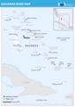
 PAT - Bahamas.gif 860 × 975; 72 KB

