Category:2013 in Scunthorpe
Jump to navigation
Jump to search
Media in category "2013 in Scunthorpe"
The following 42 files are in this category, out of 42 total.
-
 Abandoned tennis courts, Foxhills Sports Ground - geograph.org.uk - 3772333.jpg 1,024 × 768; 219 KB
-
 Action at last (2) - geograph.org.uk - 3297693.jpg 1,024 × 768; 170 KB
-
 Action at last - geograph.org.uk - 3297688.jpg 1,024 × 768; 145 KB
-
 Allotments south of Phoenix Parkway - geograph.org.uk - 3833208.jpg 640 × 480; 61 KB
-
 Almost empty car park - geograph.org.uk - 3305161.jpg 1,024 × 843; 152 KB
-

-
 Bench at the top of the hill - geograph.org.uk - 3791756.jpg 1,024 × 768; 319 KB
-
 Berkeley Street - geograph.org.uk - 3836020.jpg 640 × 480; 76 KB
-
 Buckingham Street South - geograph.org.uk - 3836023.jpg 640 × 480; 64 KB
-
 Cafe on Park Farm Road - geograph.org.uk - 3833205.jpg 640 × 480; 54 KB
-
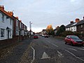
 Clannad - geograph.org.uk - 3367602.jpg 640 × 480; 72 KB
-
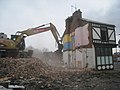
 Closed to allow demolition - geograph.org.uk - 3307960.jpg 1,024 × 768; 197 KB
-
 CrosbyOne Centre carpark and Frodingham Road - geograph.org.uk - 3790368.jpg 1,024 × 768; 234 KB
-
 DIY shed off Glebe Road - geograph.org.uk - 3836005.jpg 640 × 480; 47 KB
-
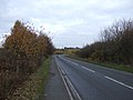
 Doncaster Road (A18) - geograph.org.uk - 3831125.jpg 640 × 480; 55 KB
-
 Factory, Foxhills Industrial Estate - geograph.org.uk - 3833203.jpg 640 × 480; 51 KB
-

-
 Just one to go - geograph.org.uk - 3307936.jpg 1,024 × 768; 142 KB
-

-
 Memorial Gardens in the snow (2) - geograph.org.uk - 3305166.jpg 1,024 × 768; 217 KB
-
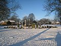 Memorial Gardens in the snow - geograph.org.uk - 3305162.jpg 1,024 × 768; 226 KB
-
 More than half gone - geograph.org.uk - 3306248.jpg 1,024 × 768; 142 KB
-
 Office building off Doncaster Road - geograph.org.uk - 3831128.jpg 640 × 480; 77 KB
-
 On Atkinson's Warren - geograph.org.uk - 3813071.jpg 1,024 × 768; 206 KB
-

-
 Plumb Center on Glebe Road - geograph.org.uk - 3836008.jpg 640 × 480; 44 KB
-
 Railway viaduct over Scotter Road - geograph.org.uk - 3831121.jpg 640 × 480; 81 KB
-
 Retail units off Mannaberg Way - geograph.org.uk - 3833212.jpg 640 × 480; 52 KB
-
 Scotter Road Railway Viaduct - geograph.org.uk - 1259418.jpg 640 × 423; 74 KB
-
 Scunthorpe tower block - geograph.org.uk - 3836009.jpg 480 × 640; 51 KB
-
 Service station on Doncaster Road - geograph.org.uk - 3831123.jpg 640 × 480; 74 KB
-
 Silver birch trees, Atkinson's Warren - geograph.org.uk - 3791732.jpg 1,024 × 768; 360 KB
-
 Silver birch, Atkinson's Warren - geograph.org.uk - 3791750.jpg 1,024 × 768; 279 KB
-
 Smash and grab - geograph.org.uk - 3307915.jpg 1,024 × 695; 105 KB
-
 Steel houses on Foxhills Road - geograph.org.uk - 3772354.jpg 1,024 × 768; 116 KB
-
 The Church of the Resurrection - geograph.org.uk - 3702839.jpg 1,024 × 768; 210 KB
-

-
 The Light, Scunthorpe - geograph.org.uk - 3836031.jpg 640 × 480; 53 KB
-
 The Poacher, Berkeley estate - geograph.org.uk - 3310168.jpg 1,024 × 768; 113 KB
-
 Unofficial path on Atkinson's Warren - geograph.org.uk - 3791735.jpg 1,024 × 768; 200 KB
-
 Winterton Road (A1077) - geograph.org.uk - 3833224.jpg 640 × 480; 65 KB
-


_-_geograph.org.uk_-_3297693.jpg)


_-_geograph.org.uk_-_3833221.jpg)


_-_geograph.org.uk_-_3831125.jpg)


_-_geograph.org.uk_-_3305166.jpg)


_-_geograph.org.uk_-_3833224.jpg)
_-_geograph.org.uk_-_3833219.jpg)