Category:2012 presidential election maps of New York (state)
Jump to navigation
Jump to search
States of the United States: Alabama · California · Connecticut · Florida · Georgia · Illinois · Kentucky · Massachusetts · New Hampshire · New York · North Carolina · Ohio · Pennsylvania · Texas
Media in category "2012 presidential election maps of New York (state)"
The following 3 files are in this category, out of 3 total.
-
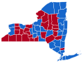 2012 Presidential Election NY.svg 655 × 500; 400 KB
-
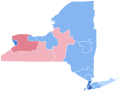
 New york presidential results 2012 2016Swing.svg 635 × 476; 401 KB
-
 NY-12-pres-districts.svg 810 × 621; 200 KB


