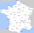
Category:2012 maps of France
Jump to navigation
Jump to search
Subcategories
This category has the following 3 subcategories, out of 3 total.
L
T
- Tour de France maps 2012 (7 F)
Media in category "2012 maps of France"
The following 12 files are in this category, out of 12 total.
-
Biding.jpg 576 × 384; 156 KB
-
Ensoleillement en France en 2012.png 1,654 × 2,338; 987 KB
-
French electricity sales 2012.svg 1,003 × 952; 523 KB
-
Map commune FR insee code 85288.png 756 × 605; 93 KB
-
Nouvelle-Calédonie répartition culture 2012.svg 708 × 591; 181 KB
-
Nouvelle-Calédonie surface et exploitations agricoles 2012.svg 708 × 591; 169 KB
-
Réseau autoroutier français - 2012.svg 1,195 × 1,179; 369 KB


