Category:2012 aerial photographs of Canada
Jump to navigation
Jump to search
Media in category "2012 aerial photographs of Canada"
The following 173 files are in this category, out of 173 total.
-
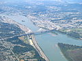
 20120909 012 Detroit, Michigan (8390388509).jpg 4,000 × 3,000; 2.01 MB
-
 Above the Swirl.jpg 2,400 × 1,779; 1.67 MB
-
 AC 319 Flight (YYZ to YEG) (6803811640).jpg 1,441 × 1,441; 908 KB
-
 Aerial photograph of a cliff on Baffin Island.jpg 1,800 × 2,400; 2.3 MB
-
 Ajax ON.JPG 1,875 × 1,250; 1.29 MB
-
 UBC Law at Allard Hall.JPG 4,256 × 2,832; 3.29 MB
-
 Atikokan High School.JPG 4,608 × 3,456; 6.14 MB
-
 Auyuittuq National Park, Baffin Island, Nunavut -a.jpg 2,400 × 2,059; 2.02 MB
-
 Auyuittuq National Park, Baffin Island, Nunavut -b.jpg 2,400 × 1,410; 941 KB
-
 Auyuittuq National Park, Baffin Island, Nunavut -c.jpg 2,400 × 1,782; 2.18 MB
-
 Backed up Against the Wall.jpg 2,400 × 1,742; 1.91 MB
-
 Baffin Island remnant holdfast ice.jpg 2,400 × 1,800; 1.51 MB
-
 Basalt and Sea Ice Axel Heiberg Island Canada.jpg 2,592 × 1,944; 1.05 MB
-
 Big glacially polished cliff on Baffin Island.jpg 2,400 × 2,082; 2.48 MB
-
 Big Trout Lake.jpg 2,300 × 1,533; 821 KB
-
 Bruce Mines ON 2.JPG 2,000 × 1,333; 908 KB
-
 Burlington Heights looking south.jpg 2,400 × 1,486; 2.91 MB
-
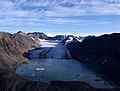
 Bylot Island Glacier (cropped).jpg 3,200 × 1,286; 1.53 MB
-
 Bylot Island Glacier.jpg 3,200 × 1,670; 2.04 MB
-
 Canada Michigan St Claire river Ontario Lambton county Chatham-Kent county IMG 1826.JPG 3,456 × 4,681; 10.19 MB
-
 Canyon (7793385952).jpg 4,608 × 3,456; 3.52 MB
-
 Churchill aerial view.JPG 3,007 × 1,882; 2.91 MB
-
 Churchill aerial view2.JPG 3,008 × 2,000; 3.02 MB
-
 Churchill aerial view3.JPG 3,008 × 2,000; 2.42 MB
-
 Clover Point and Ross Bay. MORE INFO IN PANORAMIO-DESCRIPTION - panoramio.jpg 2,488 × 1,440; 568 KB
-
 Cochrane Alberta (8625233134).jpg 5,184 × 3,456; 2.29 MB
-
 Cockburn Island 1.JPG 1,600 × 960; 249 KB
-
 CYNJ Langley Regional CURRENT.JPG 5,184 × 3,456; 5.22 MB
-
 CYSN.jpg 1,522 × 1,444; 2.37 MB
-
 Deerfoot Trail at Memorial Drive 2.jpg 4,000 × 3,000; 2.23 MB
-
 Delta, BC, Canada - panoramio.jpg 3,664 × 2,748; 2.12 MB
-
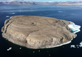
 Edinburgh Island NWT 2.jpg 3,648 × 2,736; 3.35 MB
-
 Edinburgh Island NWT.jpg 3,648 × 2,736; 4.65 MB
-
 Edmonton City Centre Airport.jpg 1,302 × 774; 685 KB
-
 Ekwi River (7793400408).jpg 4,608 × 3,456; 3.8 MB
-
 Embro ON.JPG 2,048 × 1,365; 1.29 MB
-
 Fernridge, British Columbia, from the air.JPG 5,184 × 3,456; 6.37 MB
-
 Final Runway 30 Kugluktuk.jpg 3,648 × 2,736; 3.15 MB
-
 Fjord in northern Baffin Island, Nunavut.jpg 2,400 × 1,669; 1.29 MB
-
 Flying over Vancouver (13061583614).jpg 4,000 × 3,000; 7.22 MB
-
 FortMacKay.jpg 3,648 × 2,736; 2.91 MB
-
 Franklin dike on northwestern Baffin Island..jpg 2,400 × 1,732; 1.9 MB
-
 Glacier and Moraine in Nunavut in Canada.jpg 3,008 × 2,000; 2.02 MB
-
 Glacier, Glacial Lake, and Terminal Moraine, Baffin Island -a.jpg 2,400 × 1,821; 1.31 MB
-
 GM Oshawa.jpg 1,535 × 1,535; 938 KB
-
 Hanging Glaciers in nunavut.jpg 2,400 × 1,908; 2.1 MB
-
 HansIsland.png 940 × 657; 978 KB
-
 Helicopter Day (7569330138).jpg 2,592 × 1,944; 1.05 MB
-
 Highland Valley Copper Mine.JPG 4,000 × 3,000; 1.89 MB
-

-
 Hope Bay Gold Mine 01.jpg 3,648 × 2,736; 3.81 MB
-
 Hope Bay Gold Mine 02.jpg 3,648 × 2,668; 4.03 MB
-
 Hope Bay Gold Mine 03.jpg 3,648 × 2,736; 5.42 MB
-
 Hope Bay Gold Mine 04.jpg 3,648 × 2,736; 6.04 MB
-
 Hope Bay Gold Mine 05.jpg 3,648 × 2,736; 4.55 MB
-
 Kemess Mine in 2012.JPG 5,184 × 3,456; 5.05 MB
-
 Kingfisher Lake.JPG 1,944 × 2,592; 1.03 MB
-
 Kugluktuk NT.jpg 3,648 × 2,736; 4.43 MB
-
 Lake Erie Islands, Lake Erie in Ohio and Ontario, Canada (7992985986).jpg 4,000 × 3,000; 1.65 MB
-
 Langley Speedway from the ar.JPG 5,184 × 3,456; 5.23 MB
-
 Loch Lomond ON.JPG 2,048 × 1,536; 1.15 MB
-
 Long harbour and Ganges Harbour. INFO IN PANORAMIO DESCRIPTION - panoramio.jpg 3,648 × 2,736; 1.39 MB
-
 Lufa Farms Aerial view of Montreal rooftop greenhouse.jpg 1,800 × 1,200; 382 KB
-
 Lufa Farms Aerial view of Montreal rooftop greenhouse2.jpg 1,800 × 1,200; 379 KB
-
 Mackenzie Mountains (7793397162).jpg 4,392 × 3,294; 4.24 MB
-
 Mid-Borden Peninsula, Baffin Island.jpg 2,400 × 1,981; 1.9 MB
-
 Minnitaki Lake.JPG 1,462 × 1,949; 504 KB
-
 Montreal-Dorval Airport 1.JPG 2,000 × 1,333; 816 KB
-
 Montreal-Dorval Airport 1c.JPG 1,000 × 667; 247 KB
-
 Mouth of the Churchill River at Hudson Bay (7461042054).jpg 1,280 × 853; 300 KB
-
 MV Ithaca aerial view1.JPG 2,958 × 2,214; 2.9 MB
-
 MV Ithaca aerial view2.JPG 3,648 × 2,736; 3.94 MB
-
 MV Ithaca aerial view3.JPG 3,420 × 2,144; 3.31 MB
-
 Nakiska ski hills Alberta (8625233430).jpg 5,184 × 3,456; 2.22 MB
-
 Nelson River near Norway House, from the air.jpg 3,648 × 2,736; 1.86 MB
-
 Ontario Chatham-Kent county Dresden city IMG 1835.JPG 3,456 × 5,184; 8.51 MB
-
 Ontario Chatham-Kent county east Camden Township Thames river IMG 1838.JPG 4,684 × 2,821; 5.95 MB
-
 Ontario Chatham-Kent county east Camden Township Thames river IMG 1839.JPG 5,010 × 3,456; 10.07 MB
-
 Ontario Chatham-Kent county east Elgin county west Lake Erie IMG 1844.JPG 5,086 × 2,901; 7.9 MB
-
 Ontario Chatham-Kent county east Lake Erie IMG 1840.JPG 5,184 × 2,718; 8.47 MB
-
 Ontario Chatham-Kent county east with Sydenham river Dresden city IMG 1837.JPG 3,456 × 4,942; 10.52 MB
-
 Ontario Chatham-Kent county Wallaceburg city IMG 1830.JPG 3,456 × 4,867; 9.79 MB
-
 Ontario Chatham-Kent county Wallaceburg city IMG 1831.JPG 3,456 × 5,184; 11.66 MB
-
 Ontario Chatham-Kent county Wallaceburg city IMG 1833.JPG 5,184 × 3,456; 10.44 MB
-
 Ontario Chatham-Kent east Elgin co west Lake Erie IMG 1846.JPG 3,456 × 4,196; 7.62 MB
-
 Ontario Elgin county Big Otter Creek river Port Burwell and Lake Erie IMG 1851.JPG 5,005 × 2,817; 8.65 MB
-
 Ontario Elgin county east Norfolk county west with Clear Creek river and Lake Erie IMG 1853.JPG 5,123 × 3,006; 11.13 MB
-
 Ontario Elgin county Port Stanley and Lake Erie IMG 1850.JPG 5,184 × 2,307; 7.59 MB
-
 Ontario Elgin county Port Stanley IMG 1847.JPG 4,911 × 2,562; 9.08 MB
-
 Ontario Elgin county Port Stanley IMG 1848.JPG 3,357 × 2,276; 4.91 MB
-
 Ontario Elgin county Wallacetown municipality Lake Erie IMG 1842.JPG 5,026 × 3,226; 11.2 MB
-
 Ontario Elgin county Wallacetown municipality Lake Erie IMG 1843.JPG 5,086 × 3,257; 9.92 MB
-
 Ontario Elgin county Wallacetown municipality Lake Erie IMG 1845.JPG 5,048 × 2,997; 8.37 MB
-
 Ontario Elgin county with Big Otter Creek river Port Burwell and Lake Erie IMG 1852.JPG 4,284 × 2,730; 8.4 MB
-

-
 Ontario Norfolk county Long Point Lake Erie IMG 1856.JPG 5,074 × 3,198; 7.66 MB
-
 Ontario Norfolk county Long Point Lake Erie IMG 1857.JPG 5,037 × 2,518; 7.35 MB
-
 Ontario Norfolk county Long Point Lake Erie IMG 1858.JPG 5,054 × 1,648; 4.98 MB
-
 Outcrops and Sea Ice (7569335296).jpg 2,592 × 1,944; 1.46 MB
-
 Parry Island.JPG 1,555 × 1,920; 877 KB
-
 Pelee Island and Middle Island, Ontario, Canada (7238171558).jpg 3,000 × 4,000; 1.88 MB
-
 Perched irrigated fields in the arid Fraser gorge above the Big Bar ferry (7959741892).jpg 2,121 × 1,414; 2.73 MB
-
 Point Pelee National Park, Ontario, Canada (7238172160).jpg 3,000 × 4,000; 6.34 MB
-
 Polygonal Ground in Nunavut in Canada - Aerial photo.jpg 2,592 × 1,944; 1 MB
-
 Port of Churchill aerial view.JPG 3,008 × 2,000; 2.73 MB
-
 Prairie Storm (7608957886).jpg 2,048 × 1,232; 1.32 MB
-
 Prince of Wales Fort, Churchill, MB.jpg 3,648 × 2,736; 4.58 MB
-
 RichardsonBackcountry.JPG 3,648 × 2,736; 2.3 MB
-
 River (7793393330).jpg 4,608 × 3,456; 4.05 MB
-
 Riviere Mille Iles.JPG 1,536 × 1,806; 1.06 MB
-
 Runway, Gore Bay Manitoulin Airport.jpg 4,752 × 3,168; 5.29 MB
-
 Salt Diapir Axel Heiberg Island Canada.jpg 1,944 × 2,592; 1.22 MB
-
 Sea Ice - 2 (7569331464).jpg 2,592 × 1,944; 1.24 MB
-
 Sea ice on Hudson Bay near Cape Churchill.JPG 3,008 × 2,000; 2.62 MB
-
 Shadow of the Wolf (7055313995).jpg 2,402 × 1,790; 2.1 MB
-
 Silver Islet ON.JPG 2,000 × 1,333; 818 KB
-
 Sioux Lookout ON 2.JPG 1,600 × 1,066; 237 KB
-
 Sleeping Giant PP.JPG 1,536 × 2,048; 841 KB
-

-
 Southern Gulf Islands, BC, Canada - panoramio (15).jpg 3,664 × 2,748; 2.3 MB
-
 Southern Gulf Islands, BC, Canada - panoramio (16).jpg 3,664 × 2,748; 2.5 MB
-
 Southern Ontario at night.png 954 × 608; 876 KB
-
 St-Michel-Saints QC.JPG 1,320 × 880; 421 KB
-
 Surrey aerial view.JPG 2,048 × 1,536; 1.04 MB
-
 SYNCRUDE 2012 (7173999608).jpg 4,288 × 3,216; 2.24 MB
-
 SYNCRUDE 2012 (7174002070).jpg 4,288 × 3,216; 2.22 MB
-
 SYNCRUDE 2012 (7174004158).jpg 4,288 × 3,216; 1.96 MB
-
 SYNCRUDE 2012 (7174009398).jpg 4,288 × 3,216; 5.17 MB
-
 SyncrudeWoodBuffalo.JPG 3,648 × 2,736; 2.31 MB
-
 Thames Centre ON.JPG 1,800 × 1,500; 1.01 MB
-
 The Town of Churchill as seen from the port.jpg 1,280 × 473; 253 KB
-
 Thorah Island.JPG 1,260 × 840; 143 KB
-
 Tilted Rock Layers in Nunavut in Canada.jpg 3,008 × 2,000; 1.9 MB
-
 Town of Churchill aerial view.JPG 3,648 × 2,736; 4.77 MB
-
 Tug boat pushing log raft near Vancouver.jpg 2,400 × 1,600; 911 KB
-
 Tundra Lodge, Churchill.JPG 2,664 × 2,002; 3.21 MB
-
 Vancouver - panoramio (21).jpg 3,664 × 2,748; 1.89 MB
-
 Vancouver - panoramio (22).jpg 3,664 × 2,748; 2.06 MB
-
 Vancouver - panoramio (23).jpg 3,664 × 2,748; 1.78 MB
-
 Vancouver - panoramio (24).jpg 3,664 × 2,748; 2.27 MB
-
 Vancouver - panoramio (25).jpg 3,664 × 2,748; 1.81 MB
-
 Vancouver - panoramio (26).jpg 3,664 × 2,748; 1.87 MB
-
 Vancouver - panoramio (27).jpg 3,664 × 2,748; 2.53 MB
-
 Vancouver - panoramio (28).jpg 3,664 × 2,748; 2.45 MB
-
 Vancouver - panoramio (29).jpg 3,664 × 2,748; 2.6 MB
-
 Vancouver - panoramio (30).jpg 3,664 × 2,748; 2.55 MB
-
 Vancouver - panoramio (31).jpg 3,664 × 2,748; 2.06 MB
-
 Vancouver - panoramio (32).jpg 3,664 × 2,748; 2.34 MB
-
 Vancouver - panoramio (33).jpg 3,664 × 2,748; 2.07 MB
-
 Vancouver - panoramio (34).jpg 3,664 × 2,748; 1.92 MB
-
 Victoria golf course. MORE INFO IN PANORAMIO-DESCRIPTION - panoramio.jpg 2,742 × 1,749; 1,016 KB
-
 Victoria Island - panoramio (10).jpg 3,664 × 2,748; 2.35 MB
-
 Victoria Island - panoramio (11).jpg 3,664 × 2,748; 2.42 MB
-
 Victoria Island - panoramio (13).jpg 3,664 × 2,748; 2.38 MB
-
 Victoria Island - panoramio (14).jpg 3,664 × 2,748; 2.11 MB
-
 Victoria Island - panoramio (15).jpg 3,664 × 2,748; 1.9 MB
-
 Victoria Island - panoramio (16).jpg 3,664 × 2,748; 2.19 MB
-
 Victoria Island - panoramio (17).jpg 3,664 × 2,748; 2.14 MB
-
 Victoria Island - panoramio (18).jpg 3,664 × 2,748; 1.94 MB
-
 Victoria Island - panoramio (19).jpg 3,664 × 2,748; 2.25 MB
-
 Victoria Island - panoramio (2).jpg 3,664 × 2,748; 2.37 MB
-
 Victoria Island - panoramio (3).jpg 3,664 × 2,748; 2.4 MB
-
 Victoria Island - panoramio (4).jpg 3,664 × 2,748; 2.49 MB
-
 Victoria Island - panoramio (5).jpg 3,664 × 2,748; 2.2 MB
-
 Victoria Island - panoramio (6).jpg 3,664 × 2,748; 2.53 MB
-
 Victoria Island - panoramio (7).jpg 3,664 × 2,748; 2.55 MB
-
 Victoria Island - panoramio (8).jpg 3,664 × 2,748; 1.98 MB
-
 Victoria Island - panoramio (9).jpg 3,664 × 2,748; 2.48 MB
-
 Victoria Island - panoramio.jpg 3,664 × 2,748; 2.48 MB
-
 Wapusk polar bears aerial view.JPG 3,648 × 2,736; 4.59 MB
-
 Watson Lake Airport, Watson Lake, Yukon Territory.jpg 2,705 × 1,870; 1.91 MB
-
 Whitehorse Airport, Yukon Territory.jpg 3,468 × 2,300; 2.74 MB
-
 Wunnummin Lake.JPG 2,592 × 1,728; 920 KB
.jpg)

_(6803811640).jpg)


.jpg)


.jpg)


.jpg)


.jpg)


.jpg)


.jpg)


.jpg)


.jpg)


.jpg)


.jpg)

.jpg)
.jpg)
.jpg)


.jpg)


.jpg)


.jpg)

.jpg)


.jpg)
.jpg)


.jpg)
.jpg)
.jpg)
.jpg)


.jpg)
.jpg)
.jpg)
.jpg)
.jpg)
.jpg)
.jpg)
.jpg)
.jpg)
.jpg)
.jpg)
.jpg)
.jpg)
.jpg)

.jpg)
.jpg)
.jpg)
.jpg)
.jpg)
.jpg)
.jpg)
.jpg)
.jpg)
.jpg)
.jpg)
.jpg)
.jpg)
.jpg)
.jpg)
.jpg)
.jpg)


.jpg)