Category:2011 satellite pictures
Jump to navigation
Jump to search
English: 2011 satellite pictures.
Svenska: Satellitbilder från 2011.
Deutsch: Satellitenfotografien aus 2011.
Subcategories
This category has the following 12 subcategories, out of 12 total.
F
I
S
V
Media in category "2011 satellite pictures"
The following 29 files are in this category, out of 29 total.
-
 Baixada Fluminense Stricto sensu (Imagem de Satélite).jpg 2,568 × 1,030; 905 KB
-
 Bastrop County Complex Fire Burn Scar (6147392845).jpg 924 × 1,134; 1.49 MB
-
 Bloom in the Barents Sea (SVS30286).pdf 1,500 × 843; 2.78 MB
-
 Bloom in the Barents Sea (SVS30286).png 4,104 × 2,304; 6.83 MB
-
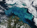 Bloom in the Barents Sea.jpg 4,000 × 3,000; 2.87 MB
-
 Bloom in the Ross Sea (SVS30293).pdf 1,500 × 843; 4.11 MB
-
 Bloom in the Ross Sea (SVS30293).png 4,104 × 2,304; 12.03 MB
-
 Dead Sea Salt Farming (SVS30053).pdf 1,500 × 843; 1.87 MB
-
 Dead Sea Salt Farming (SVS30053).png 4,104 × 2,304; 15.97 MB
-
 Dellen Landsat.png 1,200 × 1,200; 2.08 MB
-
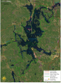 Färnebofjärden National Park satellite map-fr.svg 1,772 × 2,368; 2.41 MB
-
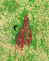
 Maciço do Gericinó-Mendanha, Rio de Janeiro.jpg 572 × 401; 85 KB
-
 NASA Satellite Captures Snow Across South Central US (5445369663).jpg 1,700 × 1,300; 669 KB
-
 NASA's NPP Satellite Acquires First VIIRS Image (6385182023).jpg 5,989 × 5,892; 7.66 MB
-
 NASA's NPP Satellite Acquires First VIIRS Image (6385184555).jpg 3,111 × 5,155; 13.48 MB
-
 Plankton Bloom South of Africa (SVS30294).pdf 1,500 × 843; 3.66 MB
-
 Plankton Bloom South of Africa (SVS30294).png 4,104 × 2,304; 10.59 MB
-
Remembering 2011’s Tohoku Earthquake and Tsunami (NESDIS 2021-03-11 684 Tsunami-Spin).webm 11 s, 1,920 × 1,080; 4.94 MB
-
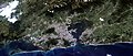 Rio de Janeiro, satellite image, LandSat-5, 2011-05-09.jpg 5,786 × 2,463; 4.53 MB
-
 Satellite view of Ashokan Reservoir after Hurricane Irene.jpg 652 × 324; 212 KB
-
 Smoke from the Honey Prairie and Pains Bay fires, Atlantic Ocean (5712979658).jpg 6,400 × 5,200; 6.1 MB
-
 Snow across the United States 2011-12-21.jpg 4,400 × 3,400; 4.56 MB
-

-
 The Super Outbreak of 2011 (50700830202).jpg 2,888 × 1,976; 1.35 MB
-
 The Tuscaloosa-Birmingham EF-4 Tornado (NESDIS 2011-04-27).png 1,920 × 1,080; 2.65 MB
-
 US East Coast VIR 2011326 large.jpg 5,986 × 5,947; 4.3 MB
-
 VIIRS First Light - NASA Earth Observatory.jpg 720 × 720; 271 KB
-
 Waves in Airglow (8246889445).jpg 1,442 × 480; 169 KB
-
 Åland Islands.jpg 6,000 × 4,000; 4.38 MB
.jpg)
.png)

.png)
.png)


.jpg)
.jpg)
.jpg)
.png)


.jpg)

.jpg)
.jpg)
.png)


.jpg)
.jpg)