Category:2011 on the South Devon Railway sea wall
Jump to navigation
Jump to search
Media in category "2011 on the South Devon Railway sea wall"
The following 74 files are in this category, out of 74 total.
-
 The Channel, from Sprey Point - geograph.org.uk - 1062265.jpg 640 × 478; 49 KB
-
 Dawlish - geograph.org.uk - 2274954.jpg 4,000 × 3,000; 2.87 MB
-
 HST under footbridge at Dawlish Warren.jpg 3,350 × 2,664; 2.51 MB
-
 Trains passing at Dawlish Warren.jpg 3,008 × 2,552; 2.14 MB
-
 Dawlish , Coastal Path - geograph.org.uk - 2330065.jpg 4,288 × 2,848; 4.91 MB
-
 Dawlish , Coastline - geograph.org.uk - 2330077.jpg 4,288 × 2,848; 5.2 MB
-
 Dawlish , Cross Country Train on the Railway - geograph.org.uk - 2330068.jpg 4,288 × 2,848; 4.92 MB
-
 Dawlish , Kennaway Railway Tunnel - geograph.org.uk - 2330051.jpg 4,288 × 2,848; 6.17 MB
-
 Dawlish , Sea Wall ^ Coastline - geograph.org.uk - 2330045.jpg 4,288 × 2,848; 4.9 MB
-
 Dawlish , Seafront of Dawlish - geograph.org.uk - 2330000.jpg 4,288 × 2,848; 4.45 MB
-
 Dawlish , Seafront ^ Railway - geograph.org.uk - 2330022.jpg 4,288 × 2,848; 4.96 MB
-
 Holcombe , Railway Viaduct - geograph.org.uk - 2329087.jpg 4,288 × 2,848; 5.38 MB
-
 Teignbridge , Coastal Path at Sprey Point - geograph.org.uk - 2328983.jpg 4,194 × 2,700; 4.1 MB
-
 Teignbridge , Coastal Path ^ Bay - geograph.org.uk - 2329047.jpg 4,288 × 2,848; 5.52 MB
-
 Teignbridge , Coastal Path ^ Signs - geograph.org.uk - 2329063.jpg 4,288 × 2,848; 4.12 MB
-
 Teignbridge , Coastal Path, Coast ^ Railway - geograph.org.uk - 2328943.jpg 4,288 × 2,848; 4.73 MB
-
 Teignbridge , Coastline - geograph.org.uk - 2328969.jpg 4,152 × 2,626; 2.79 MB
-
 Teignbridge , Cross Country Train on South Devon's Railway - geograph.org.uk - 2329269.jpg 2,848 × 4,288; 6.45 MB
-
 Teignbridge , Hole Head - geograph.org.uk - 2329013.jpg 4,218 × 2,740; 3.27 MB
-
 Teignbridge , Railway - geograph.org.uk - 2328937.jpg 4,288 × 2,848; 5.1 MB
-
 Teignbridge , Railway and shack - geograph.org.uk - 2328951.jpg 4,288 × 2,848; 6.38 MB
-
 Teignbridge , Railway ^ Coast Path - geograph.org.uk - 2329043.jpg 4,136 × 2,600; 3.67 MB
-
 Teignbridge , Railway ^ Tunnel - geograph.org.uk - 2329061.jpg 4,174 × 2,664; 5.04 MB
-
 Teignbridge , South Coast Railway - geograph.org.uk - 2329356.jpg 4,288 × 2,848; 6.76 MB
-
 Teignbridge , Sprey Point ^ Coastline - geograph.org.uk - 2328989.jpg 4,288 × 2,848; 5.46 MB
-
 Teignbridge , Teignbridge Sign - geograph.org.uk - 2328957.jpg 4,288 × 2,848; 5.84 MB
-
 Teignbridge , Train entering the tunnel - geograph.org.uk - 2329014.jpg 4,288 × 2,848; 4.56 MB
-
 Teignmouth , Coastal Path ^ Ocean - geograph.org.uk - 2328931.jpg 4,288 × 2,848; 4.54 MB
-
 Teignbridge , Coastal Path under the bridge - geograph.org.uk - 2329076.jpg 4,288 × 2,848; 5.55 MB
-
 Dawlish from Lea Mount - geograph.org.uk - 2383362.jpg 640 × 480; 77 KB
-

-
 Horse Cove - geograph.org.uk - 2383429.jpg 800 × 600; 472 KB
-

-
 Northbound train leaving Dawlish - geograph.org.uk - 2383345.jpg 800 × 600; 473 KB
-

-
 Sea wall between Teignmouth and Holcombe - geograph.org.uk - 2383453.jpg 800 × 600; 425 KB
-
-
 South West Coast Path at Langstone Rock - geograph.org.uk - 2383312.jpg 800 × 600; 441 KB
-

-
 Engineers' compound under Dawlish Cliffs - geograph.org.uk - 2542451.jpg 1,024 × 768; 329 KB
-
 Railway and Sea Wall near Teignmouth - geograph.org.uk - 2665506.jpg 640 × 478; 87 KB
-
 Beside the Dawlish sea wall - geograph.org.uk - 2643979.jpg 1,024 × 768; 178 KB
-
 Coast path, Dawlish sea wall - geograph.org.uk - 2643995.jpg 1,024 × 768; 214 KB
-
 Dawlish seafront - geograph.org.uk - 2643970.jpg 1,024 × 768; 247 KB
-
 Railway approaching Hole Head - geograph.org.uk - 2459033.jpg 1,024 × 768; 165 KB
-
 Railway approaching Teignmouth - geograph.org.uk - 2981546.jpg 1,024 × 768; 206 KB
-
 Railway passing Sprey Point - geograph.org.uk - 2459015.jpg 1,024 × 768; 276 KB
-
 Stone building at Sprey Point - geograph.org.uk - 2459026.jpg 1,024 × 768; 194 KB
-
 SWCP at Dawlish - geograph.org.uk - 2643975.jpg 1,024 × 768; 197 KB
-
 SWCP near Horse Cove - geograph.org.uk - 2643675.jpg 768 × 1,024; 257 KB
-
 The coast line north of Teignmouth - geograph.org.uk - 2459039.jpg 768 × 1,024; 179 KB
-
 The Dawlish sea wall - geograph.org.uk - 2644004.jpg 1,024 × 768; 225 KB
-
 The main line near Teignmouth - geograph.org.uk - 2643657.jpg 1,024 × 768; 230 KB
-
 Train approaching Dawlish - geograph.org.uk - 2643987.jpg 1,024 × 768; 233 KB
-
 Train at Dawlish Warren - geograph.org.uk - 2644014.jpg 1,024 × 768; 179 KB
-
 Train on the Dawlish sea wall - geograph.org.uk - 2644007.jpg 1,024 × 768; 203 KB
-
 Train passing Sprey Point - geograph.org.uk - 2459011.jpg 1,024 × 768; 272 KB
-
 MazeyDay37.JPG 3,872 × 2,592; 4.84 MB
-
 Dawlish - FGW 150128 153380.jpg 1,024 × 768; 244 KB
-
 Dawlish - FGW 43018 up train.jpg 1,024 × 768; 250 KB
-
 Dawlish 153399 150131.jpg 768 × 1,024; 245 KB
-
 Dawlish 5029 Cornishman excursion.jpg 1,024 × 768; 217 KB
-

-

-
 Teignmouth sign.jpg 2,050 × 1,494; 594 KB
-
 206 miles from London - geograph.org.uk - 2542383.jpg 640 × 480; 196 KB
-
 Pigeon in a pipe - geograph.org.uk - 2542379.jpg 640 × 480; 140 KB
-
 Pigeons under the platform - geograph.org.uk - 2542376.jpg 640 × 480; 125 KB
-
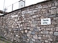 Taxis only - geograph.org.uk - 2542374.jpg 640 × 480; 149 KB
-
 Dawlish station car park - geograph.org.uk - 2542449.jpg 1,024 × 768; 285 KB
-
-

-
 The Thrill Of Steam - The Torbay Express. (15218167762).jpg 1,376 × 948; 235 KB
-
 Dawlish, station (7767816206).png 1,920 × 1,080; 3.26 MB


_through_Hole_Head_-_geograph.org.uk_-_2383442.jpg)


.jpg)
.png)