Category:2011 maps of the United Kingdom
Jump to navigation
Jump to search
Countries of Europe: Bulgaria · Croatia · Denmark · Germany · Greece · Italy · Romania · Russia‡ · Spain‡ · Switzerland · Ukraine · United Kingdom
‡: partly located in Europe
‡: partly located in Europe
Media in category "2011 maps of the United Kingdom"
The following 19 files are in this category, out of 19 total.
-
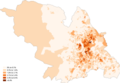
 2011 Rural Urban classification by census Output Areas in England.jpg 1,080 × 1,920; 602 KB
-
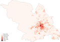
 African Sheffield 2011 census.png 25,490 × 17,669; 13.15 MB
-
 Arab Sheffield 2011 census.png 25,406 × 17,611; 13.05 MB
-
 Asian Sheffield 2011 census.png 25,490 × 17,670; 13.08 MB
-
 Bangladeshi Sheffield 2011 census.png 25,406 × 17,611; 13 MB
-
 Black Sheffield 2011 census.png 25,406 × 17,611; 12.64 MB
-
 British Sheffield 2011 census.png 25,490 × 17,669; 11.93 MB
-
 Buddhism Sheffield 2011 census.png 25,322 × 17,553; 13.3 MB
-
 Canterbury UK local election 2011 map.svg 1,076 × 1,266; 459 KB
-
 Caribbean Sheffield 2011 census.png 25,406 × 17,611; 13.33 MB
-
 Chinese Sheffield 2011 census.png 25,406 × 17,611; 13.12 MB
-
 Christianity Sheffield 2011 census.png 25,574 × 17,727; 13.07 MB
-
 City of York Council election 2011 map.svg 1,376 × 1,345; 383 KB
-
 Hinduism Sheffield 2011 census.png 25,406 × 17,611; 13.14 MB
-
 Indian Sheffield 2011 census.png 25,406 × 17,611; 13.24 MB
-
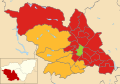 Sheffield UK local election 2011 map.svg 1,425 × 996; 641 KB
-
 SheffieldUrbanArea.svg 712 × 615; 125 KB
-
 Southampton UK local election 2011 map.svg 1,425 × 1,226; 269 KB
-
 Welsh speakers in the 2011 census Pembrokeshire.png 13,342 × 14,791; 4.62 MB


