Category:2011 maps
Jump to navigation
Jump to search
| ← · 2010 · 2011 · 2012 · 2013 · 2014 · 2015 · 2016 · 2017 · 2018 · 2019 · → |
Deutsch: Karten mit Bezug zum Jahr 2011
English: Maps related to the year 2011
Español: Mapas relativos al año 2011
Français : Cartes concernant l’an 2011
Русский: Карты 2011 года
Subcategories
This category has the following 8 subcategories, out of 8 total.
Media in category "2011 maps"
The following 124 files are in this category, out of 124 total.
-
 African Burial Ground - African Burial Ground National Monument, New York LOC 2011587283.jpg 10,305 × 4,934; 7.5 MB
-
 African Burial Ground - African Burial Ground National Monument, New York LOC 2011587283.tif 10,305 × 4,934; 145.47 MB
-
 African Burial Ground - African Burial Ground National Monument, New York LOC 2012585155.jpg 10,289 × 4,866; 6.88 MB
-
 African Burial Ground - African Burial Ground National Monument, New York LOC 2012585155.tif 10,289 × 4,866; 143.24 MB
-

-
 Big Bend National Park, Texas LOC 2011590439.jpg 10,102 × 7,141; 9.27 MB
-
 Big Bend National Park, Texas LOC 2011590439.tif 10,102 × 7,141; 206.39 MB
-
 Big Cypress National Preserve, Florida LOC 2013587303.jpg 10,044 × 4,714; 7.03 MB
-
 Big Cypress National Preserve, Florida LOC 2013587303.tif 10,044 × 4,714; 135.46 MB
-
 Big South Fork National River and Recreation Area, Kentucky and Tennessee LOC 2011593618.jpg 10,066 × 7,079; 11.7 MB
-
 Big South Fork National River and Recreation Area, Kentucky and Tennessee LOC 2011593618.tif 10,066 × 7,079; 203.87 MB
-
 Birkhead mountains Wilderness, Uwharrie National Forest LOC 2013587357.jpg 12,772 × 6,705; 13.82 MB
-
 Birkhead mountains Wilderness, Uwharrie National Forest LOC 2013587357.tif 12,772 × 6,705; 245.01 MB
-
 Biscayne National Park, Florida LOC 2013587348.jpg 10,098 × 7,072; 10.18 MB
-
 Brown Mountain off-highway vehicle (OHV) system, Pisgah National Forest LOC 2012593512.tif 12,802 × 6,735; 246.68 MB
-
 Brown Mountain off-highway vehicle system LOC 2011592151.jpg 12,816 × 6,686; 10.13 MB
-
 Brown Mountain off-highway vehicle system LOC 2011592151.tif 12,816 × 6,686; 245.15 MB
-
 Cape Hatteras National Seashore, North Carolina LOC 2011593612.jpg 5,258 × 7,138; 4.64 MB
-
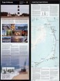 Cape Hatteras National Seashore, North Carolina LOC 2011593612.tif 5,258 × 7,138; 107.38 MB
-

-
 Catoctin Mountain, Catoctin Mountain Park, Cunningham Falls State Park, Maryland LOC 2012585123.tif 11,846 × 5,022; 170.2 MB
-
 Chamizal National Memorial, Texas LOC 2014590012.jpg 5,212 × 9,643; 6.71 MB
-
 Chamizal National Memorial, Texas LOC 2014590012.tif 5,212 × 9,643; 143.79 MB
-
 Chickasaw National Recreation Area LOC 2011590442.jpg 10,152 × 4,810; 6.27 MB
-
 Chickasaw National Recreation Area LOC 2011590442.tif 10,152 × 4,810; 139.71 MB
-

-

-

-
 Colonial National Historical Park , Virginia LOC 2011586540.jpg 5,252 × 12,080; 10.03 MB
-
 Colonial National Historical Park , Virginia LOC 2011586540.tif 5,252 × 12,080; 181.52 MB
-
 Craig projection SW.jpg 2,059 × 1,169; 575 KB
-
 Cumberland Gap National Historical Park, Kentucky-Tennessee-Virginia LOC 2011593611.jpg 10,154 × 7,084; 10.42 MB
-
 Cumberland Gap National Historical Park, Kentucky-Tennessee-Virginia LOC 2011593611.tif 10,154 × 7,084; 205.8 MB
-
 Detasseling Map.png 1,256 × 1,011; 167 KB
-
 EIA Shale Gas Europe.png 561 × 581; 493 KB
-
 Español en Canadá.png 667 × 550; 47 KB
-
 Essential Air Service Locations (cropped).png 792 × 572; 144 KB
-
 Estrecho de Gibraltar, mapa físico.jpg 4,063 × 4,892; 9.73 MB
-
 Ferry Hill, Chesapeake and Ohio Canal National Historical Park, Maryland LOC 2015585345.jpg 10,004 × 3,549; 5.95 MB
-
 Ferry Hill, Chesapeake and Ohio Canal National Historical Park, Maryland LOC 2015585345.tif 10,004 × 3,549; 101.58 MB
-
 Flight 93 National Memorial, Pennsylvania LOC 2011587870.jpg 5,281 × 7,110; 4.71 MB
-
 Flight 93 National Memorial, Pennsylvania LOC 2011587870.tif 5,281 × 7,110; 107.43 MB
-
 Fort Davis National Historic Site, Texas LOC 2011590585.jpg 5,178 × 9,510; 7.17 MB
-
 Fort Davis National Historic Site, Texas LOC 2011590585.tif 5,178 × 9,510; 140.88 MB
-
 Fort McHenry National Monument and Historic Shrine, Maryland LOC 2011587877.jpg 10,176 × 7,099; 10.36 MB
-
 Fort McHenry National Monument and Historic Shrine, Maryland LOC 2011587877.tif 10,176 × 7,099; 206.68 MB
-
 Fort Smith, Fort Smith National Historic Site LOC 2011590575.jpg 5,460 × 5,008; 4.02 MB
-
 Fort Smith, Fort Smith National Historic Site LOC 2011590575.tif 5,460 × 5,008; 78.23 MB
-
 Fort Stanwix, Fort Stanwix National Monument, New York LOC 2011587712.jpg 10,350 × 7,225; 9.08 MB
-
 Fort Stanwix, Fort Stanwix National Monument, New York LOC 2011587712.tif 10,350 × 7,225; 213.94 MB
-
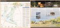
 Franklin-Highlands and Nantahala National Forest recreation map LOC 2011585850.jpg 12,770 × 7,879; 15.57 MB
-
 Franklin-Highlands and Nantahala National Forest recreation map LOC 2011585850.tif 12,770 × 7,879; 287.86 MB
-
 Gateway-Gateway National Recreation Area, New York-New Jersey LOC 2011587203.jpg 10,120 × 4,789; 5.61 MB
-
 Gateway-Gateway National Recreation Area, New York-New Jersey LOC 2011587203.tif 10,120 × 4,789; 138.66 MB
-
 Gettysburg-Gettysburg National Military Park, Pennsylvania LOC 2011587720.jpg 10,232 × 4,902; 6.75 MB
-
 Gettysburg-Gettysburg National Military Park, Pennsylvania LOC 2011587720.tif 10,232 × 4,902; 143.5 MB
-
 Global distribution of Wikipedia edits - Heat map, Spanish.png 1,001 × 500; 130 KB
-
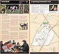 Greenbelt, Greenbelt Park, Maryland LOC 2011587729.jpg 5,110 × 4,735; 3.07 MB
-
 Greenbelt, Greenbelt Park, Maryland LOC 2011587729.tif 5,110 × 4,735; 69.23 MB
-
 Guilford Courthouse National Military Park, North Carolina LOC 2011585733.jpg 5,139 × 9,557; 5.8 MB
-
 Guilford Courthouse National Military Park, North Carolina LOC 2011585733.tif 5,139 × 9,557; 140.51 MB
-
 Hopewell Furnace LOC 2011587860.jpg 10,296 × 4,819; 7.87 MB
-
 Hopewell Furnace LOC 2011587860.tif 10,296 × 4,819; 141.95 MB
-
 Hot Springs National Park, Arkansas LOC 2011590438.jpg 10,547 × 5,064; 7.96 MB
-
 Hot Springs National Park, Arkansas LOC 2011590438.tif 10,547 × 5,064; 152.81 MB
-
 Iowa(area-codes).jpg 151 × 103; 25 KB
-
 Israel railways passenger map 2011.png 919 × 1,422; 25 KB
-
 John H. Kerr Dam and Reservoir - also known as Buggs Island Lake LOC 2013587338.jpg 9,725 × 7,312; 6.43 MB
-
 John H. Kerr Dam and Reservoir - also known as Buggs Island Lake LOC 2013587338.tif 9,725 × 7,312; 203.45 MB
-
 Kisatchie National Forest, Caney Ranger District, Louisiana 2011 LOC 2011590625.jpg 7,432 × 11,111; 8.8 MB
-
 Kisatchie National Forest, Caney Ranger District, Louisiana 2011 LOC 2011590625.tif 7,432 × 11,111; 236.25 MB
-
 Kisatchie National Forest, Louisiana - 2011 LOC 2011590589.jpg 9,483 × 10,708; 10.66 MB
-
 Kisatchie National Forest, Louisiana - 2011 LOC 2011590589.tif 9,483 × 10,708; 290.52 MB
-

-

-
 Little Rock Central High School National Historic Site, Arkansas LOC 2014590140.jpg 10,057 × 4,754; 7.11 MB
-
 Little Rock Central High School National Historic Site, Arkansas LOC 2014590140.tif 10,057 × 4,754; 136.79 MB
-
 Lyndon B. Johnson National Historical Park, Texas LOC 2011590206.jpg 5,253 × 9,594; 7.01 MB
-
 Lyndon B. Johnson National Historical Park, Texas LOC 2011590206.tif 5,253 × 9,594; 144.19 MB
-
 Map and visitors guide, National Gallery of Art, Washington. LOC 2012585481.jpg 8,115 × 10,999; 7.42 MB
-
 Map and visitors guide, National Gallery of Art, Washington. LOC 2012585481.tif 8,115 × 10,999; 255.37 MB
-

-

-
 Otis tarda distribution.png 2,802 × 1,614; 123 KB
-

-

-
 Padre Island National Seashore, Texas LOC 2011590581.jpg 5,271 × 7,148; 5.18 MB
-
 Padre Island National Seashore, Texas LOC 2011590581.tif 5,271 × 7,148; 107.8 MB
-
 Petroleum regions - Middle East map-es.svg 577 × 592; 145 KB
-
-
-

-

-
 Prince William Forest Park, Virginia LOC 2011586660.jpg 13,500 × 7,923; 12.38 MB
-
 Prince William Forest Park, Virginia LOC 2011586660.tif 13,500 × 7,923; 306.02 MB
-
 Proportion of non-Czech people in each county.png 2,362 × 2,853; 188 KB
-
 Rock Creek Park, Washington, DC LOC 2012585116.jpg 5,213 × 7,153; 5.19 MB
-
 Rock Creek Park, Washington, DC LOC 2012585116.tif 5,213 × 7,153; 106.68 MB
-
 Rock Creek Park, Washington, DC LOC 2013589263.jpg 5,213 × 7,186; 5.3 MB
-
 Rock Creek Park, Washington, DC LOC 2013589263.tif 5,213 × 7,186; 107.18 MB
-
 San Antonio Missions National Historical Park, Texas LOC 2011590584.jpg 5,211 × 9,600; 6.83 MB
-
 San Antonio Missions National Historical Park, Texas LOC 2011590584.tif 5,211 × 9,600; 143.12 MB
-
 Star-Spangled Banner National Historic Trail LOC 2013589443.jpg 5,216 × 7,236; 4.97 MB
-
 Star-Spangled Banner National Historic Trail LOC 2013589443.tif 5,216 × 7,236; 107.98 MB
-
 Stones River National Battlefield, Tennessee LOC 2011593610.jpg 5,082 × 7,081; 5.59 MB
-
 Stones River National Battlefield, Tennessee LOC 2011593610.tif 5,082 × 7,081; 102.96 MB
-
 Syria country profile. LOC 2012594227.jpg 11,774 × 7,839; 13.36 MB
-
 Syria country profile. LOC 2012594227.tif 11,774 × 7,839; 264.06 MB
-
 TotalTimingSystem.png 1,650 × 2,550; 2.29 MB
-
 Two-point equidistant projection SW.jpg 2,044 × 1,601; 1.07 MB
-
 Underground structures at CERN.png 800 × 600; 30 KB
-
 Valley Forge LOC 2011587730.jpg 10,152 × 4,778; 6.46 MB
-
 Valley Forge LOC 2011587730.tif 10,152 × 4,778; 138.78 MB
-
 Valley Forge LOC 2012585440.jpg 10,100 × 4,747; 6.3 MB
-
 Valley Forge LOC 2012585440.tif 10,100 × 4,747; 137.17 MB
-
 Vicksburg National Military Park, Louisiana-Mississippi LOC 2011585824.jpg 10,034 × 4,734; 7.51 MB
-
 Vicksburg National Military Park, Louisiana-Mississippi LOC 2011585824.tif 10,034 × 4,734; 135.9 MB
-
 Visitor guide, United States Botanic Garden. LOC 2012585333.jpg 7,357 × 6,296; 6.1 MB
-
 Visitor guide, United States Botanic Garden. LOC 2012585333.tif 7,357 × 6,296; 132.52 MB
-
 WASACE submarine cable route map.svg 1,624 × 1,088; 1.66 MB
-
 Washington(area-codes).jpg 281 × 136; 35 KB
-
 Washington, the nation's capital LOC 2011587202.jpg 14,125 × 5,063; 11.11 MB
-
 Washita Battlefield National Historic Site, Oklahoma LOC 2014589360.jpg 5,085 × 9,543; 7.31 MB
-
 Washita Battlefield National Historic Site, Oklahoma LOC 2014589360.tif 5,085 × 9,543; 138.83 MB


.png)


.jpg)


.jpg)

_LOC_2011594649.jpg)