Category:2011 in Maidenhead
Jump to navigation
Jump to search
Media in category "2011 in Maidenhead"
The following 27 files are in this category, out of 27 total.
-
 Headquarters of the Commonwealth War Graves Commission.jpg 2,560 × 1,920; 2.26 MB
-
 Boyne Hill Station.jpg 2,560 × 1,920; 2.03 MB
-
 27 Bridge Street, Maidenhead.jpg 2,560 × 1,920; 2.06 MB
-
 38 Castle Hill, Maidenhead.jpg 1,920 × 2,560; 2.24 MB
-
 41 Queen Street, Maidenhead.jpg 1,920 × 2,560; 2.17 MB
-
 Castle Hill, Maidenhead.jpg 2,560 × 1,920; 2.32 MB
-
 Maidenhead Bridge (1).jpg 2,560 × 1,920; 2.28 MB
-
 Maidenhead Bridge (2).jpg 2,560 × 1,920; 2.32 MB
-
 Maidenhead Bridge - geograph.org.uk - 2545934.jpg 1,024 × 680; 150 KB
-
 Maidenhead Bridge - geograph.org.uk - 2545938.jpg 1,024 × 680; 142 KB
-
 Maidenhead Railway Station.jpg 2,560 × 1,920; 1.81 MB
-
 Maidenhead Station (5672472047).jpg 3,072 × 1,728; 1.13 MB
-
 Maidenhead station (5673102074).jpg 3,072 × 1,728; 1.29 MB
-
 Maidenhead Station (5673102078).jpg 2,592 × 1,944; 917 KB
-
 Maidenhead Station (5673102084).jpg 2,592 × 1,944; 742 KB
-
 Maidenhead Station (5673102086).jpg 2,592 × 1,944; 810 KB
-
 Maidenhead Town Hall.jpg 2,560 × 1,920; 2.3 MB
-
 Maidenhead War Memorial.jpg 1,920 × 2,560; 2.28 MB
-
 Plaque on Smyths Almshouses.jpg 1,920 × 2,560; 2.28 MB
-
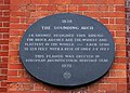 Plaque on the Sounding Arch - geograph.org.uk - 2696522.jpg 1,500 × 1,073; 226 KB
-
 Smyths Almshouses.jpg 2,560 × 1,920; 2.26 MB
-
 The Sounding Arch over the Thames - geograph.org.uk - 2696478.jpg 1,500 × 1,000; 162 KB
-
 The Sounding Arch, Maidenhead - geograph.org.uk - 2546796.jpg 1,024 × 680; 218 KB
-
 The Sounding Arch, Maidenhead - geograph.org.uk - 2546803.jpg 1,024 × 680; 184 KB
-
 The Thames Path by the Sounding Arch - geograph.org.uk - 2696436.jpg 1,500 × 1,000; 175 KB
-
 The Thames Path runs under the Sounding Bridge - geograph.org.uk - 2696518.jpg 1,500 × 1,000; 170 KB
-
 Under the Sounding Arch - geograph.org.uk - 2696448.jpg 1,500 × 1,000; 166 KB


.jpg)
.jpg)


.jpg)
.jpg)
.jpg)
.jpg)
.jpg)


