
Category:2010s maps of Maryland
States of the United States: Alabama · Alaska · Arizona · Arkansas · California · Colorado · Connecticut · Delaware · Florida · Georgia · Hawaii · Idaho · Illinois · Indiana · Iowa · Kansas · Kentucky · Louisiana · Maine · Maryland · Massachusetts · Michigan · Missouri · Montana · Nebraska · Nevada · New Hampshire · New Jersey · New Mexico · New York · North Carolina · Ohio · Oklahoma · Oregon · Pennsylvania · Rhode Island · South Carolina · Tennessee · Texas · Utah · Vermont · Virginia · Washington · West Virginia · Wisconsin – Washington, D.C.
Puerto Rico
Puerto Rico
Subcategories
This category has the following 2 subcategories, out of 2 total.
- 2010 maps of Maryland (16 F)
- 2015 maps of Maryland (1 F)
Media in category "2010s maps of Maryland"
The following 7 files are in this category, out of 7 total.
-

-
 Harford.svg 543 × 353; 274 KB
-
 Party Composition of Maryland House of Delegates Districts01.png 1,409 × 802; 122 KB
-
 Party Composition of Maryland State Senate Districts.png 1,409 × 802; 100 KB
-
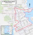 St Michaels Historic District Map 2014.png 734 × 773; 882 KB
-

-
 Star-Spangled Banner National Historic Trail LOC 2013589443.jpg 5,216 × 7,236; 4.97 MB


