Category:2008 in Wakefield, West Yorkshire
Jump to navigation
Jump to search
Subcategories
This category has the following 9 subcategories, out of 9 total.
A
- 2008 in Agbrigg (1 F)
- 2008 in Alverthorpe (4 F)
B
E
- 2008 in Eastmoor (1 F)
O
S
- 2008 in Sandal Magna (1 F)
- 2008 in Stanley, West Yorkshire (10 F)
W
- 2008 in Wrenthorpe (7 F)
Media in category "2008 in Wakefield, West Yorkshire"
The following 151 files are in this category, out of 151 total.
-
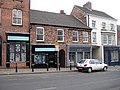 101-103 Westgate - geograph.org.uk - 1095515.jpg 640 × 480; 116 KB
-
 2-10, Northgate - geograph.org.uk - 1095478.jpg 640 × 510; 359 KB
-
 20 King Street - geograph.org.uk - 1034540.jpg 480 × 640; 113 KB
-
 Albion Inn - Stanley Road - geograph.org.uk - 759936.jpg 640 × 480; 67 KB
-
 Aldi supermarket - geograph.org.uk - 1059874.jpg 640 × 435; 80 KB
-
 Asda supermarket petrol station - geograph.org.uk - 1059871.jpg 640 × 444; 87 KB
-
 Barstow Square - geograph.org.uk - 654133.jpg 640 × 567; 39 KB
-
 Barstow Square - Westgate - geograph.org.uk - 747539.jpg 640 × 558; 76 KB
-
 Black Horse - Westgate - geograph.org.uk - 654149.jpg 640 × 460; 29 KB
-
 Black Swan Hotel - geograph.org.uk - 1013841.jpg 640 × 504; 76 KB
-
 Bradford Road, Wakefield - geograph.org.uk - 660962.jpg 640 × 380; 29 KB
-
 Bread Street - geograph.org.uk - 1006043.jpg 480 × 640; 82 KB
-
-
 British Oak Pub - geograph.org.uk - 905291.jpg 640 × 480; 70 KB
-
 Burton Street - geograph.org.uk - 943865.jpg 640 × 480; 72 KB
-
 Butchers Arms - Stanley Road - geograph.org.uk - 759934.jpg 640 × 539; 48 KB
-
 Cathedral Retail Park - geograph.org.uk - 1062157.jpg 640 × 480; 75 KB
-
 Cathedral Retail Park - geograph.org.uk - 1062164.jpg 640 × 480; 78 KB
-
 Cathedral retail park Wakefield - geograph.org.uk - 658176.jpg 640 × 512; 104 KB
-
 Chasley Hotel - geograph.org.uk - 1042512.jpg 640 × 480; 96 KB
-
 Christmas in the Ridings - geograph.org.uk - 1075691.jpg 640 × 480; 127 KB
-
 Cineworld, Westgate Leisure Park - geograph.org.uk - 1062110.jpg 640 × 480; 80 KB
-
 Citadel entrance - geograph.org.uk - 954812.jpg 640 × 480; 82 KB
-
 Concourse - Wakefield Bus Station - geograph.org.uk - 654426.jpg 640 × 431; 33 KB
-
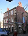
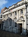
 County Hall, Wakefield - geograph.org.uk - 1095490.jpg 640 × 480; 98 KB
-
 Crown House - geograph.org.uk - 946118.jpg 640 × 480; 69 KB
-
 Denby Dale Road, Wakefield - geograph.org.uk - 942772.jpg 640 × 480; 94 KB
-
 Double Postbox - geograph.org.uk - 1005952.jpg 480 × 640; 87 KB
-
 Electricity sub-station - geograph.org.uk - 905886.jpg 640 × 480; 103 KB
-
 Entrance, Westgate Retail Park - geograph.org.uk - 1062146.jpg 640 × 486; 91 KB
-
 Exchange House - geograph.org.uk - 1075687.jpg 640 × 480; 109 KB
-
-
 Former Vicarage - geograph.org.uk - 954793.jpg 640 × 502; 97 KB
-
 Foundation Nightclub - geograph.org.uk - 1042486.jpg 459 × 640; 84 KB
-

-
 Georgian building - geograph.org.uk - 1051060.jpg 640 × 480; 102 KB
-
 Gill Sike House - Horbury Road - geograph.org.uk - 679331.jpg 640 × 483; 189 KB
-
 Goodbye Market Hall - geograph.org.uk - 982493.jpg 480 × 640; 73 KB
-
 Goodbye old market - geograph.org.uk - 882671.jpg 640 × 480; 79 KB
-
 GR V Postbox - geograph.org.uk - 1005874.jpg 480 × 640; 90 KB
-
 Grand Central, Market Street - geograph.org.uk - 1042491.jpg 640 × 561; 122 KB
-
 Grand Clothing Hall - geograph.org.uk - 917991.jpg 480 × 640; 75 KB
-
 Grey Horse - Kirkgate - geograph.org.uk - 660603.jpg 640 × 480; 29 KB
-
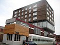
 Health Club - geograph.org.uk - 988615.jpg 640 × 476; 89 KB
-
 HSBC Bank - geograph.org.uk - 1005947.jpg 480 × 640; 102 KB
-
 HSBC Bank - Westgate - geograph.org.uk - 660623.jpg 640 × 574; 52 KB
-
 Inns of Court pub sign - geograph.org.uk - 1034528.jpg 499 × 640; 80 KB
-

-
 K6 telephone kiosk - geograph.org.uk - 1013823.jpg 480 × 640; 126 KB
-
 KFC Westgate Retail Park - geograph.org.uk - 1062141.jpg 640 × 470; 76 KB
-
 King Street - geograph.org.uk - 1005977.jpg 480 × 640; 89 KB
-
 King Street - geograph.org.uk - 1026946.jpg 480 × 640; 113 KB
-
 Kirkgate - geograph.org.uk - 654349.jpg 640 × 384; 24 KB
-
 Leeds Road - geograph.org.uk - 1020585.jpg 480 × 640; 94 KB
-
-
 Local Gov.Yorkshire and Humber - geograph.org.uk - 1034535.jpg 512 × 640; 113 KB
-
 Lower Mall - The Ridings Centre - geograph.org.uk - 654366.jpg 640 × 449; 30 KB
-
 Market house - geograph.org.uk - 949583.jpg 640 × 480; 92 KB
-
 McDonald's - Kirkgate - geograph.org.uk - 654353.jpg 640 × 480; 42 KB
-
 McDonalds, Cathedral Retail Park - geograph.org.uk - 1062149.jpg 640 × 475; 87 KB
-
 Middle Mall - The Ridings Centre - geograph.org.uk - 654373.jpg 640 × 480; 42 KB
-
 Moose Bar - geograph.org.uk - 1006053.jpg 480 × 640; 72 KB
-
 Nando's, Westgate Leisure Park - geograph.org.uk - 1062123.jpg 480 × 640; 71 KB
-
 New Life Christian Centre - geograph.org.uk - 1044577.jpg 541 × 640; 139 KB
-
 O'donoghue's - George Street - geograph.org.uk - 660620.jpg 640 × 569; 49 KB
-
 Outside seating area - geograph.org.uk - 1045633.jpg 640 × 581; 112 KB
-
 PizzaHut, Westgate Leisure Park - geograph.org.uk - 1062131.jpg 640 × 480; 81 KB
-
 Poundland - Kirkgate - geograph.org.uk - 654351.jpg 640 × 480; 44 KB
-

-
 Premier Inn - geograph.org.uk - 987611.jpg 640 × 422; 85 KB
-
-
 Red Cross Shop - Westmorland Street - geograph.org.uk - 654391.jpg 637 × 640; 40 KB
-
 Ridings Shopping Centre - geograph.org.uk - 1099221.jpg 480 × 640; 321 KB
-

-
 Room 97 unisex hairdressers - geograph.org.uk - 1075678.jpg 640 × 512; 135 KB
-
 Room 97 unisex hairdressers - geograph.org.uk - 1075683.jpg 640 × 441; 128 KB
-
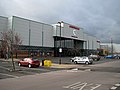
 Sainsbury's supermarket - geograph.org.uk - 1098908.jpg 640 × 480; 96 KB
-
 Sirocco - geograph.org.uk - 948860.jpg 640 × 480; 78 KB
-
 Spice Cottage - geograph.org.uk - 1098656.jpg 640 × 464; 97 KB
-
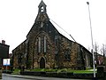 St Andrew's Church - Peterson Road - geograph.org.uk - 660609.jpg 640 × 480; 31 KB
-
 St Austin's Church - geograph.org.uk - 843973.jpg 480 × 640; 88 KB
-

-
 St Johns, St Johns Square - geograph.org.uk - 945834.jpg 640 × 480; 94 KB
-
 St Michael's Church - Westgate End - geograph.org.uk - 660630.jpg 640 × 444; 32 KB
-

-
 Stoneleigh Hotel - Doncaster Road - geograph.org.uk - 747519.jpg 640 × 500; 73 KB
-
 Subway, Westgate Retail Park - geograph.org.uk - 1062133.jpg 640 × 504; 84 KB
-
 Sundial - geograph.org.uk - 1075651.jpg 480 × 640; 112 KB
-
 Telephone Kiosk - geograph.org.uk - 1025975.jpg 480 × 640; 120 KB
-
 The Bedroom Bar - geograph.org.uk - 1005920.jpg 480 × 640; 102 KB
-
 The Foresters Arms - Barnsley Road - geograph.org.uk - 747087.jpg 640 × 435; 54 KB
-
 The former Metro Nightclub - geograph.org.uk - 1098699.jpg 640 × 480; 331 KB
-
 The Hop, Bank Street - geograph.org.uk - 1098664.jpg 555 × 640; 435 KB
-
 The Inns Of Court - geograph.org.uk - 1025992.jpg 480 × 640; 88 KB
-
 The Jockey - Northgate - geograph.org.uk - 654107.jpg 640 × 505; 48 KB
-
 The Pinder of Wakefield - geograph.org.uk - 1020498.jpg 640 × 475; 78 KB
-
 The Rainbow - geograph.org.uk - 948832.jpg 640 × 480; 73 KB
-
 The Rainbow - geograph.org.uk - 954847.jpg 640 × 480; 66 KB
-
 The Rainbow - Lower Warrengate - geograph.org.uk - 654377.jpg 640 × 501; 25 KB
-
 The Ridings car park - geograph.org.uk - 946044.jpg 640 × 480; 69 KB
-
 The Six Chimneys - Kirkgate - geograph.org.uk - 654356.jpg 640 × 540; 53 KB
-
 The Springs - geograph.org.uk - 654386.jpg 640 × 480; 35 KB
-
 The Vine Tree - Leeds Road - geograph.org.uk - 654022.jpg 640 × 482; 21 KB
-
 The Yorkshire Penny Bank - geograph.org.uk - 949616.jpg 640 × 480; 71 KB
-
 Travelodge - geograph.org.uk - 949574.jpg 640 × 480; 83 KB
-
 Treacy Hall memorial stone - geograph.org.uk - 954898.jpg 640 × 480; 136 KB
-
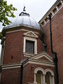
 Treacy Hall, Wakefield Cathedral - geograph.org.uk - 954857.jpg 640 × 480; 91 KB
-
 Victorian Market - geograph.org.uk - 1050304.jpg 480 × 640; 96 KB
-
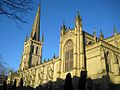 Wakefield - Cathedral.jpg 640 × 480; 109 KB
-
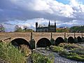 Wakefield Bridge (3016997576).jpg 2,560 × 1,920; 3.92 MB
-
 Wakefield Bus Station - geograph.org.uk - 1020484.jpg 640 × 480; 72 KB
-
 Wakefield Cathedral (3016158355).jpg 1,920 × 2,560; 3.61 MB
-
 Wakefield Cathedral North Side - geograph.org.uk - 883390.jpg 640 × 480; 114 KB
-
 Wakefield Cathedral south porch and sundial.JPG 480 × 640; 77 KB
-
 Wakefield Cathedral spire - geograph.org.uk - 1075649.jpg 480 × 640; 114 KB
-

-
 Wakefield College - Burton Street - geograph.org.uk - 660686.jpg 640 × 422; 30 KB
-
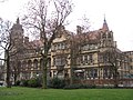
 Wakefield College - geograph.org.uk - 1095334.jpg 640 × 480; 68 KB
-
 Wakefield College - geograph.org.uk - 867238.jpg 640 × 480; 68 KB
-
 Wakefield College - geograph.org.uk - 994526.jpg 640 × 480; 68 KB
-

-

-
 Wakefield Express newspaper offices - geograph.org.uk - 918027.jpg 640 × 480; 98 KB
-
 Wakefield House, Borough Road - geograph.org.uk - 1099176.jpg 640 × 480; 251 KB
-
 Wakefield Labour Club "The Red Shed" - geograph.org.uk - 954801.jpg 640 × 480; 72 KB
-
-
 Wakefield skyline - geograph.org.uk - 969212.jpg 640 × 480; 66 KB
-
 Wakefield Theatre and Opera House - geograph.org.uk - 1075677.jpg 498 × 640; 95 KB
-

-
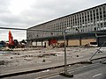
 Wakefield Westgate railway station, Yorkshire (geograph 3471881).jpg 1,024 × 768; 193 KB
-
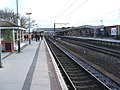
 Wakefield Westgate Station - geograph.org.uk - 837526.jpg 640 × 480; 264 KB
-
 Wakefield Westgate Station - geograph.org.uk - 837552.jpg 640 × 480; 226 KB
-

-

-
 Wakefield's new Market Hall - geograph.org.uk - 863415.jpg 480 × 640; 91 KB
-
 WakefieldCathedral-1.jpg 3,232 × 2,279; 4.51 MB
-
 War memorial - geograph.org.uk - 974762.jpg 480 × 640; 104 KB
-
 War memorial detail - geograph.org.uk - 974777.jpg 480 × 640; 128 KB
-

-
 We are not amused - geograph.org.uk - 949464.jpg 480 × 640; 84 KB
-
 We Will Remember Them - geograph.org.uk - 1038982.jpg 480 × 640; 135 KB
-
 Wentworth House, Wentworth Street - geograph.org.uk - 944659.jpg 640 × 480; 88 KB
-
 Wentworth Street - geograph.org.uk - 945594.jpg 640 × 480; 102 KB
-
 Wentworth Terrace - geograph.org.uk - 945638.jpg 640 × 480; 92 KB
-
 West Yorkshire Police Headquarters - geograph.org.uk - 1020555.jpg 480 × 640; 125 KB
-

-
 Westgate retail park sign - geograph.org.uk - 1062106.jpg 640 × 480; 116 KB
-
 White Hart - Westgate End - geograph.org.uk - 660673.jpg 640 × 503; 37 KB
-
 Woolworths Wakefield - geograph.org.uk - 1075665.jpg 640 × 534; 98 KB
-
 York House - geograph.org.uk - 975062.jpg 640 × 480; 107 KB
-
 York House Hotel - geograph.org.uk - 975064.jpg 640 × 480; 89 KB


.jpg)

.jpg)


.jpg)


