Category:2008 in Kirkstall
Jump to navigation
Jump to search
Media in category "2008 in Kirkstall"
The following 35 files are in this category, out of 35 total.
-
 Abbey Guest House - Vesper Road - geograph.org.uk - 665486.jpg 640 × 471; 35 KB
-
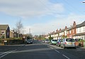
 Argie Road - Kirkstall Road - geograph.org.uk - 1049090.jpg 640 × 463; 204 KB
-
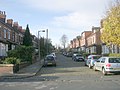
 Bankfield Grove, Kirkstall, Leeds - geograph.org.uk - 852448.jpg 640 × 480; 66 KB
-
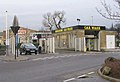
 Dunnes Stores - Kirkstall Retail Park - geograph.org.uk - 665513.jpg 640 × 480; 27 KB
-
 Eden Crescent, Kirkstall, Leeds - geograph.org.uk - 852463.jpg 640 × 480; 96 KB
-
 Eden Drive, Kirkstall, Leeds - geograph.org.uk - 852466.jpg 640 × 493; 60 KB
-
 Former Boston Diner, Kirkstall, Leeds - geograph.org.uk - 852458.jpg 480 × 640; 77 KB
-
 Haircut Sir ^ - geograph.org.uk - 852451.jpg 640 × 480; 86 KB
-
 Kirkstall Abbey 4 (2321486565).jpg 2,147 × 1,615; 3.83 MB
-

-
 Kirkstall forge Monks wheel - geograph.org.uk - 756709.jpg 640 × 426; 81 KB
-
 Morrisons - Kirkstall Retail Park - geograph.org.uk - 665514.jpg 640 × 431; 25 KB
-
-

-
 Paved area, Sandford Road, Leeds - geograph.org.uk - 843764.jpg 640 × 480; 82 KB
-
 Ready Steady Store, Kirkstall Road - geograph.org.uk - 741973.jpg 640 × 480; 105 KB
-

-
 St Ann's Close, Kirkstall, Leeds - geograph.org.uk - 852460.jpg 640 × 460; 60 KB
-
 St Ann's Gardens, Kirkstall, Leeds - geograph.org.uk - 852450.jpg 640 × 480; 82 KB
-
 St Ann's Lane, Kirkstall, Leeds - geograph.org.uk - 852462.jpg 640 × 480; 60 KB
-
 St Ann's Way, Kirkstall, Leeds - geograph.org.uk - 852456.jpg 640 × 480; 71 KB
-
 St Anne's Drive - St Michael's Road - geograph.org.uk - 1057968.jpg 640 × 445; 177 KB
-
 St Anne's Drive, Kirkstall, Leeds - geograph.org.uk - 852461.jpg 640 × 476; 68 KB
-

-
 St Stephen's Graveyard - Morris Lane - geograph.org.uk - 665504.jpg 640 × 362; 45 KB
-
 St Stephen's School - Morris Lane - geograph.org.uk - 665503.jpg 640 × 529; 42 KB
-
 Stanmore Crescent - St Anne's Drive - geograph.org.uk - 1057973.jpg 640 × 451; 205 KB
-
 Stanmore Place - St Michael's Road - geograph.org.uk - 1057936.jpg 640 × 480; 253 KB
-
 Stanmore Road - St Michael's Road - geograph.org.uk - 1057962.jpg 640 × 480; 261 KB
-
 Stanmore Street - St Michael's Road - geograph.org.uk - 1057947.jpg 640 × 455; 210 KB
-
 Stanmore View - St Michael's Road - geograph.org.uk - 1057931.jpg 640 × 453; 210 KB
-
 Talbot Mount - St Michael's Road - geograph.org.uk - 1057919.jpg 640 × 480; 256 KB
-
 Talbot Terrace - St Michael's Road - geograph.org.uk - 1057926.jpg 640 × 480; 269 KB
-
 Talbot View - geograph.org.uk - 636049.jpg 640 × 435; 27 KB
-
 Talbot View - St Michael's Road - geograph.org.uk - 1057923.jpg 640 × 446; 205 KB


.jpg)


