Category:2008 in Hessle
Jump to navigation
Jump to search
Media in category "2008 in Hessle"
The following 155 files are in this category, out of 155 total.
-
 "Humber Rescue" Lifeboat House - geograph.org.uk - 692995.jpg 640 × 423; 109 KB
-
 'Please' stick to the footpath^ - geograph.org.uk - 722975.jpg 640 × 480; 102 KB
-
 Humber Bridge - geograph.org.uk - 646844.jpg 640 × 480; 92 KB
-
 A Corner House - geograph.org.uk - 775857.jpg 640 × 480; 258 KB
-

-
 Under The Bridge - geograph.org.uk - 828888.jpg 640 × 480; 51 KB
-
 April Shower over Hessle - geograph.org.uk - 780656.jpg 640 × 451; 59 KB
-
 New House on Woodfield Lane - geograph.org.uk - 862527.jpg 640 × 480; 362 KB
-
 New Houses on Woodfield Lane - geograph.org.uk - 862534.jpg 640 × 480; 398 KB
-
 1 Prestongate, Hessle - geograph.org.uk - 696177.jpg 640 × 510; 91 KB
-

-
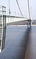
 Crossing the Humber - geograph.org.uk - 1073942.jpg 640 × 561; 79 KB
-
 A bucket of mud - geograph.org.uk - 696221.jpg 444 × 640; 48 KB
-
 A green space amongst the roads - geograph.org.uk - 775829.jpg 640 × 480; 247 KB
-
 A Long Way Down - geograph.org.uk - 696200.jpg 429 × 640; 73 KB
-
 A Misty Humber View - geograph.org.uk - 1035256.jpg 640 × 481; 44 KB
-
 Aa Humber Bridge 01.jpg 1,600 × 1,200; 356 KB
-
 Across The Humber - geograph.org.uk - 828885.jpg 480 × 640; 73 KB
-
 All Saints Church, Hessle - geograph.org.uk - 689066.jpg 640 × 561; 62 KB
-
 Barton Haven - geograph.org.uk - 1011289.jpg 640 × 480; 81 KB
-
 Barton Haven - geograph.org.uk - 1075341.jpg 640 × 480; 85 KB
-
 Barton Haven - geograph.org.uk - 669987.jpg 640 × 480; 84 KB
-
 Beacon Garth, Hessle - geograph.org.uk - 706580.jpg 640 × 371; 80 KB
-
 Beacon Garth, Hessle - geograph.org.uk - 706623.jpg 640 × 551; 133 KB
-
 Between Heaven and Hull - geograph.org.uk - 697116.jpg 463 × 640; 60 KB
-
 Beverley Road, Hessle - geograph.org.uk - 878879.jpg 640 × 480; 233 KB
-
 Boothferry Road, Hessle - geograph.org.uk - 878878.jpg 640 × 440; 194 KB
-
 Cedar Tree in Chestnut Avenue - geograph.org.uk - 765924.jpg 631 × 640; 188 KB
-
 Cliff Road and Hessle Foreshore - geograph.org.uk - 804198.jpg 640 × 344; 151 KB
-
 Cliff Road, Hessle - geograph.org.uk - 672515.jpg 640 × 478; 116 KB
-
 Cliff Road, Hessle - geograph.org.uk - 672521.jpg 640 × 482; 92 KB
-
 Corner House, Chestnut Avenue - geograph.org.uk - 775663.jpg 640 × 486; 260 KB
-
 Cottages near Home Farm - geograph.org.uk - 689090.jpg 640 × 373; 75 KB
-
 Cycle path to Schools - geograph.org.uk - 775640.jpg 640 × 457; 195 KB
-
 Darleys, Boothferry Road - geograph.org.uk - 878573.jpg 640 × 423; 190 KB
-
 Davenport Avenue, Hessle - geograph.org.uk - 1052676.jpg 640 × 481; 171 KB
-
 Doorway - Beacon Garth, Hessle - geograph.org.uk - 706592.jpg 480 × 640; 94 KB
-
 Doorway - Dykes House, Hessle - geograph.org.uk - 706657.jpg 561 × 640; 130 KB
-
 Dreaming of the Future - geograph.org.uk - 836772.jpg 517 × 640; 61 KB
-
 E VII R Postbox, Davenport Avenue - geograph.org.uk - 1051774.jpg 481 × 640; 142 KB
-
 Eden Roc - geograph.org.uk - 878881.jpg 640 × 393; 219 KB
-
 Eden Roc and Jenny Brough Lane - geograph.org.uk - 734353.jpg 640 × 289; 65 KB
-

-
 Farmers market, Hessle - geograph.org.uk - 910860.jpg 640 × 480; 45 KB
-
 Ferriby Road Allotments - geograph.org.uk - 775668.jpg 640 × 480; 287 KB
-
 Ferriby Road, Hessle - geograph.org.uk - 689084.jpg 640 × 400; 95 KB
-
 Ferriby Road, Hessle - geograph.org.uk - 775849.jpg 640 × 480; 270 KB
-
 Fishermen on Hessle Foreshore - geograph.org.uk - 836929.jpg 640 × 478; 67 KB
-
 From the Humber Bridge.jpg 640 × 480; 45 KB
-
 Hessle Foreshore - geograph.org.uk - 722976.jpg 640 × 480; 113 KB
-
 Hessle Haven - geograph.org.uk - 803223.jpg 640 × 473; 71 KB
-
 Hessle Haven - geograph.org.uk - 803234.jpg 640 × 461; 61 KB
-
 Hessle Haven - geograph.org.uk - 951789.jpg 420 × 640; 212 KB
-

-
 Hessle Viewpoint - geograph.org.uk - 1035270.jpg 640 × 481; 59 KB
-
 Home Farm, Hessle - geograph.org.uk - 775841.jpg 640 × 476; 242 KB
-
 House on the corner of Cliff Road - geograph.org.uk - 673857.jpg 640 × 478; 101 KB
-
 Houses by the Humber - geograph.org.uk - 804176.jpg 640 × 502; 190 KB
-
 Houses on Ferriby Road, Hessle - geograph.org.uk - 767697.jpg 480 × 640; 106 KB
-
 Humber Bank Footpath - geograph.org.uk - 1088420.jpg 640 × 481; 73 KB
-
 Humber bridge (cropped).jpg 2,183 × 1,099; 571 KB
-
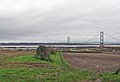
 Humber Bridge - geograph.org.uk - 1028625.jpg 640 × 480; 55 KB
-
 Humber Bridge - geograph.org.uk - 818350.jpg 640 × 426; 110 KB
-
 Humber Bridge - geograph.org.uk - 818352.jpg 640 × 407; 114 KB
-
 Humber Bridge - geograph.org.uk - 945562.jpg 640 × 485; 61 KB
-
 Humber Bridge - North Tower - geograph.org.uk - 686557.jpg 480 × 640; 32 KB
-
 Humber Bridge at Sunset - geograph.org.uk - 685277.jpg 640 × 480; 40 KB
-
 Humber Bridge East Yorkshire - geograph.org.uk - 869872.jpg 640 × 427; 70 KB
-
 Humber Bridge from North Tower - geograph.org.uk - 657084.jpg 485 × 640; 84 KB
-
 Humber Bridge Panorama October 2008.jpg 11,129 × 2,972; 12.51 MB
-
 Humber Bridge Toll Bar.jpg 640 × 348; 55 KB
-
 Humber Bridge Viewing Area, Hessle - geograph.org.uk - 978125.jpg 640 × 480; 71 KB
-
 Humber Bridge-edit.jpg 680 × 884; 615 KB
-
 Humber bridge.jpg 2,183 × 1,611; 918 KB
-
 Humber Bridge.jpg 2,268 × 1,512; 2.65 MB
-
 Humber Bridge00003.jpg 2,240 × 1,680; 682 KB
-
 Humber Bridge00016.jpg 2,240 × 1,518; 1.44 MB
-
 Humber Bridge00026.jpg 2,068 × 1,680; 825 KB
-
 Humber Bridge00027.jpg 2,240 × 1,680; 1.52 MB
-
 Humber Bridge00031.jpg 2,240 × 1,680; 1.79 MB
-
 Humber Bridge00048.jpg 2,240 × 1,680; 1.61 MB
-
 Humber Foreshore - geograph.org.uk - 673865.jpg 640 × 482; 115 KB
-
 Humber Foreshore - geograph.org.uk - 842069.jpg 480 × 640; 330 KB
-
 Humber Foreshore - geograph.org.uk - 842080.jpg 640 × 480; 371 KB
-
 Humber Foreshore at Low Tide - geograph.org.uk - 946058.jpg 480 × 640; 52 KB
-
 Humber Foreshore Posts - geograph.org.uk - 702332.jpg 640 × 480; 111 KB
-
 Humber Foreshore Reedbed - geograph.org.uk - 1011298.jpg 480 × 640; 97 KB
-
 Humber Inshore Rescue.jpg 640 × 469; 208 KB
-
 Humber North Bank - geograph.org.uk - 688800.jpg 640 × 384; 58 KB
-
 Infill Development on Woodfield Lane - geograph.org.uk - 706216.jpg 640 × 407; 135 KB
-
 Jenny Brough Lane, Hessle - geograph.org.uk - 878883.jpg 489 × 640; 245 KB
-
 Jenny Brough Lane, Hessle - geograph.org.uk - 878884.jpg 640 × 459; 155 KB
-
 Jenny Brough Lane, Hessle - geograph.org.uk - 912792.jpg 640 × 383; 104 KB
-
 King George V Playing Fields - geograph.org.uk - 878574.jpg 640 × 447; 205 KB
-
 Long shadows - geograph.org.uk - 696340.jpg 459 × 640; 110 KB
-
 Neglect - geograph.org.uk - 951787.jpg 640 × 423; 245 KB
-
 North Lodge, Jenny Brough Lane, Hessle - geograph.org.uk - 878581.jpg 640 × 448; 272 KB
-
 Pastures near Hessle Mount Farm - geograph.org.uk - 878880.jpg 640 × 480; 249 KB
-
 Pier at Hessle Haven - geograph.org.uk - 951777.jpg 640 × 387; 178 KB
-
 Recycling at Hessle Haven - geograph.org.uk - 951796.jpg 427 × 640; 216 KB
-
 Redcliff Road, Hessle - geograph.org.uk - 706682.jpg 640 × 426; 105 KB
-
 Riverside Motors, Hessle - geograph.org.uk - 775513.jpg 640 × 471; 188 KB
-
 Scrapheap Challenge - geograph.org.uk - 836782.jpg 456 × 640; 85 KB
-
 Service Road under Humber Bridge - geograph.org.uk - 693013.jpg 640 × 480; 114 KB
-
 Shops on Prestongate - geograph.org.uk - 767679.jpg 640 × 480; 89 KB
-
 Shops on Southgate, Hessle - geograph.org.uk - 767707.jpg 640 × 373; 63 KB
-
 South Elevation - Dykes House, Hessle - geograph.org.uk - 706646.jpg 640 × 484; 109 KB
-
 Southfield, Hessle - geograph.org.uk - 1021574.jpg 640 × 481; 161 KB
-

-
 Sunken Barge at Hessle Haven - geograph.org.uk - 951780.jpg 640 × 425; 241 KB
-
 Sunrise, Hessle Foreshore - geograph.org.uk - 1084249.jpg 640 × 438; 141 KB
-
 Swinegate Hessle.jpg 640 × 518; 98 KB
-

-
 The A63 looking westwards - geograph.org.uk - 722969.jpg 640 × 480; 69 KB
-
 The A63, Hessle - geograph.org.uk - 1084243.jpg 640 × 515; 159 KB
-
 The Admiral Hawke, Hessle - geograph.org.uk - 775657.jpg 640 × 480; 198 KB
-
 The Beacon Hessle.jpg 480 × 640; 255 KB
-
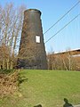 The disused windmill, Hessle, East Yorks. - geograph.org.uk - 775417.jpg 480 × 640; 207 KB
-
 The Hessle Foreshore in November - geograph.org.uk - 1035263.jpg 640 × 481; 76 KB
-
 The Hessle Lifeboat on duty - geograph.org.uk - 836937.jpg 640 × 488; 67 KB
-
 The Humber Bridge - geograph.org.uk - 1038479.jpg 575 × 640; 70 KB
-
 The Humber Bridge - geograph.org.uk - 1040606.jpg 640 × 459; 58 KB
-
 The Humber Bridge - geograph.org.uk - 1067360.jpg 640 × 480; 54 KB
-
 The Humber Bridge - geograph.org.uk - 659423.jpg 640 × 508; 75 KB
-
 The Humber Bridge - geograph.org.uk - 696194.jpg 389 × 640; 66 KB
-
 The Humber Bridge - geograph.org.uk - 696280.jpg 467 × 640; 50 KB
-
 The Humber Bridge - geograph.org.uk - 870885.jpg 640 × 427; 76 KB
-
 The Humber Bridge - High Tide - geograph.org.uk - 871443.jpg 640 × 505; 82 KB
-
 The Humber Bridge - Low Tide - geograph.org.uk - 871440.jpg 640 × 480; 67 KB
-
 The Humber River Bank - geograph.org.uk - 723222.jpg 640 × 480; 103 KB
-
 The Humber River shore west of Hessle - geograph.org.uk - 702323.jpg 640 × 538; 74 KB
-
 The Mouth of Barton Haven - geograph.org.uk - 969935.jpg 640 × 481; 62 KB
-
 The Norland Hessle.jpg 640 × 393; 205 KB
-
 The Police Station Hessle.jpg 640 × 404; 176 KB
-
 The Public Footpath to Dam Road - geograph.org.uk - 1040579.jpg 640 × 436; 72 KB
-
 The Remains of the Old Jetty - geograph.org.uk - 894276.jpg 640 × 489; 71 KB
-

-
 The River Humber bank west of Hessle - geograph.org.uk - 702325.jpg 640 × 451; 97 KB
-
 The River Humber Foreshore west of Hessle - geograph.org.uk - 702491.jpg 640 × 480; 100 KB
-
 The River Humber Shoreline Hessle.jpg 640 × 480; 128 KB
-
 The Sign of The Hase - geograph.org.uk - 769996.jpg 480 × 640; 78 KB
-
-
 The Sign of The Tophouse - geograph.org.uk - 765903.jpg 501 × 640; 74 KB
-
 The Tide Mark - geograph.org.uk - 688803.jpg 640 × 480; 82 KB
-
 The Tophouse, Hessle - geograph.org.uk - 775653.jpg 640 × 480; 193 KB
-

-
 The western approaches to Hull - geograph.org.uk - 804160.jpg 640 × 324; 138 KB
-
 The Windmill on Hessle Foreshore - geograph.org.uk - 836861.jpg 472 × 640; 38 KB
-

-
 Tower Gate Methodist Church, Hessle - geograph.org.uk - 775643.jpg 640 × 631; 306 KB
-
 Tower Hill Methodist Church, Hessle - geograph.org.uk - 689073.jpg 418 × 640; 58 KB
-
 War Memorial Hessle.jpg 480 × 640; 226 KB
-
 West Elevation - Beacon Garth, Hessle - geograph.org.uk - 706609.jpg 640 × 480; 120 KB
-
 Woodfield Lane, Hessle - geograph.org.uk - 862660.jpg 640 × 480; 446 KB
-
 Yorkshire Wolds Way Marker.jpg 567 × 640; 146 KB


.jpg)


_-_geograph.org.uk_-_693002.jpg)


