Category:2006 maps of Bucks County, Pennsylvania
Jump to navigation
Jump to search
Counties of Pennsylvania : Adams · Allegheny · Bucks · Crawford · Delaware · Lebanon · Luzerne · Philadelphia · Somerset · York
| 2000s maps of Bucks County, Pennsylvania: | 2006 |
Media in category "2006 maps of Bucks County, Pennsylvania"
The following 71 files are in this category, out of 71 total.
-
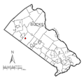
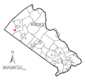
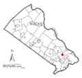
Map of Churchville, Bucks County, Pennsylvania Highlighted.png 1,796 × 1,710; 89 KB
-
Map of Bedminster Township, Bucks County, Pennsylvania Highlighted.png 1,796 × 1,710; 89 KB
-
Map of Bensalem Township, Bucks County, Pennsylvania Highlighted.png 1,796 × 1,710; 89 KB
-
Map of Bridgeton Township, Bucks County, Pennsylvania Highlighted.png 1,796 × 1,710; 89 KB
-
Map of Bristol, Bucks County, Pennsylvania Highlighted.png 1,796 × 1,710; 89 KB
-
Map of Bristol Township, Bucks County, Pennsylvania Highlighted.png 1,796 × 1,710; 89 KB
-
Map of Brittany Farms-Highlands, Bucks County, Pennsylvania Highlighted.png 1,796 × 1,710; 89 KB
-
Map of Buckingham Township, Bucks County, Pennsylvania Highlighted.png 1,796 × 1,710; 90 KB
-
Map of Chalfont, Bucks County, Pennsylvania Highlighted.png 1,796 × 1,710; 89 KB
-
Map of Cornwells Heights-Eddington, Bucks County, Pennsylvania Highlighted.png 1,796 × 1,710; 89 KB
-
Map of Croydon, Bucks County, Pennsylvania Highlighted.png 1,796 × 1,710; 89 KB
-
Map of Doylestown, Bucks County, Pennsylvania Highlighted.png 1,796 × 1,710; 89 KB
-
Map of Doylestown Township, Bucks County, Pennsylvania Highlighted.png 1,796 × 1,710; 89 KB
-
Map of Dublin, Bucks County, Pennsylvania Highlighted.png 1,796 × 1,710; 89 KB
-
Map of Durham Township, Bucks County, Pennsylvania Highlighted.png 1,796 × 1,710; 89 KB
-
Map of East Rockhill Township, Bucks County, Pennsylvania Highlighted.png 1,796 × 1,710; 89 KB
-
Map of Fairless Hills, Bucks County, Pennsylvania Highlighted.png 1,796 × 1,710; 89 KB
-
Map of Falls Township, Bucks County, Pennsylvania Highlighted.png 1,796 × 1,710; 130 KB
-
Map of Feasterville-Trevose, Bucks County, Pennsylvania Highlighted.png 1,796 × 1,710; 89 KB
-
Map of Haycock Township, Bucks County, Pennsylvania Highlighted.png 1,796 × 1,710; 89 KB
-
Map of Hilltown Township, Bucks County, Pennsylvania Highlighted.png 1,796 × 1,710; 90 KB
-
Map of Hulmeville, Bucks County, Pennsylvania Highlighted.png 1,796 × 1,710; 89 KB
-
Map of Ivyland, Bucks County, Pennsylvania Highlighted.png 1,796 × 1,710; 89 KB
-
Map of Langhorne, Bucks County, Pennsylvania Highlighted.png 1,796 × 1,710; 89 KB
-
Map of Langhorne Manor, Bucks County, Pennsylvania Highlighted.png 1,796 × 1,710; 89 KB
-
Map of Levittown, Bucks County, Pennsylvania Highlighted.png 1,796 × 1,710; 89 KB
-
Map of Lower Makefield Township, Bucks County, Pennsylvania Highlighted.png 1,796 × 1,710; 89 KB
-
Map of Lower Southampton Township, Bucks County, Pennsylvania Highlighted.png 1,796 × 1,710; 89 KB
-
Map of Bucks County Pennsylvania School Districts.png 444 × 353; 17 KB
-
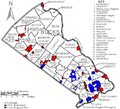
Map of Bucks County, Pennsylvania No Text.png 1,796 × 1,710; 89 KB
-
Map of Bucks County, Pennsylvania.png 1,796 × 1,710; 318 KB
-
Map of Middletown Township, Bucks County, Pennsylvania Highlighted.png 1,796 × 1,710; 89 KB
-
Map of Milford Township, Bucks County, Pennsylvania Highlighted.png 1,796 × 1,710; 89 KB
-
Map of Morrisville, Bucks County, Pennsylvania Highlighted.png 1,796 × 1,710; 89 KB
-
Map of New Britain Township, Bucks County, Pennsylvania Highlighted.png 1,796 × 1,710; 90 KB
-
Map of New Britain, Bucks County, Pennsylvania Highlighted.png 1,796 × 1,710; 89 KB
-
Map of New Hope, Bucks County, Pennsylvania Highlighted.png 1,796 × 1,710; 89 KB
-
Map of Newtown, Bucks County, Pennsylvania Highlighted.png 1,796 × 1,710; 89 KB
-
Map of Newtown Grant, Bucks County, Pennsylvania Highlighted.png 1,796 × 1,710; 89 KB
-
Map of Newtown Township, Bucks County, Pennsylvania Highlighted.png 1,796 × 1,710; 89 KB
-
Map of Nockamixon Township, Bucks County, Pennsylvania Highlighted.png 1,796 × 1,710; 89 KB
-
Map of Northampton Township, Bucks County, Pennsylvania Highlighted.png 1,796 × 1,710; 89 KB
-
Map of Penndel, Bucks County, Pennsylvania Highlighted.png 1,796 × 1,710; 89 KB
-
Map of Perkasie, Bucks County, Pennsylvania Highlighted.png 1,796 × 1,710; 89 KB
-
Map of Plumstead Township, Bucks County, Pennsylvania Highlighted.png 1,796 × 1,710; 90 KB
-
Map of Quakertown, Bucks County, Pennsylvania Highlighted.png 1,796 × 1,710; 89 KB
-
Map of Richboro, Bucks County, Pennsylvania Highlighted.png 1,796 × 1,710; 89 KB
-
Map of Richland Township, Bucks County, Pennsylvania Highlighted.png 1,796 × 1,710; 89 KB
-
Map of Richlandtown, Bucks County, Pennsylvania Highlighted.png 1,796 × 1,710; 89 KB
-
Map of Riegelsville, Bucks County, Pennsylvania Highlighted.png 1,796 × 1,710; 89 KB
-
Map of Sellersville, Bucks County, Pennsylvania Highlighted.png 1,796 × 1,710; 89 KB
-
Map of Silverdale, Bucks County, Pennsylvania Highlighted.png 1,796 × 1,710; 89 KB
-
Map of Solebury Township, Bucks County, Pennsylvania Highlighted.png 1,796 × 1,710; 89 KB
-
Map of Springfield Township, Bucks County, Pennsylvania Highlighted.png 1,796 × 1,710; 89 KB
-
Map of Telford, Bucks County, Pennsylvania Highlighted.png 1,796 × 1,710; 89 KB
-
Map of Tinicum Township, Bucks County, Pennsylvania Highlighted.png 1,796 × 1,710; 89 KB
-
Map of Trumbauersville, Bucks County, Pennsylvania Highlighted.png 1,796 × 1,710; 89 KB
-
Map of Tullytown, Bucks County, Pennsylvania Highlighted.png 1,796 × 1,710; 89 KB
-
Map of Upper Makefield Township, Bucks County, Pennsylvania Highlighted.png 1,796 × 1,710; 89 KB
-
Map of Upper Southampton Township, Bucks County, Pennsylvania Highlighted.png 1,796 × 1,710; 89 KB
-
Map of Village Shires, Bucks County, Pennsylvania Highlighted.png 1,796 × 1,710; 89 KB
-
Map of Warminster Heights, Bucks County, Pennsylvania Highlighted.png 1,796 × 1,710; 89 KB
-
Map of Warminster Township, Bucks County, Pennsylvania Highlighted.png 1,796 × 1,710; 89 KB
-
Map of Warrington Township, Bucks County, Pennsylvania Highlighted.png 1,796 × 1,710; 89 KB
-
Map of Warwick Township, Bucks County, Pennsylvania Highlighted.png 1,796 × 1,710; 89 KB
-
Map of West Rockhill Township, Bucks County, Pennsylvania Highlighted.png 1,796 × 1,710; 89 KB
-
Map of Woodbourne, Bucks County, Pennsylvania Highlighted.png 1,796 × 1,710; 89 KB
-
Map of Woodside, Bucks County, Pennsylvania Highlighted.png 1,796 × 1,710; 89 KB
-
Map of Wrightstown Township, Bucks County, Pennsylvania Highlighted.png 1,796 × 1,710; 89 KB
-
Map of Yardley, Bucks County, Pennsylvania Highlighted.png 1,796 × 1,710; 89 KB


