Category:2006 in Flamborough
Jump to navigation
Jump to search
Media in category "2006 in Flamborough"
The following 21 files are in this category, out of 21 total.
-
 Arch - geograph.org.uk - 207481.jpg 640 × 427; 84 KB
-
 Beacon Hill - geograph.org.uk - 295462.jpg 640 × 480; 90 KB
-
 Breil Nook - geograph.org.uk - 293569.jpg 640 × 480; 115 KB
-
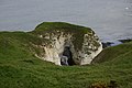
 Caves at Northwick bay - geograph.org.uk - 507130.jpg 640 × 480; 142 KB
-
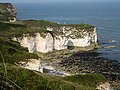
 Cliff top, Flamborough Head. - geograph.org.uk - 247753.jpg 640 × 416; 121 KB
-
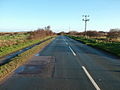
 Danes Dyke from the B1229 - geograph.org.uk - 294117.jpg 640 × 480; 125 KB
-
 Flamborough Lighthouse - geograph.org.uk - 659739.jpg 418 × 640; 42 KB
-
 Flamborough Lighthouse.JPG 1,704 × 2,272; 628 KB
-
 Lighthouse Road B1259 - geograph.org.uk - 294096.jpg 640 × 480; 80 KB
-
 North landing, Flamborough Head. - geograph.org.uk - 247748.jpg 640 × 480; 94 KB
-
 North Marine Road - geograph.org.uk - 294099.jpg 640 × 480; 74 KB
-
 Old Fall Plantation - geograph.org.uk - 293319.jpg 640 × 480; 160 KB
-
 Old Trailer in Farmland - geograph.org.uk - 294109.jpg 640 × 480; 119 KB
-
 Ringley Hills - geograph.org.uk - 294090.jpg 640 × 480; 90 KB
-
 Selwick's Bay, Flamborough Head - geograph.org.uk - 248335.jpg 640 × 480; 113 KB
-
 Selwicks Bay - geograph.org.uk - 1049818.jpg 640 × 480; 89 KB
-
 South Landing - geograph.org.uk - 293323.jpg 640 × 480; 101 KB
-
 South landing, Flamborough Head - geograph.org.uk - 247737.jpg 640 × 480; 99 KB
-
 Thornwick looking out to sea - geograph.org.uk - 499565.jpg 640 × 480; 85 KB
-
 Thornwick looking out to sea 2 - geograph.org.uk - 499568.jpg 640 × 480; 80 KB
-
 WW2 Pillbox at Thornwick Bay - geograph.org.uk - 499561.jpg 640 × 480; 100 KB


