Category:2005 in the City of Wakefield
Jump to navigation
Jump to search
Subcategories
This category has the following 13 subcategories, out of 13 total.
Media in category "2005 in the City of Wakefield"
The following 20 files are in this category, out of 20 total.
-
 Barratt Road allotments - geograph.org.uk - 21964.jpg 640 × 480; 146 KB
-
 Bottom Boat Wakefield - geograph.org.uk - 39758.jpg 640 × 443; 102 KB
-
-

-
 Farmland near Haw Park Wood - geograph.org.uk - 63046.jpg 640 × 480; 66 KB
-

-
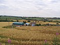
 Harvested Corn Fields - Badsworth - geograph.org.uk - 56482.jpg 640 × 479; 70 KB
-
 Haw Park woods - geograph.org.uk - 61798.jpg 640 × 480; 121 KB
-
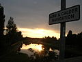
 Hedgerows at Sundown - geograph.org.uk - 57768.jpg 640 × 479; 88 KB
-
 Indian Balsam - geograph.org.uk - 395487.jpg 427 × 640; 49 KB
-

-
 Methley Lanes - geograph.org.uk - 39762.jpg 640 × 454; 58 KB
-
 Recreation field, Calder and Hebble canal - geograph.org.uk - 386521.jpg 640 × 427; 110 KB
-
 Stocksmoor Farm, Midgley, Sitlington - geograph.org.uk - 64591.jpg 640 × 452; 131 KB
-
 The road to Altofts - geograph.org.uk - 44189.jpg 640 × 480; 85 KB
-
 Tufty Farm Gawthorpe - geograph.org.uk - 31066.jpg 640 × 480; 91 KB
-
 Wakefield Westgate Station - geograph.org.uk - 57334.jpg 640 × 480; 98 KB
-

-
 Welbeck Land-fill Site, Wakefield - geograph.org.uk - 356377.jpg 640 × 427; 83 KB
-
 Y-Fronts Part II - geograph.org.uk - 56733.jpg 640 × 479; 111 KB


_-_geograph.org.uk_-_96566.jpg)


