Category:2004 presidential election maps of Georgia (U.S. state)
Jump to navigation
Jump to search
States of the United States: Alabama · California · Connecticut · Florida · Georgia · Illinois · Kentucky · Massachusetts · New Hampshire · New York · North Carolina · Ohio · Pennsylvania · Texas
Media in category "2004 presidential election maps of Georgia (U.S. state)"
The following 2 files are in this category, out of 2 total.
-
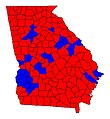 Georgia Counties 2004 Election.JPG 442 × 480; 37 KB
-
 GA2004.jpg 998 × 1,076; 195 KB

