Category:2002 maps of the United States
Jump to navigation
Jump to search
States of the United States: Alabama · California · Georgia · Iowa · Kentucky · Massachusetts · North Carolina · Pennsylvania · South Carolina · Texas – Washington, D.C.
Subcategories
This category has the following 12 subcategories, out of 12 total.
A
- 2002 maps of Alabama (2 F)
C
- 2002 maps of California (2 F)
D
G
I
K
M
- 2002 maps of Massachusetts (6 F)
N
- 2002 maps of North Carolina (1 F)
P
S
- 2002 maps of South Carolina (3 F)
T
- 2002 maps of Texas (1 F)
Media in category "2002 maps of the United States"
The following 3 files are in this category, out of 3 total.
-
 DC satellite image — NE quadrant (cropped).jpg 707 × 833; 1.09 MB
-
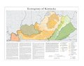 Kentucky Level IV ecoregions.pdf 4,800 × 3,750; 1.41 MB
-
 United States. LOC 2003629855.jpg 2,426 × 3,131; 798 KB
.jpg)
