Category:2000 United States Census TIGER maps of ZIP Code Tabulation Areas
Jump to navigation
Jump to search
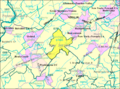
English: Maps of ZIP Code Tabulation Areas (roughly matching the boundaries of ZIP Codes), generated by the United States Census using TIGER data for the 2000 United States Census.
U.S. Census area of all places with the same ZIP Code | |||||
| Upload media | |||||
| Instance of |
| ||||
|---|---|---|---|---|---|
| |||||
Media in category "2000 United States Census TIGER maps of ZIP Code Tabulation Areas"
The following 18 files are in this category, out of 18 total.
-
 ZCTA 07836 Flanders, New Jersey.gif 575 × 425; 76 KB
-
 ZCTA 07920 Basking Ridge, New Jersey.gif 575 × 425; 73 KB
-
 ZCTA 08023 Deepwater, New Jersey.gif 575 × 425; 38 KB
-
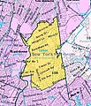
 NewRochelle10801.JPG 341 × 372; 57 KB
-
 U.S. Census 2000 reference map of ZIP Code 10801.gif 341 × 372; 43 KB
-
 NewRochelle10804.JPG 343 × 401; 65 KB
-
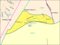
 NewRochelle10805.JPG 317 × 366; 41 KB
-
 U.S. Census 2000 reference map of ZIP Code 10805.gif 317 × 366; 32 KB
-
 16640 area.png 575 × 425; 46 KB
-
 92694LM.png 500 × 375; 20 KB
-
 ZCTA 92845 West Garden Grove, California.gif 575 × 425; 52 KB
-
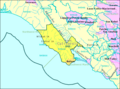
 93920 ZCTA 2000 Census.png 575 × 425; 27 KB
-
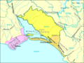
 94924 5-Digit ZCTA.png 575 × 425; 36 KB
-
 94970 5-Digit ZCTA.png 575 × 425; 36 KB
-
 95002 5-Digit ZCTA.png 575 × 425; 40 KB
-
 Census Bureau map of ZCTA 07865 Port Murray, New Jersey.png 575 × 425; 61 KB
-
 ZCTA 07838 Great Meadows, New Jersey.png 575 × 425; 46 KB
-
 ZCTA 08858.gif 575 × 425; 45 KB


