Category:19th-century maps of Seine-et-Marne
Jump to navigation
Jump to search
Subcategories
This category has the following 2 subcategories, out of 2 total.
Media in category "19th-century maps of Seine-et-Marne"
The following 9 files are in this category, out of 9 total.
-

-
 Carte melun.jpg 2,304 × 1,542; 2.5 MB
-
 Carte routière de Seine et Marne - 1867.jpg 4,608 × 4,096; 3.03 MB
-
 Carte routière et hydrographique de Seine-et-Marne - 1858.jpg 8,324 × 10,860; 13.02 MB
-
 Carte topographique de la forêt de Fontainebleau - 1895 - btv1b530291367.jpg 7,191 × 9,542; 18.68 MB
-
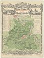
 Dépt. de Seine et Marne (région du nord) - Fonds Ancely - B315556101 A LEVASSEUR 077.jpg 3,036 × 2,045; 2.12 MB
-
 Géoportail.png 935 × 597; 883 KB
-

-
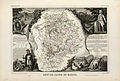
 Vuillemin Alexandre, Seine-et-Marne, 1880, carte.jpg 1,218 × 1,497; 1.33 MB
_-_Geographicus_-_SeineEtMarne-levasseur-1852.jpg)


_-_Fonds_Ancely_-_B315556101_A_LEVASSEUR_077.jpg)


