Category:19th-century maps of Mount Etna
Jump to navigation
Jump to search
Subcategories
This category has the following 2 subcategories, out of 2 total.
1
Media in category "19th-century maps of Mount Etna"
The following 11 files are in this category, out of 11 total.
-
 Admiralty Chart No 188 Catania to Cefalu Published 1872 (cropped).jpg 1,702 × 403; 296 KB
-
 Admiralty Chart No 188 Catania to Cefalu Published 1872.jpg 10,426 × 7,208; 8.26 MB
-
 Die Gartenlaube (1892) b 571.jpg 680 × 1,384; 241 KB
-
 Etna (15556723462).jpg 2,456 × 2,508; 7.5 MB
-
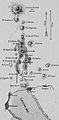
 Etna - a history of the mountain and of its eruptions (1878) (14595678990).jpg 3,232 × 2,176; 1.03 MB
-
 Etna - a history of the mountain and of its eruptions (1878) (14595720109).jpg 3,232 × 2,198; 1.03 MB
-
 Etna - a history of the mountain and of its eruptions (1878) (14779248731).jpg 3,328 × 2,352; 736 KB
-
 Etna - a history of the mountain and of its eruptions (1878) (14780036724).jpg 3,296 × 2,218; 583 KB
-
 PSM V20 D063 Fissure on etna during eruption of 1865.jpg 1,436 × 552; 148 KB
-
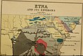
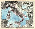 Stielers Handatlas 1891 22.jpg 5,050 × 4,300; 6.56 MB
-
 Valle del Bove, 1880.png 600 × 328; 59 KB

_b_571.jpg)
.jpg)
_(14595678990).jpg)
_(14595720109).jpg)
_(14779248731).jpg)
_(14780036724).jpg)


.jpg)