Category:19th-century maps of Meuse (department)
Jump to navigation
Jump to search
Subcategories
This category has the following 2 subcategories, out of 2 total.
V
- 19th-century maps of Verdun (20 F)
Media in category "19th-century maps of Meuse (department)"
The following 18 files are in this category, out of 18 total.
-
 Zoom moulin des marats.jpg 1,538 × 1,785; 559 KB
-
 Moulin de Caïpha cadastre 1833.jpg 1,787 × 1,190; 450 KB
-
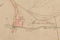
 Moulin à vent cadastre 1833.jpg 2,191 × 1,268; 580 KB
-
 Zoom moulin.jpg 1,538 × 1,785; 559 KB
-

-
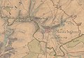 Etat Major 1866.jpg 920 × 637; 125 KB
-
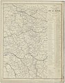 Carte des voies de communication du département de la Meuse - 1871.jpg 8,900 × 11,310; 14.51 MB
-
 Dépt. de la Meuse (région du nord-est) - Fonds Ancely - B315556101 A LEVASSEUR 058.jpg 2,011 × 3,019; 2.08 MB
-
 LASB K Hellwig 0621.jpg 3,201 × 2,673; 2.08 MB
-
 LASB K Hellwig 0634.jpg 5,368 × 4,796; 3.6 MB
-
 LASB K Hellwig 0646.jpg 3,702 × 2,874; 725 KB
-
 LASB K Hellwig 0779.jpg 955 × 1,510; 390 KB
-
 LASB K Hellwig 0784.jpg 995 × 1,540; 395 KB
-
 LASB K Hellwig 0793.jpg 1,155 × 1,772; 444 KB
-
 LASB K Hellwig 0798.jpg 2,154 × 3,204; 1.04 MB
-
 LASB K Hellwig 0816.jpg 2,472 × 2,742; 1 MB
-
 LASB K Hellwig 0828.jpg 3,156 × 4,200; 2.4 MB
-
 Sorcy-Saint-Martin, Chateau Emmi (Emy) (11088069665).jpg 2,592 × 1,434; 689 KB


_-_Geographicus_-_Meuse-levasseur-1852.jpg)


_-_Fonds_Ancely_-_B315556101_A_LEVASSEUR_058.jpg)


_(11088069665).jpg)