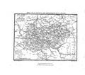
Category:19th-century maps of Meurthe-et-Moselle
Jump to navigation
Jump to search
Subcategories
This category has only the following subcategory.
Media in category "19th-century maps of Meurthe-et-Moselle"
The following 6 files are in this category, out of 6 total.
-
B543956101M00820 007 PL.jpg 7,108 × 5,484; 8.41 MB
-
Guide pittoresque 060 carte Meurthe-et-Moselle cropped.png 2,112 × 1,596; 202 KB
-
Guide pittoresque 060 carte Meurthe-et-Moselle.pdf 2,033 × 1,512; 182 KB
-
LASB K Hellwig 0822.jpg 3,465 × 4,626; 2.55 MB
-
LASB K Hellwig 0830.jpg 3,156 × 4,212; 2.03 MB


