Category:19th-century maps of Lyon
Jump to navigation
Jump to search
Media in category "19th-century maps of Lyon"
The following 71 files are in this category, out of 71 total.
-
 Atlas général de la France - Plan de Lion - E. Cortambert.jpg 1,072 × 1,552; 271 KB
-

-

-

-
 Anonyme 1810 Plan des abords de la Ville de Lyon.jpg 16,416 × 9,698; 21.81 MB
-
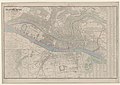
 Baedeker plan Lyon 1877.jpg 1,600 × 1,090; 528 KB
-
 Cadastre Lyon 1835 - Guillotière A 421-614.PNG 1,922 × 827; 2.3 MB
-
 Camp de Lyon en 1843.jpg 12,060 × 8,840; 16.73 MB
-
 Carte inondations 1856 Lyon 01.jpg 551 × 563; 147 KB
-
 Carte inondations 1856 Lyon 02.jpg 785 × 569; 128 KB
-
 Carte inondations 1856 Lyon 04.jpg 640 × 976; 139 KB
-
 Carte Lyon 1852.jpg 4,913 × 3,270; 8.24 MB
-
 Carte topographique de la ville de Lyon, et du canton de Villeurbanne.jpg 5,772 × 7,182; 15.36 MB
-
 Curten 1.jpg 768 × 412; 82 KB
-
 Curten 2.jpg 768 × 382; 65 KB
-
 Dignoscyo Rembiélinski Plan Lyon 1863.jpg 9,267 × 6,364; 23.08 MB
-
 Exposition Universelle de Lyon 1872, nouveau plan illustré de la ville de Lyon.jpg 9,493 × 6,743; 20.89 MB
-
 Garella 1833 Plan du cours du Rhône entre le pont de la Guillotière et la Vitriolerie.jpg 10,779 × 6,851; 8.02 MB
-

-
 Hyacinthe Garella 1835 Traversee de Lyon chemin de fer.jpg 10,535 × 7,803; 10.47 MB
-

-
 Lyon 1888.jpg 4,948 × 3,773; 13.3 MB
-

-
 Lyon monumental 1894.jpg 10,722 × 8,566; 32.7 MB
-
 Lyon monumental, 1894.jpg 10,005 × 6,737; 33.62 MB
-
 Lyon pittoresque et monumental.jpg 1,000 × 665; 155 KB
-
 Lyon rive gauche 1892.jpg 8,613 × 5,731; 22.03 MB
-
 Lyon ses fortifications et ses environs 18xx.jpg 7,789 × 6,130; 11.64 MB
-
 Lyon vers 1890.png 1,015 × 789; 1.6 MB
-
 Meyers b11 s0010a.jpg 2,460 × 1,675; 5.86 MB
-
 Montée Saint-Clair-Duport.png 707 × 665; 781 KB
-

-
 Nouveau Plan de la ville de Lyon et de ses faubourgs - 1894.jpg 11,520 × 8,009; 46.26 MB
-
 Nouveau plan de Lyon avec subdivision en 5 mairies 1854.jpg 7,211 × 5,487; 11.49 MB
-
 Nouveau plan topographique et historique de la ville de Lyon 1847.jpg 11,616 × 7,680; 35.69 MB
-
 Nouveau plan topographique et historique de la Ville de Lyon….jpg 1,000 × 670; 105 KB
-

-
 Plan de distribution de la presqu'île Perrache 1828.jpg 2,456 × 1,208; 589 KB
-

-
 Plan de la ville de Lyon et ses environs 1834.jpg 11,022 × 7,479; 55.61 MB
-
 Plan de la ville de Lyon, dressé en 1872.jpg 10,566 × 7,278; 25.76 MB
-
 Plan de Lyon 1830.jpg 10,552 × 6,596; 52.13 MB
-
 Plan de Lyon 1882 Aml 3S0128.jpg 4,306 × 3,611; 8.69 MB
-
-
 Plan de Lyon et Forts 1844.jpg 11,210 × 8,384; 37.19 MB
-
 Plan des inondations du Rhône et de la Saône dans Lyon et ses faubourgs en l'année 1840.jpg 9,600 × 7,560; 9.43 MB
-
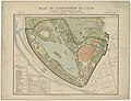
 Plan du parc de la Tête d'Or, exposition universelle de 1871, 1er projet par Jules Chatron.jpg 11,629 × 8,164; 16.46 MB
-
 Plan du parc de la Tête d'Or, exposition universelle de 1871, 2e projet par Jules Chatron 01.jpg 11,328 × 8,258; 16.23 MB
-
 Plan du parc de la Tête d'Or, exposition universelle de 1871, 3e projet par Jules Chatron 02.jpg 11,221 × 7,917; 19.19 MB
-
 Plan Exposition universelle Lyon 1894 Parc Tête d'Or.jpg 10,426 × 8,015; 31.09 MB
-
 Plan forts de Lyon 1847.jpg 5,792 × 3,581; 4.16 MB
-
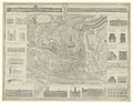
 Plan général de l'hospice de l'Antiquaille de Lyon - 1834.jpg 6,117 × 4,713; 11.86 MB
-
 Plan géométral de Lyon 1801.jpg 9,071 × 7,026; 30.72 MB
-
 Plan Lyon 1818.jpg 6,216 × 4,221; 12.8 MB
-
 Plan Lyon 1849.jpg 9,264 × 6,712; 29.25 MB
-
 Plan Lyon 1872.jpg 10,602 × 7,936; 38.98 MB
-
 Plan Lyon 1900.jpg 6,554 × 4,844; 17.39 MB
-
 Plan Lyon E.Wagner 1852.jpg 5,314 × 3,672; 4.25 MB
-
 Plan militaire de Lyon assiégé en 1793 - 1844.jpg 6,160 × 5,165; 16.69 MB
-
 Plan officiel des rues et places publiques de la ville de Lyon dressé en 1871 01.jpg 9,564 × 7,414; 14.3 MB
-
 Plan topographique de la ville de Lyon et de ses environs 1847.pdf 3,700 × 5,329; 67.59 MB
-
 Plan topographique de la Ville de Lyon et de ses environs 1863 Dignoscyo.jpg 4,797 × 2,527; 2.56 MB
-
 Plan topographique de la Ville de Lyon et ses environs de Rembielinski et Dignoscyo en 1847.jpg 12,414 × 8,615; 17.32 MB
-

-
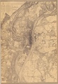
 Plan topographique Lyon 1808.jpg 9,380 × 7,332; 32.7 MB
-
 Plan Vaise 1847.png 459 × 729; 901 KB
-
 Prequile lyon 1853.jpg 2,568 × 1,409; 1.17 MB
-
 Prequile lyon 1863.jpg 2,745 × 1,452; 1.42 MB
-
 Projet Jardins du Rosaire.JPG 3,000 × 4,000; 4.23 MB
-
 S.Wolf Plan de Lyon et de ses environs 1818.jpg 4,426 × 3,072; 3.25 MB
-
 Tramways de la ville de Lyon, réseau adopté.jpg 5,054 × 4,298; 7.37 MB

%27_(11302060064).jpg)
%27_(11231714284).jpg)
.jpg)


_(14597169949).jpg)


_(14779003941).jpg)


