Category:19th-century maps of Loire River
Jump to navigation
Jump to search
Media in category "19th-century maps of Loire River"
The following 14 files are in this category, out of 14 total.
-

-
 248 of 'La France Illustrée- géographie générale ... Par F. J' (11201092423).jpg 2,032 × 1,271; 642 KB
-

-
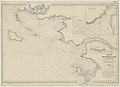
 Admiralty Chart No 2989 Entrance to the Loire River and approaches to St. Nazaire, Published 1898.jpg 16,206 × 11,085; 65.91 MB
-
 Amboise - Carte d'État major 1866.jpg 1,926 × 1,427; 2 MB
-

-
 Desmarest-1827--atlas du dictionnaire de geographie physique--pl.45-volcans 2e epoque.png 1,608 × 1,112; 2.24 MB
-
 France & Colonies-1894-bancs de sables de la Loire à Paimbœuf.jpg 4,424 × 2,856; 2.62 MB
-
 France & Colonies-1894-confluent Loire & Allier.jpg 4,576 × 3,776; 3.64 MB
-
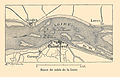
 France & Colonies-1894-val de Loire à Saumur.jpg 4,320 × 4,736; 4.41 MB
-
-
 Rezé plan cadastral 1826.jpg 936 × 568; 184 KB
-
 Rezé, la Loire et le Seil en 1883.jpg 1,024 × 660; 201 KB
-
 Stielers Handatlas 1891 31.jpg 5,100 × 4,116; 7.55 MB
_-_btv1b105676318.jpg)
.jpg)
%27_(11214397175).jpg)


