Category:19th-century maps of Khartoum
Jump to navigation
Jump to search
Subcategories
This category has only the following subcategory.
1
Media in category "19th-century maps of Khartoum"
The following 31 files are in this category, out of 31 total.
-
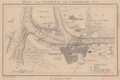
 1835 Hartoom detail map Northern Africa by Thomas Bradford BPL m0612003.png 1,068 × 748; 1.34 MB
-
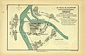
 Khartum vers 1840.jpg 1,810 × 1,269; 464 KB
-
 Khartoum (G. Lejean feuille VI).png 2,265 × 3,131; 11.97 MB
-
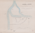
 Confluent des deux Nils.png 3,053 × 2,349; 10.85 MB
-
 Plan von Chartum und Umgebung (1876).png 2,233 × 1,487; 4.5 MB
-
 Khartûm and environs.png 6,214 × 5,831; 26.04 MB
-
 Kartoum 1884 drawn from rough sketches made by the late M. General C.G. Gordon, C.B.png 1,839 × 2,910; 3.96 MB
-

-
 Map of the Nile provinces from the Third Cataract (Hannek) to Khartum. - September 1884.png 6,930 × 5,152; 51.63 MB
-

-
 Fort Omdurman (295).png 1,315 × 1,213; 1.25 MB
-
 Fort Omdurman (297).png 1,311 × 830; 887 KB
-
 Fort Omdurman (302).png 1,306 × 943; 1.01 MB
-
 Plan of Khartoum.png 2,017 × 1,804; 564 KB
-
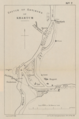 Sketch of environs of Khartum.png 1,873 × 2,828; 3.57 MB
-
-
 Khartum and Environs.jpg 1,134 × 1,764; 412 KB
-

-
 Plan of Khartum, showing places in the neighbourhood.jpg 1,134 × 1,764; 301 KB
-
 A plan of Omdurman.png 3,271 × 2,684; 8.7 MB
-
 1893 map Khartoum and Omdurman by Thomas Cook.png 727 × 624; 606 KB
-
 Khartoum and Omdurman.png 2,536 × 2,561; 6.66 MB
-
 Chartum und Omm Derman.png 3,283 × 2,636; 10.06 MB
-

-
 SLATIN(1896) p701 MAP OF KHARTUM AND OMDURMAN.jpg 2,761 × 2,829; 3.45 MB
-

-

-
 Plan of Omdurman and Khartum.png 2,207 × 3,504; 6.03 MB
-
 656 of 'Feuer und Schwert im Sudan ... Zehnte Auflage' (11249817634).jpg 1,558 × 2,588; 802 KB
-
 657 of 'Feuer und Schwert im Sudan ... Zehnte Auflage' (11290613103).jpg 511 × 2,583; 191 KB
-
 Expédition Prout. Route de Khartoum à Obeiyad.png 4,895 × 5,728; 27.82 MB


.png)

.png)


_to_Khartum._-_September_1884_(cropped).png)
_to_Khartum._-_September_1884.png)

.png)
.png)
.png)


_(14800288083).jpg)
_p701_MAP_OF_KHARTUM_AND_OMDURMAN.jpg)
_(14797496803).jpg)

.jpg)

_(14782897382).jpg)
.jpg)