Category:19th-century maps of Hautes-Alpes
Jump to navigation
Jump to search
Subcategories
This category has only the following subcategory.
Media in category "19th-century maps of Hautes-Alpes"
The following 6 files are in this category, out of 6 total.
-

-

-
 Carte physique, politique, routière et administrative du département des Hautes-Alpes - 1877.jpg 11,364 × 9,184; 17.95 MB
-
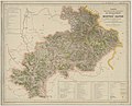
 Dépt. des Hautes Alpes (région du sud-est) - Fonds Ancely - B315556101 A LEVASSEUR 009.jpg 3,056 × 2,064; 2.34 MB
-
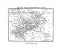
 Guide pittoresque 087 carte Hautes-Alpes cropped.png 2,034 × 1,554; 783 KB
-
 Guide pittoresque 087 carte Hautes-Alpes.pdf 1,860 × 1,695; 172 KB

%27_(11202269055).jpg)

_-_Fonds_Ancely_-_B315556101_A_LEVASSEUR_009.jpg)
