Category:19th-century maps of Haute-Savoie
Jump to navigation
Jump to search
Media in category "19th-century maps of Haute-Savoie"
The following 17 files are in this category, out of 17 total.
-
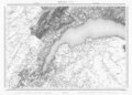 Swisstopo Dufourkarte BLATT XVI GENEVE LAUSANNE LT TK 016 1845.tiff 11,983 × 8,600; 98.3 MB
-

-
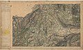
 Carte d'État-major de la France, Feuille Albertville N.E.jpg 23,645 × 13,709; 121.97 MB
-
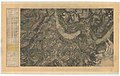
 Carte d'État-major de la France, Feuille Albertville N.O.jpg 23,645 × 13,787; 127.68 MB
-
 Carte d'État-major de la France, Feuille Annecy N.E.jpg 22,913 × 13,794; 110.95 MB
-
 Carte d'État-major de la France, Feuille Annecy N.O.jpg 22,913 × 13,714; 102.48 MB
-
 Carte d'État-major de la France, Feuille Annecy S.E.jpg 24,083 × 15,289; 119.99 MB
-
 Carte d'État-major de la France, Feuille Annecy S.O.jpg 22,913 × 13,762; 111.8 MB
-
 Carte d'État-major de la France, Feuille Chambéry N.E.jpg 23,645 × 13,864; 118 MB
-
 Carte d'État-major de la France, Feuille Fernex N.E.jpg 23,386 × 13,687; 68.12 MB
-
 Carte d'État-major de la France, Feuille Fernex N.O.jpg 23,622 × 13,729; 68.3 MB
-
 Carte d'État-major de la France, Feuille Fernex S.E.jpg 23,858 × 13,645; 104.78 MB
-
 Carte d'État-major de la France, Feuille Fernex S.O.jpg 23,386 × 13,746; 93.58 MB
-
 Carte d'État-major de la France, Feuille Nantua N.E.jpg 22,913 × 13,746; 107.68 MB
-
 Carte d'État-major de la France, Feuille Nantua S.E.jpg 22,913 × 13,726; 110.03 MB
-
 Carte d'État-major de la France, Feuille Vallorcine N.O.jpg 22,913 × 13,818; 63.91 MB
-
 Carte d'État-major de la France, Feuille Vallorcine S.O.jpg 22,913 × 13,727; 74.16 MB


