Category:19th-century maps of Greenland
Jump to navigation
Jump to search
Subcategories
This category has the following 2 subcategories, out of 2 total.
Media in category "19th-century maps of Greenland"
The following 45 files are in this category, out of 45 total.
-

-
 Landkort over Norge og nogle Naboe-Lande - no-nb krt 01037.jpg 8,468 × 5,294; 11.94 MB
-
 Grönlands historiske Mindesmærker Vol.3 (1845) Tab.4.jpg 1,305 × 2,085; 868 KB
-
 Grönlands historiske Mindesmærker Vol.3 (1845) Tab.5.jpg 1,227 × 2,217; 1.16 MB
-
 Grönlands historiske Mindesmærker Vol.3 (1845) Tab.6.jpg 3,303 × 2,110; 2.51 MB
-
 Grönlands historiske Mindesmærker Vol.3 (1845) Tab.7.jpg 2,197 × 1,245; 922 KB
-
 Grönlands historiske Mindesmærker Vol.3 (1845) Tab.11.jpg 5,564 × 3,468; 7.43 MB
-
 Grönlands historiske Mindesmærker Vol.3 (1845) Tab.12.jpg 3,473 × 2,341; 3.37 MB
-

-

-
 1857 Colton Map of Canada and Alaska - Geographicus - Canada-colton-1857.jpg 3,500 × 2,828; 2.96 MB
-

-

-
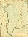
 MAJOR(1874) p67 Map of Greenland.jpg 4,039 × 2,448; 4.3 MB
-

-
-
-

-

-

-

-

-

-

-

-
 Bihang till Kongl. Svenska vetenskaps-akademiens handlingar (1891) (20370292815).jpg 2,188 × 2,894; 1.33 MB
-

-
-
 Holm1887p250 Trækort.png 800 × 1,440; 281 KB
-
 Karte Nordostgrönlands 2. Dt. Nordpolarexpedition.jpg 649 × 1,053; 721 KB
-

-
 Le Tour du monde-01-p023.jpg 1,220 × 2,700; 1.31 MB
-
 Meyers b19 s0228 b1.png 370 × 500; 63 KB
-
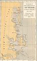
 NansenGreenlandmap1888.jpg 546 × 850; 78 KB
-

-
 Part of Scoresby's Map of Greenland 1823.png 884 × 1,145; 692 KB
-
 PSM V27 D055 Map of ancient viking and portuguese colonies in canada.jpg 1,706 × 2,210; 430 KB
-
 Qalaherriaiq map.jpg 1,013 × 1,293; 266 KB
-
 Scottish geographical magazine (1885) (14596599950).jpg 2,142 × 3,384; 996 KB
-

-
 Skizze der Entdeckungen der englischen Polar-Expedition unter Nares, 1876 - UvA-BC OTM HB-KZL 31.02.36.tif 2,714 × 3,387, 2 pages; 26.32 MB
-
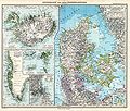 Stielers Handatlas 1891 42.jpg 5,000 × 4,250; 6.53 MB
-

-

-
 The Quarterly journal of the Geological Society of London (14340768444).jpg 1,247 × 1,996; 502 KB
%27_(11246234695).jpg)

_Tab.4.jpg)
_Tab.5.jpg)
_Tab.6.jpg)
_Tab.7.jpg)
_Tab.11.jpg)
_Tab.12.jpg)
.jpg)
.jpg)

.jpg)
_(With_a_map.)%27_(11106387955).jpg)
_p67_Map_of_Greenland.jpg)
%27_(11171282676).jpg)
.jpg)
.jpg)
%27_(11247253676).jpg)
.jpg)
%27_(11100994104).jpg)
)%27_(11052278755).jpg)
%27_(11051545164).jpg)
.jpg)
_(20362195792).jpg)
_(20370292815).jpg)
_(14782042412).jpg)


._Traduit_de_l%27allemand,_avec_l%27autorisation_de_l%27auteur_et_annot%C3%A9e_sous_la_direction_de_Emm._de_Margerie._Avec_une_pr%C3%A9f._par_Marcel_Bertrand_(1897)_(14798132703).jpg)


.jpg)


_(14596599950).jpg)


_(14585071908).jpg)
_(14755084326).jpg)
.jpg)
%27_(11271298975).jpg)