Category:19th-century maps of Châlons-en-Champagne
Jump to navigation
Jump to search
Media in category "19th-century maps of Châlons-en-Champagne"
The following 4 files are in this category, out of 4 total.
-
 B514546101 Aff GF152.jpg 5,232 × 4,160; 28.76 MB
-
 B514546101 LXXXXI 148 BMR66 307.jpg 1,787 × 1,400; 579 KB
-
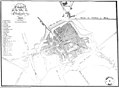 Plan chalons 1836.jpg 3,376 × 2,484; 1.15 MB
-
 Plan Chalons Nicaise 43546.jpg 2,768 × 2,180; 5.53 MB


