Category:1991 maps of Louisiana
Jump to navigation
Jump to search
States of the United States: Florida · Georgia · Kentucky · Louisiana · Maryland · Massachusetts · Mississippi · North Carolina · Ohio · Pennsylvania · Texas · Virginia
| 1990 1991 |
Media in category "1991 maps of Louisiana"
The following 6 files are in this category, out of 6 total.
-

-

-
 Louisiana watersheds. LOC 92682940.jpg 7,589 × 6,976; 7.36 MB
-
 Louisiana watersheds. LOC 92682940.tif 7,589 × 6,976; 151.47 MB
-
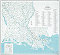
 Soil and water conservation districts, Louisiana LOC 92682937.jpg 2,491 × 3,267; 718 KB
-
 Soil and water conservation districts, Louisiana LOC 92682937.tif 2,491 × 3,267; 23.28 MB


