Category:1980s maps of the Solomon Islands
Jump to navigation
Jump to search
Countries of Oceania: Australia · Fiji · Kiribati · Papua New Guinea · Solomon Islands · Tonga · Tuvalu · Vanuatu
Other areas: Hawaii – Partly: Indonesia
Other areas: Hawaii – Partly: Indonesia
Media in category "1980s maps of the Solomon Islands"
The following 7 files are in this category, out of 7 total.
-
 Caste Solomon islands.jpg 690 × 600; 176 KB
-
 Political map of the Solomon Islands archipelago in 1989.jpg 748 × 650; 72 KB
-
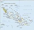
 Solomon Islands 1989.jpg 1,203 × 962; 131 KB
-
 Solomon Islands and Oceania.jpg 416 × 302; 14 KB
-
 Solomon islands.jpg 769 × 625; 122 KB
-
 Solomon Islands. LOC 90682623.jpg 3,309 × 2,561; 695 KB
-
 Solomon Islands. LOC 90682623.tif 3,309 × 2,561; 24.25 MB


