Category:1979 administrative division of cantons of Vendée
Jump to navigation
Jump to search
Media in category "1979 administrative division of cantons of Vendée"
The following 33 files are in this category, out of 33 total.
-
 Cantons of Vendée (1979-2015).svg 854 × 547; 43 KB
-
 Carte des cantons de la Vendée (1975-1979).svg 854 × 547; 44 KB
-
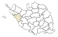
 Locator map of the canton de Beauvoir-sur-Mer in Vendée (2015).svg 854 × 547; 43 KB
-

-
 Locator map of the canton de Challans in Vendée (1979-2015).svg 854 × 547; 43 KB
-
 Locator map of the canton de Chantonnay in Vendée (1979-2015).svg 854 × 547; 43 KB
-
-

-

-

-

-
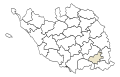
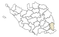
 Locator map of the canton de Luçon in Vendée (1979-2015).svg 854 × 547; 43 KB
-
 Locator map of the canton de L’Hermenault in Vendée (1979-2015).svg 854 × 547; 43 KB
-
 Locator map of the canton de L’Île-d’Yeu in Vendée (1979-2015).svg 854 × 547; 43 KB
-
 Locator map of the canton de Maillezais in Vendée (1979-2015).svg 854 × 547; 43 KB
-

-
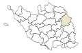
 Locator map of the canton de Montaigu in Vendée (1979-2015).svg 854 × 547; 43 KB
-

-

-

-
 Locator map of the canton de Palluau in Vendée (1979-2015).svg 854 × 547; 43 KB
-
 Locator map of the canton de Pouzauges in Vendée (1979-2015).svg 854 × 547; 43 KB
-
 Locator map of the canton de Rocheservière in Vendée (1979-2015).svg 854 × 547; 43 KB
-
 Locator map of the canton de Saint-Fulgent in Vendée (1979-2015).svg 854 × 547; 43 KB
-
-
-

-

-
 Locator map of the canton de Talmont-Saint-Hilaire (1979-2015).svg 854 × 547; 43 KB
-
 Locator map of the canton des Essarts in Vendée (1979-2015).svg 854 × 547; 43 KB
-
 Locator map of the canton des Herbiers (1979-2015).svg 854 × 547; 43 KB
-
 Locator map of the canton des Sables-d’Olonne (1979-2015).svg 854 × 547; 43 KB
-
 Locator map of the canton du Poiré-sur-Vie in Vendée (1979-2015).svg 854 × 547; 43 KB
.svg)
.svg)
.svg)
.svg)
.svg)
.svg)
.svg)
.svg)
.svg)
.svg)
.svg)
.svg)
.svg)
.svg)
.svg)
.svg)
.svg)
.svg)
.svg)
.svg)
.svg)
.svg)
.svg)
.svg)
.svg)
.svg)
.svg)
.svg)
.svg)
.svg)
.svg)
.svg)
.svg)