Category:1977 maps of Massachusetts
Jump to navigation
Jump to search
States of the United States: Florida · Georgia · Massachusetts · New York · North Carolina · Pennsylvania · South Carolina · Virginia · West Virginia
| 1970 1971 1974 1976 1977 1979 → |
Media in category "1977 maps of Massachusetts"
The following 12 files are in this category, out of 12 total.
-
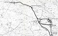 Alternative alignments for the Red Line Northwest Extension.jpg 5,018 × 3,095; 3.22 MB
-
 Boston National Historical Park, Massachusetts LOC 80690980.jpg 3,955 × 8,489; 5.15 MB
-
 Boston National Historical Park, Massachusetts LOC 80690980.tif 3,955 × 8,489; 96.06 MB
-
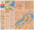 Fall 1977 MBTA system map reverse.png 3,500 × 3,099; 19.48 MB
-
 Minute Man National Historical Park, Massachusetts LOC 80694750.jpg 3,932 × 8,492; 4.87 MB
-
 Minute Man National Historical Park, Massachusetts LOC 80694750.tif 3,932 × 8,492; 95.53 MB
-

-

-

-

-
 Water-resources investigations in Massachusetts, 1977 LOC 83692063.jpg 9,756 × 12,820; 11.79 MB
-
 Water-resources investigations in Massachusetts, 1977 LOC 83692063.tif 9,756 × 12,820; 357.83 MB


